


Located on the border of Oita and Miyazaki Prefectures, Mt. Sobo (Sobo-san) used to be the most famous peak in the Kyushu area, and is known as the historic mountain on which Walter Weston, a.k.a., the father of modern mountaineering in Japan, climbed prior to the Japanese Alps. It is also designated as one of Japan’s 100 most famous mountains. One of the mountain’s appeals is that it has many trailheads, offering a variety of approaches. This article introduces the go-around route starting from Kitadani trailhead that is the closest to the summit, and continues to Fuketsu (literally, “Wind Cave”) course and Sengen-daira course.
Mt. Sobo: Round Trip from Kitadani Trailhead to Fuketsu and Sengen-daira
To the summit that commands a sweeping view of Sobo, Katamuki and Okue Biosphere Reserve.
-
- Duration
- 1Day / 6Hours
- Highest Point
- 1756m
- Elevation Gain
- 650m
-
- Skill Level


- Fitness Level
- Gear Level
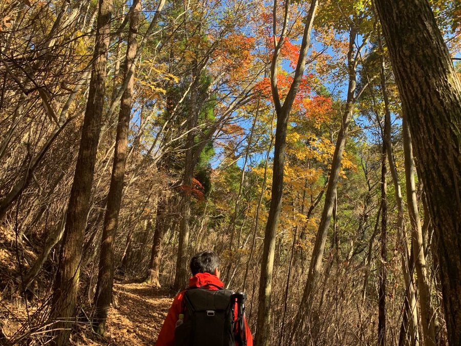
The entrance to the Fuketsu course is located on the righthand side of the forestry road a little bit in from Kitadani trailhead. After wading across Kitadani, the path continues on around the ridge, and soon turns into a rocky trail along the marsh. Many loose rocks make it difficult to walk and the route is hard to spot. Make sure to check marking tapes as you proceed.
After about an hour of hiking from the trailhead, you will arrive at Fuketsu. The area around Fuketsu enjoys cool breezes in the summer and, is sometimes covered with ice during the winter. The trail parts from the marsh after passing Fuketsu and turns into a path for more experienced hikers, with rope-equipped areas, ladders and traverses through rocky sections one after another.
It takes about one and half hours from Fuketsu to the summit. From the open summit, the magnificent view of the long and massive traverse route that leads to Mt. Katamuki (Katamuki-yama) and of Mt. Okue (Okue-yama) can be enjoyed. To return, take Sengen-daira course back to Kitadani trailhead. This path is part of the Kyushu Nature Trail, a national long trail of Japan. The trail through the forest is well maintained and has no dangerous rocky sections.
It is a surprisingly easy course to hike considering that most of the hiking trails in Mt. Sobo are relatively difficult. Family hikers and hiking beginners are recommended to take the round-trip route on Sengen-daira course from Kitadani trailhead.
Gallery
Other Info
The name of Mt. Sobo (“Sobo” literally means “grandmother”) originates in Toyotama-hime, the grandmother of the first Emperor of Japan, Jinmu Tenno.
The 1446.1 triangulation point on Sengen-daira course is the perfect observatory deck, commanding a view of the representative mountains of Kyushu, including Mt. Yufu (Yufu-dake), Kuju Mountain Range (Kuju Renzan) and the five peaks of Mt. Aso (Aso-gogaku).
High Season:April to June, October to November
Notes
Routes extend in four directions from the summit. Be careful not to take the wrong route when descending.
Fuketsu course has many dangerous spots such as rocky sections and is not recommended as a descending route.
Route Map
Elevation Map
Height (m)
Horizontal Distance (km)
Spec
- Duration
- 1Day / 6Hours
- Highest Point
- 1756m(Mt. Sobo)
- Elevation Gain
- 650m
- Horizontal Distance
- 7.5Km
- Skill Level
- Fitness Level
- Gear Level
On the Trail
- Sleeping
Sobosan-kyugome-goya (shelter hut)
- Eating
Takachiho Beef Restaurant Nagomi
- Hot-Springs
Amanoiwato-no-yu


