


Shin-etsu trail is a long trail that spans about 110 kilometers along the Sekida mountain range and Mt. Naeba (Naeba-san), which are located on the border of Nagano and Niigata prefectures. Crossing 16 mountain passes, the entire route of this trail was finally opened in 2008 and extended to 110 kilometers in 2021, as a result of a long period of surveys and development by the local municipality and residents. This article introduces distinctive features of each section. Hike on whichever section you like that fits your schedule.
Japan’s Own Long Trail: Shin-etsu Trail
Hike on the ridgeline and Satoyama surrounded by the virgin beech forest.
-
- Duration
- 9Days
- Highest Point
- 2145m
- Elevation Gain
- -----
-
- Skill Level


- Fitness Level
- Gear Level
Section 1 starts from Mt. Madarao (Madarao-yama), where the Shin-etsu trail begins, and heads for Aka-ike Pond.From the Rest House Tyrol trailhead, hike straight through the ski slope of Madarao Mountain Resort , and proceed along the zigzag path through forest, the summit of Mt. Madarao is about 2 hours away. This is the western starting point of the Shin-etsu trail. Descend along the beech forest ridgeline and the surrounding will soon change to larch forest. Manzaka-toge Pass is about an hour and 40 minutes away. Walk on the roadway from here and hike up through forest again. Pass through the wetland along a wooden walkway and hike up the beech forest ridgeline. You will arrive at Mt. Hakama (Hakama-dake) in an hour. Descend the steep slope from the summit and take a right at the fork of the Kashiwaga-toge Pass, and the trail becomes forestry road. About an hour and 20 minutes from Mt. Hakama, you will arrive at Aka-ike Pond.
Section 2 starts from Aka-ike Pond and heads to Wakui. Departing Aka-ike Pond, proceed along a gentle slope in the forest, and you will arrive at Numanohara wetland in about 50 minutes. Walk on the roadway and descend along the stream, and Lake Nozomi (Nozomi-ko) is about 50 minutes away. From Lake Nozomi, hike up a larch trail for approximately 40 minutes and you will arrive at Mt. Kenashi (Kenashi-yama). Descend the steep slope and walk through countryside, and you will arrive at Wakui in about 2 hours.
Section 3 starts from Wakui and heads for Katsura-ike Pond. Pass through the village of Wakui, it takes about another hour to get to Tomikura-toge Pass. Continue hiking on the forestry path on the bank of the pond and hike up a steep slope, and you will arrive at Mt. Kuroiwa (Kuroiwa-yama) in about 2 hours. The view of the Iiyama countryside landscape can be enjoyed from the summit. Descend the ridgeline for about an hour, and you will arrive at Katsura-ike Pond.
Section 4 starts from Katsura-ike Pond and heads for Sekita-toge Pass. Hike past the pond and in about an hour and 40 minutes, you will arrive at Hotokegamine trailhead. Hike through the upper part of Togari Onsen Snow Resort and up the ridgeline, you will arrive at Ozawa-toge Pass in 2 and a half hours. Hike back up from the pass and along a narrow ridge, Mt. Nabekura (Nabekura-yama) is 2 hours and 30 minutes away. From Mt. Nabekura to Kuguno-toge Pass, and on to Mt. Kurokura (Kurokura-yama), continue hiking up and down for about an hour and 20 minutes and you will arrive at Sekita-toge Pass.
Section 5 starts from Sekita-toge Pass and heads for Busuno-toge Pass. From Sekita-toge Pass, the hike continues to go up and down via Nashidaira-toge Pass. The virgin forest of beech trees with their trunks bent by the weight of snow shows how heavy the snowfall is in this area. Maki-toge Pass is about 2 hours away from Sekita-toge Pass. Proceed on a narrow ridgeline and hike over Mt. Hanatate (Hanatate-yama), and you will arrive at Utsunomata-toge Pass. Hike back up the steep slope, and you will arrive at a small pond known as Maboroshino-ike (literally, “pond of illusion”), surrounded by beech forest. After hiking along a path of ups and downs through the beech forest and then going down a steep slope, you will arrive at Busuno-toge Pass.
Section 6 starts from Busuno-toge Pass and heads for Mt. Amamizu (Amamizu-yama). Hike up the steep hill from Busuno-toge Pass and continue hiking with a view of the wetland on your right and in 2 and half hours you will reach Nonoumi-toge Pass. Proceed on the gentle road from Nonoumi-toge Pass and past the northern edge of Nagano prefecture. Fukasaka-toge Pass is 45 minutes away. This pass has a stone monument that commemorates it as being the oldest in the entire Shin-etsu trail, which is believed to have had the traffic of people since the 6th century. Hike up the steep slope from the pass for about 40 minutes, and you will arrive at Mt. Sanpo (Sanpo-dake). Proceed on the ridgeline with a cliff on the left side for about an hour, and you will start to see terraced rice fields in front of you to the left, and that is where Mt. Amamizu, the end of Shin-etsu trail is. Take a left at the fork on the ridge, descend and take a left again at the next fork, and you will arrive at Matunoyama trailhead (the end of the trail).
Section 7 starts from Mt. Amamizu and heads to Morimiyanohara Station. From here on to Section 9, the course leaves the Sekida mountain range and becomes a hike through a rural natural area, referred to as Satoyama in Japanese, towards Mt. Naeba. Descend a long distance from Mt. Amamizu, and the path from Satoyama Deai to Morimiyanohara Station is paved.
Section 8 is from Morimiyanohara Station to Ketto. Though most of the route is paved, the path goes through a vast pastoral area and farms, which makes it uniquely fun and different from other sections.
Section 9 is from Ketto to Koakasawa. The village along Nakatsu-gawa River (Nakatsu-gawa) in between mountains is known as Akiyamago, and still has private houses from olden times. This secluded village offers the scenery of the life in an area of heavy snow as it was in days gone by.
Section 10 is from Koakasawa to Mt. Naeba. Mt. Naeba is a mountain with an elevation of 2145m, which requires serious mountaineering. Staying at the mountain hut on the summit is highly recommended. Lodging facilities at foothills are available at the start and end of each section. Traverse across the Sekida mountain range camping in a tent is also a possibility.
Reservations are required to use camping sites on the Shin-etsu trail. In addition, although camping sites are usually equipped with water, it is recommended to use a water purifier before drinking.
Gallery
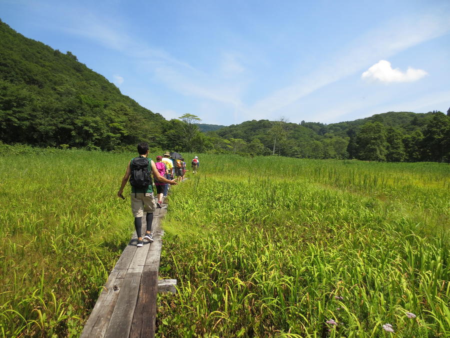
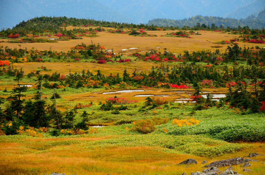
Marshland ( Photo by NPO Shin-etsu Trail Club )
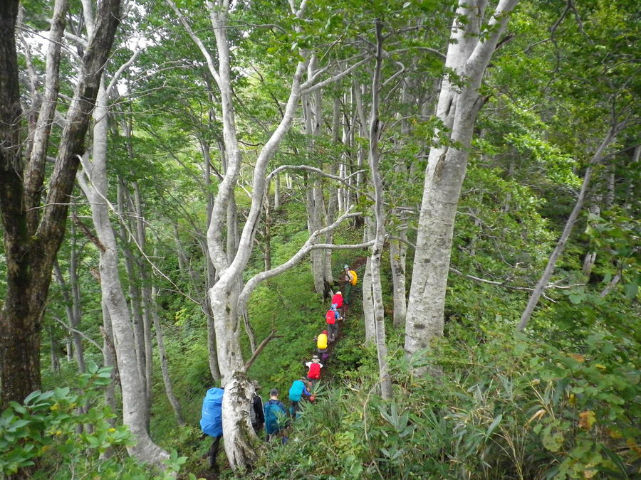
Hikers ( Photo by NPO Shin-etsu Trail Club )
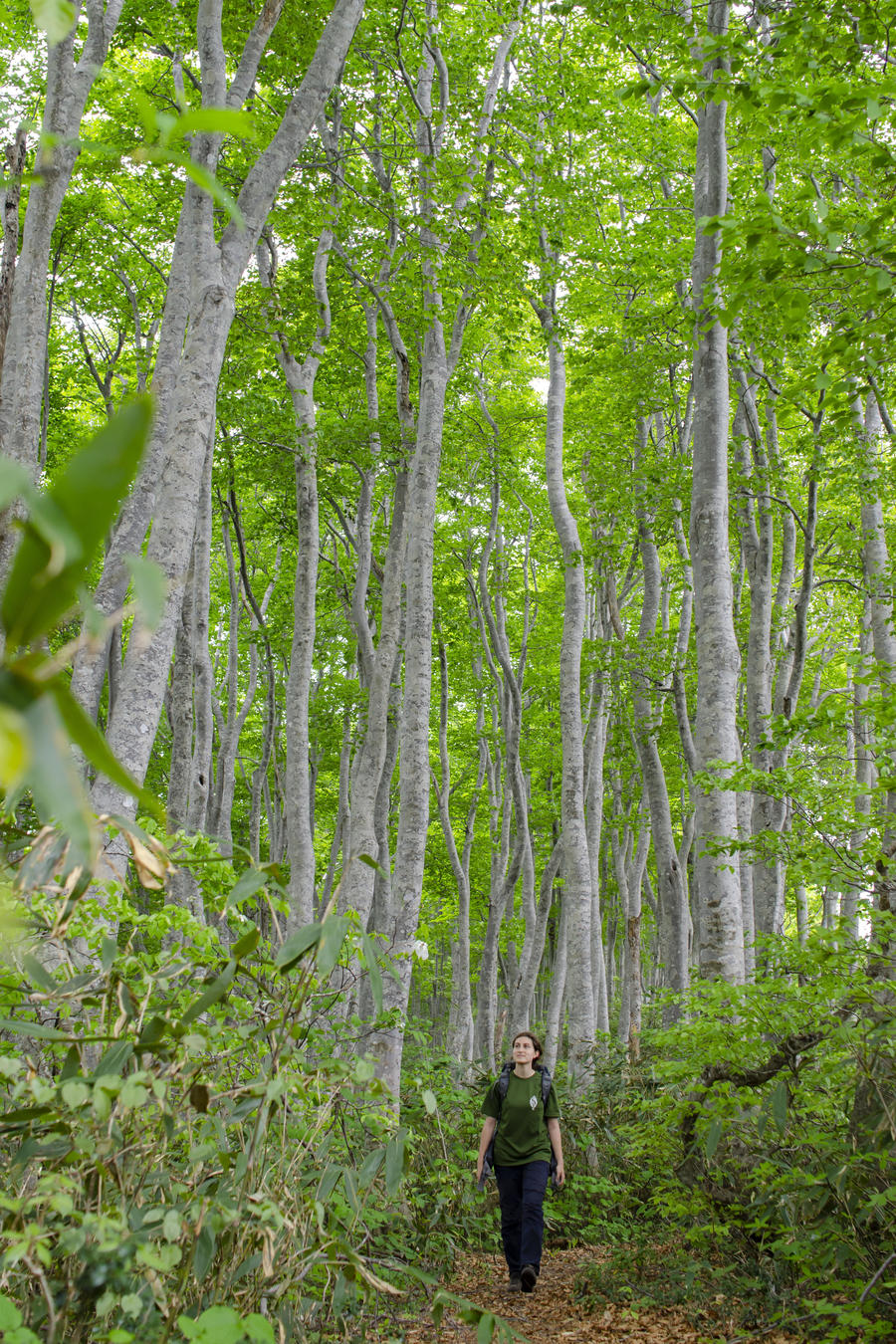
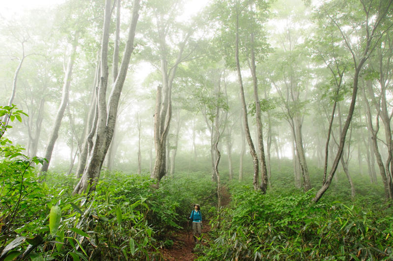
Fresh green beech forest ( Photo by NPO Shin-etsu Trail Club )
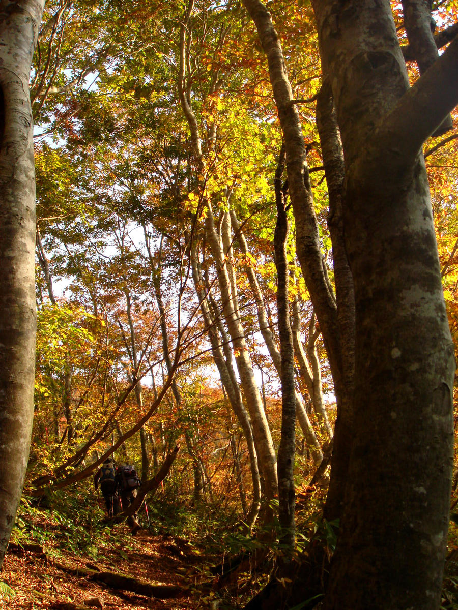
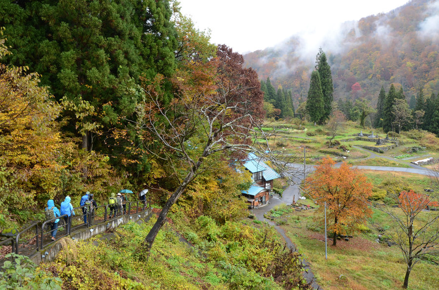
Autumn forest ( Photo by NPO Shin-etsu Trail Club )
Mt. Amamizu ( Photo by NPO Shin-etsu Trail Club )
Mt. Naeba in autumn ( Photo by NPO Shin-etsu Trail Club )
hike through a rural natural area, referred to as Satoyama in Japanese ( Photo by NPO Shin-etsu Trail Club )
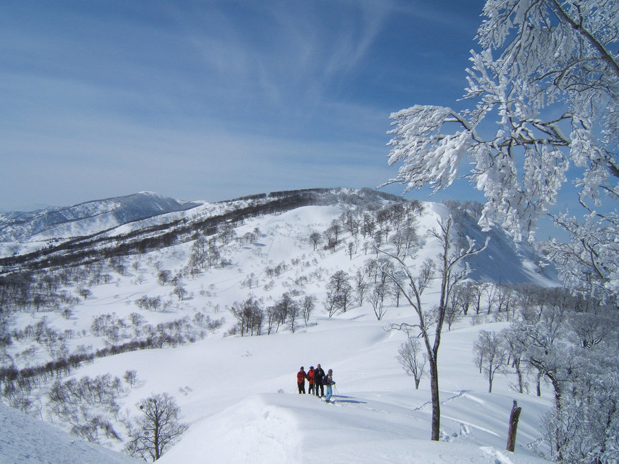
snow-covered ridgeline ( Photo by NPO Shin-etsu Trail Club )
Other Info
The attraction of Shin-etsu trail is the beauty of the beech virgin forest along the trail. The best hiking season would be from mid-to-late October when the beech tree leaves turn to autumn colors. However, the season coincides with the earlier sunset time. Hikers are encouraged to be cautious about their time of activities. Though late May to June when beech trees are covered with fresh green buds is another attractive season for hiking, there may still be snow left on the route, which requires attention of hikers.
High Season:June to October
Notes
Shin-etsu trail is managed and maintained by an incorporated NPO, Shinetsu Trail Club Office. Be sure to submit a hiking registration to the office prior to start hiking.
Route Map
Elevation Map
Height (m)
Horizontal Distance (km)
Spec
- Duration
- 9Days
- Highest Point
- 2145m(Mt. Naeba)
- Elevation Gain
- -----
- Horizontal Distance
- 110Km
- Skill Level
- Fitness Level
- Gear Level
On the Trail
- Sleeping
Nabekura Kogen Morino-ie, Green Pal Kogen-so, Daigonji Kogen Rest House Kibo-kan
- Eating
Nakajo Onsen Tomatono-kuni
- Hot-Springs
Nakajo Onsen Tomatono-kuni


