


Round Trip Hike & Climb for Mt. Tsurugi via Bessan Ridge
-
- Duration
- 2Days / 12Hours
- Highest Point
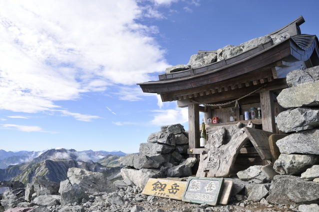
- 2999m
- Elevation Gain
- 739m
-
- Skill Level


- Fitness Level


- Gear Level
Beginning at Tateyama Murodo, walk along the stone-paved footpaths for about 30 minutes, admiring sights like Mikuriga-ike Pond and Rindo-ike Pond along the way. Then descend the steps on the trail toward Raicho-daira.
From Raicho-daira, hike up a rocky slope that passes through grassy fields and later a stone pine belt. Eventually you will reach Bessan Pass (Bessan Nokkoshi), where the Tsurugi-gozen-goya mountain hut stands. On a clear day, there is a full view of Mt. Tsurugi from here. From Tateyama Murodo, it will take about 2 hours and 50 minutes to the Tsurugi-gozen–goya.
From Bessan Pass hike down the rocky slope past the camping area and, in about an hour, you will arrive at the Tsurugisawa-goya mountain hut where you will spend the first night of the trek.
The second day begins with a hike through a stone pine belt. By the time you reach the Kenzan-so mountain hut, you will be on a real alpine trail. Climb up a zigzagging path, with several chain-fitted sections, and in around 30 minutes you will reach the Ippuku Tsurugi peak.
From Ippuku Tsurugi to Mae Tsurugi, there is a long chain segment with little in the way of inclines. From this point you will begin the toughest part of the climb to Tsurugi’s summit.
As you work your way down toward the col beneath Mae Tsurugi, use the narrow ledges and chains to navigate the cliff side path and then climb up to the Heizo no Zuko peak on the other side of the col.
Once again, use the chains to lower yourself down in to the Heizo col and you will reach the point where the route splits off into two separate paths: one for climbing only and the other for descent only.
From the Heizo col, continue on to the Kani no Tatebai, a very steep rock face which you climb with the help of chains. Then, head for the summit. From here, the course turns into a gentler rocky slope and after reaching the point where the path merges with the one from Hayatsuki Bridge, you will arrive at the summit of Mt. Tsurugi.
From Kenzanso, it will take about 2 hours and 30 minutes to the summit of Mt. Tsurugi.
On the return leg of the hike, you must scuttle sideways across the Kani no Yokobai, a sheer rock face fitted with chains as well as some ladders. Traverse the route ahead until you return to the Heizo col.
From here, follow the same path that you took before to complete your descent.
Gallery
Other Info
You can see many different aspects of Mt. Tsurugi when viewing the mountain from different angles. One especially popular viewpoint is at Sennin-ike Pond on the east side of the mountain. From late September until early October, when the pond is framed by colorful red and yellow leaves, you can see the steep peaks of Mt. Tsurugi reflected in the pond’s surface. Known as Ura-Tsurugi (or Tsurugi viewed from behind), it’s a popular subject for amateur photographers. Its takes about 6 hours to reach this spot from Tsurugi-sawa.
Best Season:mid-July to September
If you go to this trail outside of the best season, you should pay attention to weather and trail conditions, as the mountain is located in a snowy area; there may still be snow on the trail in July, and it may start snowing from October. Snow mountaineering equipements and experience are required during the winter season.
Notes
Although the route introduced here is the one favored by most hikers, it is by no means an easy one. Between Ippuku Tsurugi and Mt. Tsurugi’s peak, there is always a danger of falling rocks as well as slipping and falling from trails and ledges. The use of helmets is obviously recommended along with other technical climbing equipment like harnesses, slings, and carabiners, which you can clip onto chains to help with your climb and descent.
Route Map
Elevation Map
Spec
- Duration
- 2Days / 12Hours
- Highest Point
- 2999m(Mt. Tsurugi)
- Elevation Gain
- 739m
- Horizontal Distance
- 15.9Km
- Skill Level
- Fitness Level
- Gear Level
On the Trail
- Sleeping
Hotel Tateyama, Tateyama Murodo Sanso, Lodge Tateyama Renpo, Raicho-so, Raichosawa Hutte, Mikuriga-ike Onsen, Tsurugi-gozen-goya, Tsurugisawa-goya, Kenzan-so
- Eating
Murodo Terminal Restaurant Tateyama
- Hot-Springs
Mikuriga-ike Onsen


