


Mt. Miyanoura Round Trip from the Yodogawa Trailhead
-
- Duration
- 1Day / 10Hours
- Highest Point
- 1935m
- Elevation Gain
- 567m
-
- Skill Level


- Fitness Level
- Gear Level
From the start of trail you will walk up and down a series of gentle slopes after the trailhead for about 50 minutes before arriving at the Yodogawa-goya mountain hut.After crossing the bridge over the Yodogawa River, you will arrive at a proper ridgeline trail that proceeds through the forest belt.
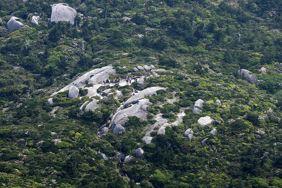
As you continue to ascend the trail, you will arrive at the Kobandake-tenbodai Observatory, which offers a view of Mt. Koban (Kohban-dake) and the large boulders, collectively referred to as Tofu-iwa rocks that sit on its peak.
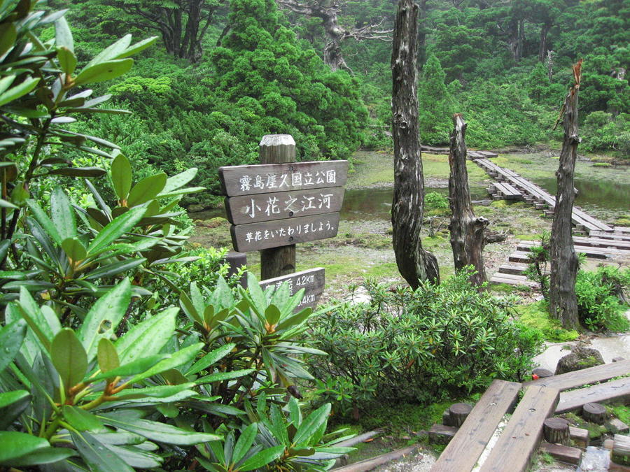
Kohananoego, a small wetland, is located slightly below here.After proceeding further from here, you will arrive at the Hananoego, a wetland that resembles a Japanese garden, about 2 hours after leaving the Yodogawa-goya mountain hut.
After walking about 25 minutes from Hananoego, you will come to the Mt. Kuromi (Kuromi-dake) branch. Instead of heading for Mt. Kuromi, traverse the eastern side of the mountain before arriving at Nageishidaira (It takes around 40 minutes to Mt. Kuromi and back).
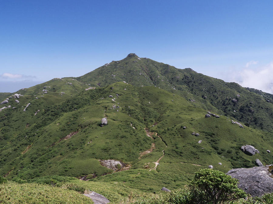
Ascend the trail, which traverses up and down the western sides of three mountains bristling with granite boulders; Mt. Nageishi (Nageishi-dake), Mt. Anbo (Anbo-dake), and Mt. Okina (Okina-dake).
After crossing over Mt. Kurio (Kurio-dake) and hiking all the way to the top of the trail through the bamboo grass, you will arrive at the peak of Mt. Miyanoura.
Take the same path back down the mountain.
Gallery
Other Info
Kohananoego and Hananoego are Japan’s southernmost high moors.
The scenery created Hananoego’s carpet of moss, the surfaces of its pools of rain water and melted snow, and its bleached white trees gives the wetland a beauty like that of a Japanese garden.
High Season:April to June, September to November
Notes
Yakushima sees a lot of rainfall, so there is a need to prepare for carefully for rain.
Although Yakushima has a humid subtropical climate, the peak of Mt. Miyanoura is a subarctic zone due to the high altitude. As such, there is a need to be prepared for cold weather.
Please be aware that typhoons sometimes cut off access to the Yakushima from the Kyushu mainland from summer to fall.
Route Map
Elevation Map
Spec
- Duration
- 1Day / 10Hours
- Highest Point
- 1935m
- Elevation Gain
- 567m
- Horizontal Distance
- 12.8Km
- Skill Level
- Fitness Level
- Gear Level
On the Trail
- Sleeping
Yodogawa-goya
- Eating
- -----
- Hot-Springs
Hirauchi Kaichu Onsen (Hot spring)


