


Round Trip Hike of Mt. Kaikomagatake from the Kuroto-one Ridge
-
- Duration
- 2Days / 14.5Hours
- Highest Point
- 2967m
- Elevation Gain
- 2190m
-
- Skill Level


- Fitness Level
- Gear Level
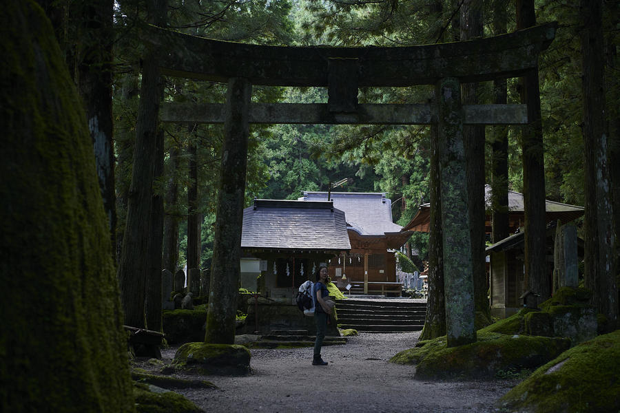
Set off from the trailhead at the Ojiragawa Valley parking area. You will soon come to the Chikuu-komagatake-jinja Shrine where you can offer prayers for safe passage through the mountains before you begin. Walk across the suspension bridge to the other side of the Ojiragawa Valley, and hike up a steep zigzagging path, over a surface of small loose rocks, through a conifer belt.
After about 2 and a half hours of hiking from the Ojiragawa parking area, you will reach a point where the trail converges with another trail starting at the Yokote-komagatake-jinja Shrine. You will then pass through a gentle, bamboo grass-covered segment of trail called Sasano-taira. From here, the trail turns steep and continues up through a mossy old-growth forest.
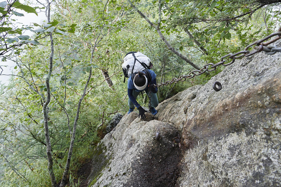
Continue beyond the Maebyobuno-kashira peak to reach a steep, exposed ridgeline known as Hawatari (literally, “crossing over the blade”). Grasp the regulation chains, attached with piles to the rock face, and take special care as you negotiate this segment of ridge. Once you have passed the Hawatari, continue on through an exposed stretch of ridgeline where no chain is equipped and then work your way through a succession of ladders and chains. After about 2 hours of hiking from Sasano-taira, you will arrive at Toritengu where a small shrine stands.
Pass through a forest belt along a path traversing the right slope of Mt. Kuroto (Kuroto-yama) and down into the col known as “the Fifth Station.” In the latter half of the 19th century, there was a mountain hut at this location, but it was torn down and now only a relief remains in its place.
From the Fifth Station, continue on through another forest belt, negotiating a succession of ladders and chains along the way. Cross the bridge spanning the col and proceed up an even steeper segment of trail. From here, you will climb ladders set up along the steep rock face and use chains to negotiate exposed areas along the ridge. After about 6 hours and a half of hiking from the start point at Ojiragawa Valley parking area, you will arrive at the Seventh Station where the Shichijo-goya mountain hut is located. You will spend the night here.
At the start of the next day, climb up the ladder behind Shichijo-goya and continue past the camping area and onto yet another series of ladders and chains. Hike up past the treeline and into a rock pine belt. After about an hour of hiking from Shichijo-goya, you will reach the Eighth Station, Goraigoba, with its excellent observation point.
From this point, use the artificial handholds and chains to negotiate the rockface, and climb up to reach the Ninth Station where you will see a massive rock with two swords stuck in it.
From the Ninth Station, the trail becomes a gentler path through a rock pine belt. Pass the west peak where the Komagatake-jinja Honja (main mountaintop shrine) is located and continue on toward the summit. After about 2 and a half hours of hiking from Shichijo-goya, you will reach the summit area of Mt. Kaikomagatake, where the Komagatake-jinja Okumiya (inner shrine) is located.
Repeat your hike in reverse to descend back to your starting point.
Gallery
Other Info
Notes
Route Map
Elevation Map
Spec
- Duration
- 2Days / 14.5Hours
- Highest Point
- 2967m(Mt. Kaikomagatake)
- Elevation Gain
- 2190m
- Horizontal Distance
- 17.1Km
- Skill Level
- Fitness Level
- Gear Level
On the Trail
- Sleeping
Shichijo-goya
- Eating
Roadside Station Hakushu
- Hot-Springs
Ojirano-yu


