


Hike of a Sacred Mountain, Mt. Hoki-daisen; Round Trip from the Natsuyama Hiking Course
-
- Duration
- 1Day / 5.5Hours
- Highest Point
- 1709m
- Elevation Gain
- 957m
-
- Skill Level


- Fitness Level
- Gear Level
From the Daisenji Temple bus stop, walk along the paved path for about 15 minutes to reach the Natsuyama trailhead.
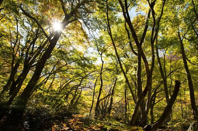
Climb the stone steps and proceed past the Amida-do Temple and continue on up the steps of the path through an old growth forest of Japanese beech trees.
Next, the trail winds through a stretch of shrubbery and merges with the Gyojadani course. From the Natsuyama trailhead, it’s about an hour and 40 minute hike to the Sixth Station where you will see a shelter hut. From here, hike up the steep rocky slope to reach the next segment of the route, which consists of easy to climb wooden steps.
From the Ninth Station, follow the wood covered path through clusters of daisenkyaraboku (a species of Japanese yew endemic to the area). It takes about an hour and 20 minutes from the Sixth Station to the peak of Mt. Misen, where you will see a shelter hut.
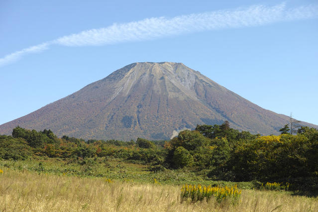
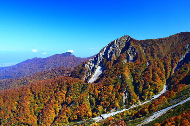
Because of the danger of crumbling rocks due to erosion near the mountain’s true summit, Kengamine, hikers are not permitted to climb to it. Mt. Misen is therefore highest point that hikers can access.
For the return hike, follow the same course in reverse.
Gallery
Other Info
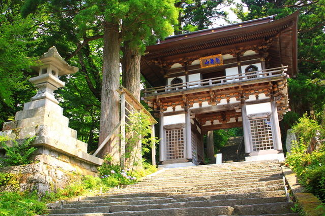
Daisen-ji is a Buddhist temple and is located at the trailhead. It was founded to mark the opening of the mountain in the 8th century and gives a strong sense of the mountain’s history of religious devotion. Inside the Amida-do Temple, a statue of Amitabha (celestial Buddha) is enshrined. It is listed as an Important Cultural Property of Japan.
High Season:May to October
Notes
The ridge in the area near Mt. Daisen’s summit continues to be affected by erosion. The true summit is the 1729 m Kengamine, but the danger of crumbling and falling rocks has led to the peak being declared off limits to hikers. For this reason, the highest point accessible on the route described here is Mt. Misen.
Route Map
Elevation Map
Spec
- Duration
- 1Day / 5.5Hours
- Highest Point
- 1709m
- Elevation Gain
- 957m
- Horizontal Distance
- 5.6Km
- Skill Level
- Fitness Level
- Gear Level
On the Trail
- Sleeping
Sixth Station hinan-goya, Daisen-chojo-hinan-goya
- Eating
Goenyuin
- Hot-Springs
Goenyuin


