


Mt. Hiuchi (Hiuchi-yama) and Mt. Myoko (Myoko-san) are located in the Myoko-Togakushi renzan National Park, and are both listed among Japan’s 100 most famous mountains. While Mt. Hiuchi is interspersed with wetland and ponds, Mt. Myoko is characterized by a surrounding outer crater and continuous rocky ridges, providing completely different atmospheres despite their adjacent location. This route introduces the course that includes a stay at a mountain hut by a pond at the foot of Mt. Hiuchi, and descending by the gondola lift called Skycable from Mt. Myoko.
Traverse of Mt. Hiuchi and Mt. Myoko from Mt. Sasagamine
Traversing route with a variety of natural features including wetlands, ponds and rock ridges.
-
- Duration
- 2Days / 12.5Hours
- Highest Point
- 2462m
- Elevation Gain
- 1214m
-
- Skill Level


- Fitness Level
- Gear Level
Passing through the gate entrance of the Sasagamine trail, which continues on through the broadleaved forest, about an hour of hiking will lead you to Kurosawa-bashi Bridge. Crossing the bridge, the trail turns into a zigzag steep slope known as Jyuni-magari (literally, “twelve bends”), which you can go up using the wooden stairs.
About an hour and 40 minutes of hiking from Kurosawa-bashi will bring you to a flat ridgeline. Take a left at the fork. Traverse the left path for about 50 minutes, and you will arrive at Koya-ike (wetland). Proceeding on the wooden walkway for 15 minutes from Koya-ike, there is another wetland known as “Tenguno-niwa” (literally, “the garden of Tengu goblin”). It is a famous scenic spot for the beautiful image of Mt. Hiuchi reflected on the water surface.
Hike up through a grassy field to the ridgeline, and the surrounding turns into creeping pine belt. The top of the wooden walkway is the summit of Mt. Hiuchi. Descend the same route back to Koya-ike, to Koyaike Hutte, the accommodation for the night.
Destination of day 2 is Mt. Myoko. Descend from Koya-ike over the gentle slope of Mt. Chausu (Chausu-yama), and you will arrive at Kurosawa-ike (wetland) in about 50 minutes. Kurosawa Hutte is there. From Kurosawa-ike, hike through the forest belt and up a bamboo grass field for about 30 minutes, you will arrive at Okura-nokkoshi Pass.
Traverse downwards for another 30 minutes on a grass-covered rocky surface, you will arrive at a fork. The trail turns into a rocky forest belt zone. Hike up the steep hill with ropes equipped in some places, and you will reach the north peak of Mt. Myoko.
Proceed on the ridgeline consisting of rows of giant rocks, and the south peak of the mountain is about one and half hours away from the fork. From Mt. Myoko, climb down the chain-equipped rocky area, proceed onto the ridgeline through shrubs and bamboo grass fields, until arriving at the fork near to a small shrine. Take a right at the fork, and continue descending with the view of the opposite slope emitting volcanic fumes.
Otani Hutte is about an hour and 20 minutes away from Mt. Myoko. Continue walking on the paved road for about 400 meters, and descend the steep slope of beech forest.
Hike over the swamp and descend down the lawn of the ski slope, then you will arrive at Skycable Sancho Station, about an hour and 20 minutes away from Otani Hutte. Use Skycable to descend.
Gallery
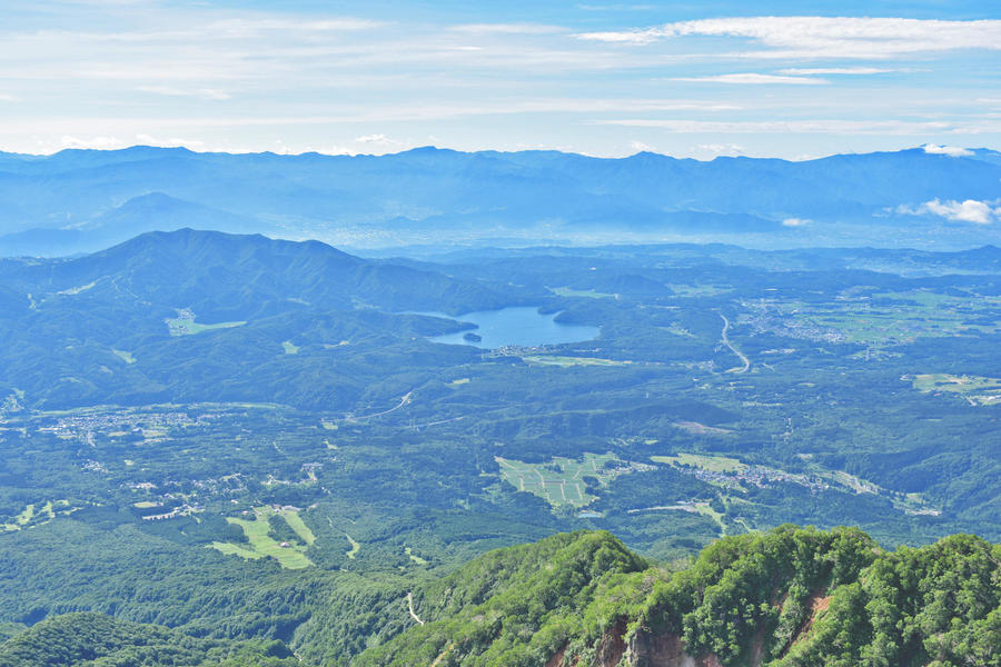
View from the peak of Mt. Myoko
Other Info
Being wetland-rich, Mt. Hiuchi is blessed with various alpine plants that blossom in July and the autumn-colored foliage of grassy fields in October. Mt. Myoko also has many broadleaved shrubs, and the autumn foliage turns vivid colors in October.
High Season:July to October
Notes
Koyaike Hutte, the accommodation utilized on this route, operates by a reservation-only system. They operate only from July to early November, with the flower season in July and the foliage season in October being the busiest seasons, especially on weekends. Early reservation is highly recommended.
Route Map
Elevation Map
Height (m)
Horizontal Distance (km)
Spec
- Duration
- 2Days / 12.5Hours
- Highest Point
- 2462m(Mt. Hiuchi)
- Elevation Gain
- 1214m
- Horizontal Distance
- 22.2Km
- Skill Level
- Fitness Level
- Gear Level
On the Trail
- Sleeping
Koyaike Hutte, Kurosawa-ike Hutte, Otani Hutte
- Eating
Restaurant Hetre
- Hot-Springs
Akakura Onsen hot spring Dai Notenburo outdoor bath Takino-yu


