


Mt. Kiso-Komagatake Round Trip from Senjojiki Cirque
-
- Duration
- 1Day / 4Hours
- Highest Point
- 2956m
- Elevation Gain
- 350m
-
- Skill Level


- Fitness Level
- Gear Level
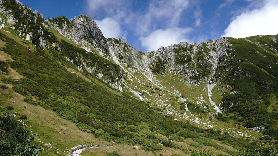
After getting off the ropeway, the Senjojiki Cirque will spread out before your eyes. From the bottom of the Cirque, climb the steep slope, which is scattered with granite rocks of various sizes.
After climbing to the top of the steep slope, which is equipped with handholds and steps, you will arrive at Jodo Nokkoshi (Johdo Nokkoshi), where expansive ridgelines will spread out before your eyes. Looking back, you will see the Senjojiki Cirque spread out below you.
After passing the blue-roofed Hoken Sanso mountain hut (Hohken Sanso) and ascending the gently-sloping trail, you will arrive at Mt. Nakadake, which is lined with massive boulders.
As you ascend the gentle slope, you will find the Komagatake Chojo Sanso mountain hut half-way up to the peak. After passing the mountain hut, you will start the final gently-sloping hike to the summit, which is scattered with granite rocks.
There are two shrines stemming back to the days of mountain worship located at the peak.From the peak you can enjoy a commanding view of the Central Japanese Alps including the precipitous Mt. Hoken (Hoken-dake or Hohken-dake) and the triangular Mt. Sannosawa (Sannosawa-dake).
Take the same path down the mountain.
Gallery
Other Info
After ascending to the peak while enjoying the views of the alpine plants in summer or the autumn colors in fall you will be treated to a sweeping view of Mt. Ontake (Ontake-san), Mt. Fuji (Fuji-san) and the Japanese Alps.
You can also stay the night at the mountain hut and, if the weather cooperates, enjoy stargazing at night.
Komagane Highland (Komagane Kohgen) at the base of the mountain offers a full range of tourist attractions to enjoy including hot springs, hotels, and restaurants.
High Season:July to September
Notes
Watch out for the signs of altitude sickness as the ropeway you will be taking ascends very quickly up to Senjojiki Cirque.
Route Map
Elevation Map
Spec
- Duration
- 1Day / 4Hours
- Highest Point
- 2956m
- Elevation Gain
- 350m
- Horizontal Distance
- 8Km
- Skill Level
- Fitness Level
- Gear Level
On the Trail
- Sleeping
Hoken Sanso, Komagatake Chojo Sanso, Chojo Kiso Koya
- Eating
Hotel Senjojiki
- Hot-Springs
Komakusa no Yu


