


Mt. Kobushigatake straddles the borders of Yamanashi Prefecture and Nagano Prefecture as well as Saitama Prefecture. It is also listed among Japan's 100 most famous mountains as the representative peak of the Okuchichibu Mountain Range. Mt. Kobushigatake is the source of several rivers, including Chikuma-gawa River, a tributary to Japan’s longest river, Shinano-gawa River; the Fuefuki-gawa River, a tributary to Japan’s third fastest runing river, Fuji-kawa River; and Ara-kawa River which runs across the Kanto plain and empties into Tokyo Bay. Mt. Kobushigatake also serves as an important drainage divide. Although there is also a route that approaches Mt. Kobushigatake from the Nagano Prefecture side and traverses the Okuchichibu Mountain Range, the one introduced here is from Yamanashi Prefecture and benefits from easy access via public transit.
Round Trip Hike of Mt. Kobushigatake via the Tokuchan-Shindo Trail
-
- Duration
- 2Days / 9.5Hours
- Highest Point
- 2475m
- Elevation Gain
- 1373m
-
- Skill Level


- Fitness Level
- Gear Level
The Nishizawa Keikoku Ravine, which serves as the trailhead, has a parking lot and toilets. From here, walk along the level path on the left side of the ravine for about 30 minutes to arrive at the Nishizawa Sanso mountain hut (currently, not in service). The trail, known as the Tokuchan-shindo trail begins beside the mountain hut. Hike up to the ridge and continue on for about 2 hours and 20 minutes to reach the junction.
From the junction, hike up a ridge lined with Azuma shakunage (rhododendrons). After about 2 hours, the surrounding flora turns into a conifer forest belt and the trail merges with another trail coming from the east. Hike up the gentle slope to reach the peak of Mt. Tokusa (Tokusa-yama). From Mt. Tokusa, hike down into the mountain pass below where you will find the Kobushi-goya mountain hut. You can enjoy the view of Mt. Kobushigatake’s pyramid-shaped peak towering before you.
From Kobushi-goya, hike up out of the pass and make your way up a scenic, rocky slope through a cluster of trees. After about 20 minutes of hiking from the mountain hut, you will reach the summit. From here you can see Mt. Fuji (Fuji-san), the Southern Japanese Alps, and the Yatsugatake Mountains. You can also sense the depth and substance of these mountains, including Mt. Kobushigatake.
From Mt. Kobushigatake’s peak, make your way back to the Kobushi-goya where you will spend the first night of the trek. On the following day, enjoy early morning atop the mountain and follow the same route back.
Gallery
Other Info
From late May until mid-June, Azuma shakunage (rhododendrons) growing around the trail blossom into large pink flowers. During this period, you can walk through a veritable tunnel of rhododendrons.
High Season:May to November
Notes
You can continue to follow the trail along the stream by the Nishizawa Sanso mountain hut and cross the suspension bridge to the other side where you will find the Nishizawa Ravine. Here you see a succession of beautiful waterfalls and stream pools. Of particular interest, the Nanatsugama Godan Falls (Nanatsugama-godan-no-taki, literally means “Seven-Pools and Five-Steps Falls”) - found at the area’s furthest reach is listed among the 100 elections of the waterfall in Japan.
There is also a well-maintained trail from Nishizawa Sanso which can be completed in around 3 hours and is known for its beautiful leaves during the autumn foliage season. There is a danger of slipping and falling in the area around the ravine, and some slipping accidents have occurred around waterfalls. Caution is advised, especially during or after rainfall.
Route Map
Elevation Map
Spec
- Duration
- 2Days / 9.5Hours
- Highest Point
- 2475m(Mt. Kobushigatake)
- Elevation Gain
- 1373m
- Horizontal Distance
- 14.6Km
- Skill Level
- Fitness Level
- Gear Level
On the Trail
- Sleeping
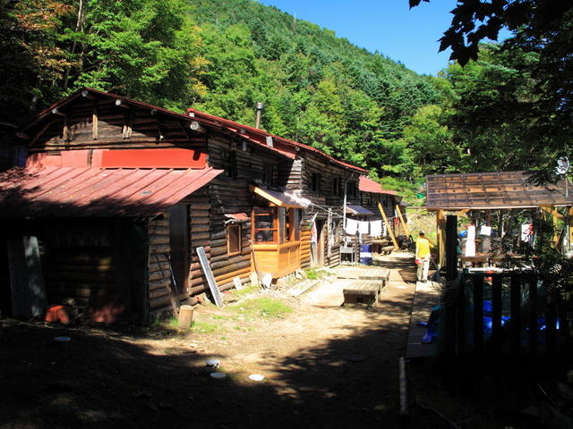
Kobushi-goya
- Eating
Roadside Station Mitomi
- Hot-Springs
Hanakage-no-yu


