


Mt. Aizu-Komagatake: Round Trip from the Takizawa Trailhead
-
- Duration
- 2Days / 8.5Hours
- Highest Point
- 2133m
- Elevation Gain
- 1204m
-
- Skill Level


- Fitness Level
- Gear Level
From the Komagatake Trailhead, start walking along the paved forestry road. It's about a 30-minute hike from there to the Takizawa Trailhead where there's a parking lot for hikers who have come by car. On the way, you take a shortcut up a trail through broadleaf forest before rejoining the forestry road.
From the Takizawa Trailhead, ascend the steep wooden stairs and then a steep trail through broadleaf forest. About two hours out from the Komagatake Trailhead, you'll reach an open area with water access. From there you ascend rather gently through a conifer forest belt with a lush understory of bamboo grass.
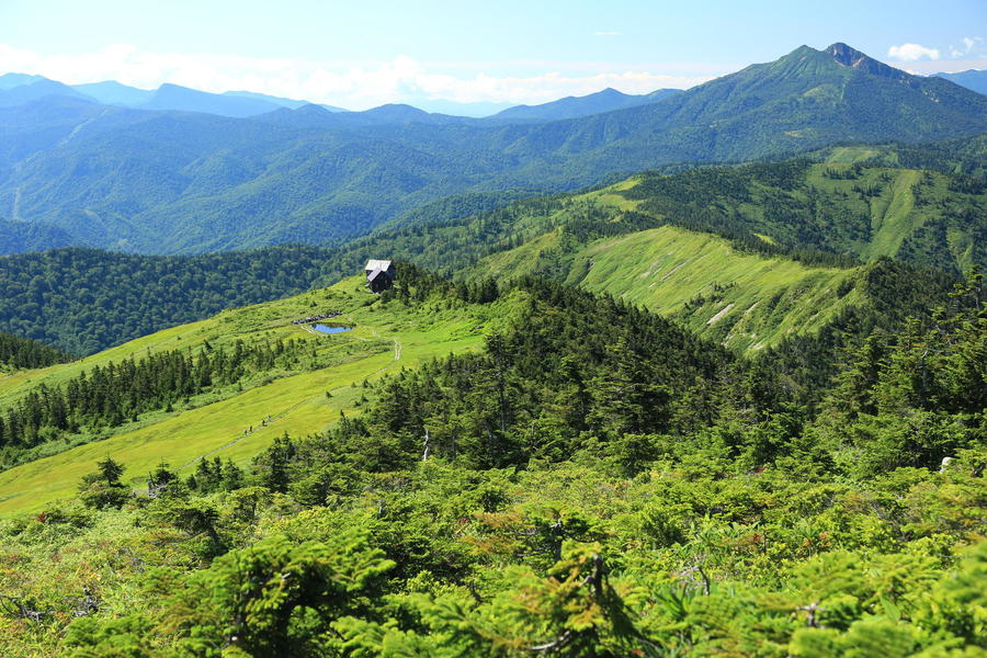
When you arrive at an area with wooden walkways, the conifers and shrubs you pass through will be punctuated with wetlands. About 3.5 hours out from the Komagatake Trailhead, you’ll pass over a small peak and arrive at the Koma-no-koya mountain hut at the edge of Koma-no-Oike Pond. Spend the night here.
The next day you'll hike the boardwalk through a bamboo grass field, and about 20 minutes out from Koma-no-koya you'll reach the summit of Mt. Aizu-Komagatake. From there you proceed along a boardwalk over a large ridge through a marshland dotted with ponds. You’ll arrive at Mt. Chumon-dake in about 50 minutes.
Blooming alpine plants in the wetlands around Mt. Aizu-Komagatake and Mt. Chumon-dake can be seen from late June to August. The wetland's autumnal grasses turn colors from the middle of September to the beginning of October.
Return the way you came.
Gallery
Other Info
The area around Mt. Aizu-Komagatake gets heavy snowfall. Its relatively gentle topography makes it a popular mountain for skiing from the end of December to the beginning of April.
Lots of skiers ascend via nearly the same route described and then ski down. When it snows, you need to be careful not to go astray from the route when descending.
High Season:July to October
Notes
You should book in advance to secure a spot to stay at Koma-no-koya as capacity is limited. They don't offer meals. While they sell beverages, alcohol, packaged food, and rent small stoves, it's a good idea to bring your own comestibles and cooking gear. Camping is prohibited.
Route Map
Elevation Map
Spec
- Duration
- 2Days / 8.5Hours
- Highest Point
- 2133m(Mt. Aizu Komagatake)
- Elevation Gain
- 1204m
- Horizontal Distance
- 13.8Km
- Skill Level
- Fitness Level
- Gear Level
On the Trail
- Sleeping
Koma-no-koya
- Eating
Oze no Sato Koryu Center "Mizubasho"
- Hot-Springs
Aruza-oze no Sato


