


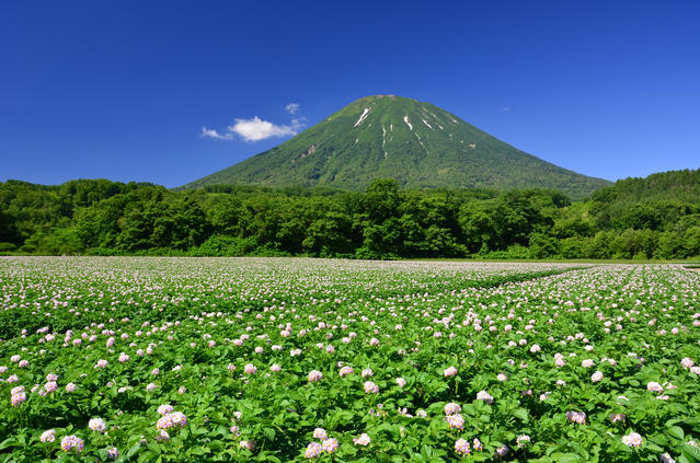
Round Trip Hike of Mt. Yotei via the Makkari Trail
-
- Duration
- 1Day / 9Hours
- Highest Point
- 1898m
- Elevation Gain
- 1670m
-
- Skill Level


- Fitness Level
- Gear Level
From the Yotei Nature Park trailhead, walk along the forestry road for about 30 minutes. Go past the camping area to reach the Makkari trailhead. Continue on through and area lined with coniferous tress and eventually the surroundings will turn to broad-leafed trees followed by a shrubbery belt. Eventually, you will arrive at the Sixth Station. It takes about 2 and half hours from Makkari trailhead to Sixth Station.
Hike up the zigzagging trail to reach the stone pine belt above. From the Sixth Station, it’s about an hour and 10 minutes hike to the Ninth Station. From here, continue for another 10 minutes to reach the Yoteizan-hinan-goya shelter hut, where you may stop to rest if you are pressed for time or forced to stop by inclement weather. From the Ninth Station, hike up a steep slope through a stone pine belt for about 30 minutes to reach the crater wall at Mt. Yotei’s peak.
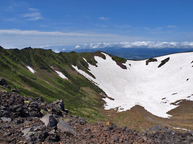
From this point, you can hike all the way around the outer edge of the crater, called Chichigama, which has a diameter of around 700 meters and a depth of around 200 meters. Walk around the crater rim while traversing downward and you will come to Mt. Yotei’s highest point (1898 meters) at the east side of the crater.
Continue on further to reach the mountain’s former peak (1892.7 meters) where a triangulation station is set up. Once you pass the point where the trail merges with the Kyogoku Trial, the path turns from a rock face to a rocky section.
Continue straight on past the junction with Mt. Kita (Kita-yama) and Kutchan (Hirafu) trail and then past the remains of an abandoned shelter hut. After about 80 minutes of walking, you will have completed a full loop around the crater rim. For the return leg of your hike, follow the Makkari Trail in reverse back to the trailhead.
Gallery
Other Info
There are many famous springs in the area around Mt. Yotei. Rainfall and melted snow from Mt. Yotei blended together to form an underground river and decades late emerged from the surface in the form of springs whose waters are rich in mineral components.
There is a spring in the Yotei Nature Park, where the hike begins and ends, called Yotei no Wakimizu. You may approach the spring and even drink from it. Across from Mt. Yotei, near the trailhead of the Kyogoku Trail, there is a spring named Kyogoku no Fukidashi Wakimizu, which is listed among the Japan's100 most famous water.
Best Season:July to September
If you go to this trail outside of the best season, you should pay attention to weather and trail conditions, as the mountain is located in a snowy area; there may still be snow on the trail in June, and it may start snowing from September. Snow mountaineering equipements and experience are required during the winter season.
Notes
Although this route is relatively easy, it has a significant change in altitude and takes a long time to complete. You are advised to be in good condition when attempting the hike and also to give yourself some leeway with the hiking schedule.
Also, as is often the case with free-standing peaks, the changes in weather can be dramatic, which has led to some fatalities due to hypothermia in the past. Even during the summer hiking season (July to August), it is necessary to prepare rain gear and a warm change of clothing.
Route Map
Elevation Map
Spec
- Duration
- 1Day / 9Hours
- Highest Point
- 1898m
- Elevation Gain
- 1670m
- Horizontal Distance
- 13.4Km
- Skill Level
- Fitness Level
- Gear Level
On the Trail
- Sleeping
Yoteizan-hinan-goya, Ezo-Fuji-goya
- Eating
Makkari Onsen
- Hot-Springs
Makkari Onsen


