


Round Trip Hike of Mt. Kai-komagatake and Mt. Senjogatake from the Kitazawa-toge Pass.
-
- Duration
- 2Days / 14.5Hours
- Highest Point
- 3033m
- Elevation Gain
- 997m
-
- Skill Level


- Fitness Level
- Gear Level
On the first day, you will climb Mt. Kai-komagatake.
Leave any unneeded baggage at a mountain hut in the Kitazawa-toge Pass area, and walk for about 10 minutes down a forest road until you reach Choei-goya, a mountain hut with a camping area.
Cross the bridge over a stream and hike up through a coniferous belt and you will see Sensui-goya mountain hut. Continue on and eventually the path will turn into a rocky slope with an excellent view. It takes about 1 hour and 10 minutes to go from Choei-goya to the col of Sensui-toge Pass.
From the Sensui-toge Pass, hike up a steep path through another belt of coniferous trees which in time gives way to stone pines and shrubbery. Continue on beyond the tree line and hike up the rocky slope. From Sensui-goya to the Komatsumine peak takes about 1 hour and 30 minutes.
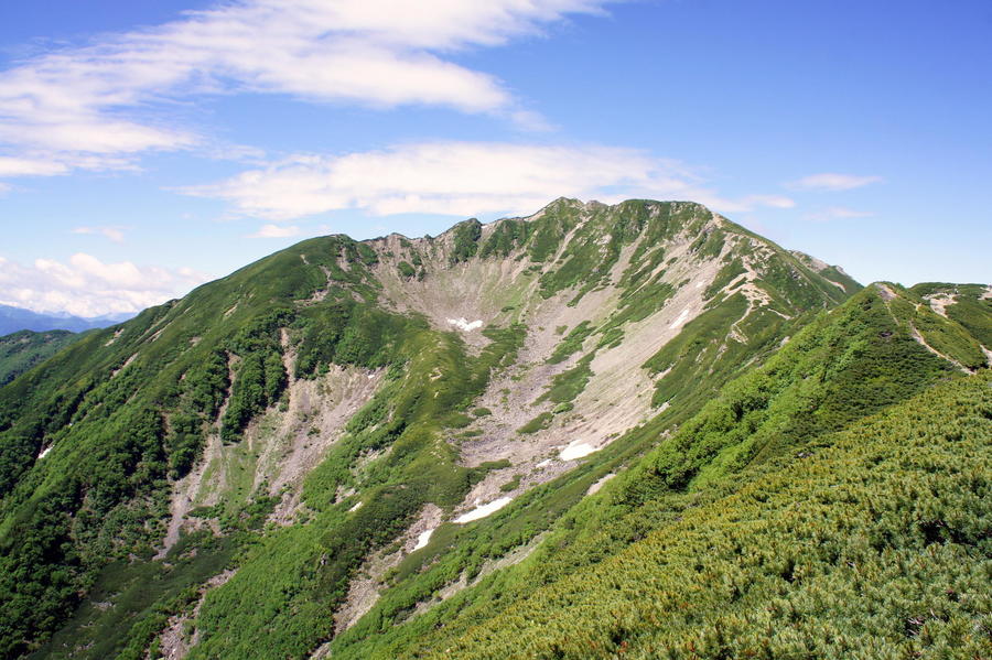
Descend the rocky slope into the col and hike over the sandy path passing through granite rock formations. Continue on past the Marishiten and Kuroto-one junctions toward the peak. The hike from Komatsumine to Mt. Kai-komagatake’s main peak takes about 1 hour and 30 minutes.
The return route from the peak follows the same path in reverse. It takes about 1 hour to reach the Komatsumine peak en route to Mt. Futago (Futago-yama).
Hike down through the rock pine belt and pass through a forest col before climbing up another rock pine belt to reach Mt. Futago. From here, head down the coniferous forest trail. The return hike from Komatsumine peak to Kitazawa-toge Pass takes about 1 hour and 50 minutes. Spend the first night of your trek at a mountain hut in the Kitazawa-toge Pass area.
On the second day, you will hike Mt. Senjogatake.
There are two separate paths at the start of the hike: one that follows a ridgeline and another that skirts around it. However, these two routes converge at the Second Station. Hike through the coniferous belt toward the Otaki no Atama (Ohtaki no Atama) Fifth Station, which is about 2 hours from Kitazawa-toge Pass. From there, go left at the junction and continue on toward Mt. Kosenjogatake. Along the way, the coniferous belt gradually turns into a stone pine belt and, as your view of the area opens up you will arrive at Mt. Kosenjogatake, approximately 1 hour from the Otaki no Atama Fifth Station.
Hike down through the stone pine belt and cross over the barren rocks to reach the col. Then hike back up a stretch of loose rocks passing through another stone pine belt on the other side. Go straight along the right hand side of the junction which branches off to Senjo-goya mountain hut. Then, traverse the ridgeline winding to the right and alongside the Sotaku Col, which will be below and to the right of you. This portion of the trek takes about 1 hour and 20 minutes, from Mt. Kosenjogataketo Mt. Senjogatake.
Descend along the rock ridge from Mt. Senjogatake’s peak and pass the Senjo-goya at the base of the Yabusawa Cirque . Then, hike down through a stone pine belt and the stretch of shrubbery beyond it. When you reach the junction with the Tankei Shindo, take the right hand side of the path and follow the trail down to the Umanose Hutte. From Mt. Senjogatake, this part of the hike takes about 1 hour and 40 minutes.
From the Umanose Hutte, hike through the shrub-lined traverse, crossing several small streams along the way. It takes about 40 minutes to reach the Otaki no Atama Fifth Station from the Umanose Hutte. From the Otaki no Atama Fifth Station, travel for about 1 hour and 10 minutes along the same path you started on to reach your goal at Kitazawa Pass.
Gallery
Other Info
Senryu-so Hotel and the Kitazawa-toge Pass are connected by a sloping alpine road, which runs a few hundred meters above the Todai-gawa River, opening up the area to visitors. Only Minami Alps Rindo buses are permitted to drive on this road.
You can admire gorgeous scenic spots like the Todai-gawa River down below the road and the steep ridges of Mt. Nokogiri (Nokogiri-dake) on the opposite side of the river through the window as you ride the bus.
Best Season:June to October
If you go to this trail outside of the best season, you should pay attention to weather and trail conditions, as the mountain is located in a snowy area; there may still be snow on the trail in May, and it may start snowing from October. Snow mountaineering equipements and experience are required during the winter season.
Notes
There is a route which bypasses the area around the peak of Mt. Kai-komagatake and which poses little risk of dangerous falls. However, both mountains have areas with sand and loose rocks above the treeline. You must exercise caution to avoid slipping and falling, especially on your descents.
Route Map
Elevation Map
Spec
- Duration
- 2Days / 14.5Hours
- Highest Point
- 3033m(Mt. Senjogatake)
- Elevation Gain
- 997m
- Horizontal Distance
- 16.8Km
- Skill Level
- Fitness Level
- Gear Level
On the Trail
- Sleeping
Komorebi Sanso, Odaira Sanso, Choe-goya, Sensui-goya, Senjo-goya, Umanose Hutte, Senjo-yabusawa-goya
- Eating
Senryu-so
- Hot-Springs
Senryu-so


