


Round Trip Hike of Mt. Kumotori from Kamosawa
-
- Duration
- 2Days / 10Hours
- Highest Point
- 2017m
- Elevation Gain
- 1470m
-
- Skill Level


- Fitness Level
- Gear Level
From the Kamosawa bus stop, follow the paved road. Walk up through the forest of Japanese cryptomeria for about 30 minutes and arrive the parking area.From the parking area, follow the paved road for about 5 minutes and you will find the entrance to the trail on your left. From here, continue hiking up through a conifer belt.
At length, you will come to a forest of broad-leaved trees, and within about 2 and an half hours since departing Kamosawa bus stop, you will arrive at Dodokoro. From here, the trail runs along a ridgeline.When you reach the fork at Mamushi-iwa Rock, head in the direction of Nanatsuishi-goya mountain hut. Hike up through a steep patch of bamboo grass to reach the Nanatsuishi-goya. You can purchase food and souvenirs here and there is a pay toilet available, making the hut a good place to stop for a rest.
Continue hiking up the trail past the mountain hut and the nearby shrine to enter the broad main traverse trail on Ishi-one ridge. After about 4 hours of hiking from Kamosawa, you’ll arrive at Mt. Nanatsuishi (Nanatsuishi-yama).
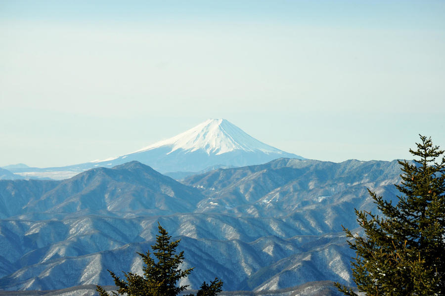
Descend the slope through beech trees into the Bunazakano-col below and continue to the point where the trail winding around Mt. Nanatsuishi’s peak and the Karamatsudani forest path intersect at a crossroads. From this point, the traverse follows a broad ridgeline path lined with Japanese larch and some broad-leaved trees. You will reach an area where trees have been cut down to prevent the spread of forest fires. From here, the trail commands an excellent view of the surroundings.
Continue on past the heliport and the currently inactive Okutama-goya mountain hut, then follow a path composed of small loose stones up to Yomogino-atama.Hike up a moderately steep slope through a patch of larches and pass under the peak of Mt. Kokumotori to arrive at the junction for the Kumotori Sanso mountain hut. On either the outgoing or return part of the hike, it’s possible to use the detour path rather than passing over the peak of Mt. Kumotori.
Hike further up the broad and gentle ridgeline trail, then go past the Kumotori-sancho hinan-goya shelter hut and on to the summit. It takes a total of about 5 and an half hours to reach the peak of Mt. Kumotori from your starting point at Kamosawa.
From the peak of Mt. Kumotori, hike down the trail for about 20 minutes to reach Kumotori-goya mountain hut where you will spend the night.
For the return leg of your trek, simply repeat the previous day’s hike in reverse.
Gallery
Other Info
Located on a ridge bordering Tokyo and Saitama prefectures, Kumotori-sanso is an unusually large mountain hut with two floors.
On clear days, the panoramic vantage point in front of the mountain hut allows you to enjoy views of central Tokyo at night and other aspects of the scenery such as beautiful sunrises.
High Season:May to November
Notes
The route featured here is the shortest one you can take to reach the peak of Mt. Kumotori, but it still takes about six hours to reach Kumotori-sanso. The best period for viewing the lovely Japanese larch foliage on the ridgeline is from October to November. At this time of year, however, sunset occurs early and it begins to get dark around 4 pm. The nearby Nanatsuishi-goya generally requires reservations and uses a system of guests cooking for themselves, so you should avoid showing up unannounced and expecting a place to stay. Be sure to give yourself ample time to work with when planning your trip.
Route Map
Elevation Map
Spec
- Duration
- 2Days / 10Hours
- Highest Point
- 2017m(Mt. Kumotori)
- Elevation Gain
- 1470m
- Horizontal Distance
- 22.8Km
- Skill Level
- Fitness Level
- Gear Level
On the Trail
- Sleeping
Nanatsuishi-goya, Kumotori-sanso
- Eating
Okutama Onsen, Moegino-yu
- Hot-Springs
Okutama Onsen, Moegino-yu


