


Hike of a Sacred Mountain, Mt. Hakusan; Round Trip from the Kanko Shindo Route
-
- Duration
- 2Days / 9.5Hours
- Highest Point
- 2702m
- Elevation Gain
- 1444m
-
- Skill Level


- Fitness Level
- Gear Level
From the Bettodeai trailhead, pass through the torii gate and follow the trail on the left side of the Sabo Shindo junction. Hike up a zigzagging section of trail through a forested area. When the trail becomes a traverse, your field of vision will open up, and the path once again turns to steep rocky steps.
From Bettodeai, it’s a two-hour hike to the Bettozaka junction where you emerge into the ridgeline. Hike up a ridge lined with shrubs and bamboo grass and pass through a large rock formation called Senninkutsu and you will soon be hiking up a zigzagging segment of trail. After about an hour and 20 minutes of departing from the Bettozaka junction, you will arrive at the Tonogaike-hinan-goya shelter hut. From Tonogaike-hinan-goya, hike up for about an hour and 20 minutes through grassy meadows where flowers bloom through July and August, and you’ll reach a large rock formation called Kuroboko-iwa Rock.
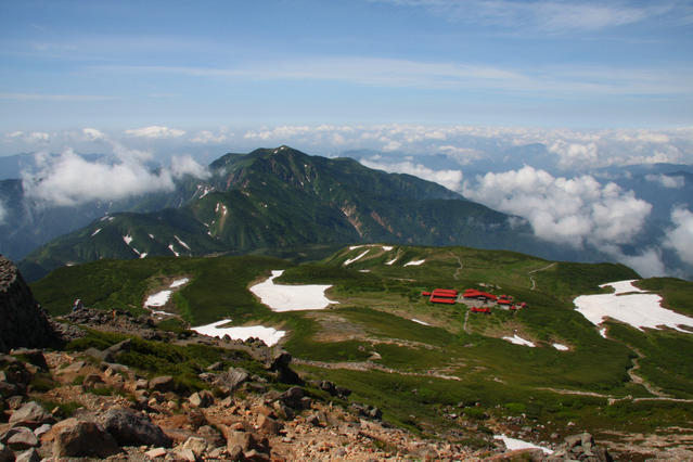
Follow a level segment of trail from Kuroboko-iwa Rock. Proceed straight past the junction with Minami-ryugabanba then hike up a rocky slope called Goyozaka through a stone pine belt to reach the Hakusan Murodo Visitor Center(mountain hut) where you will lodge for the first night of the trek.
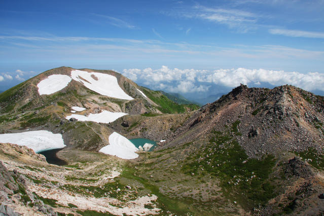
On the second day, follow the stone paved path for about 40 minutes to reach the summit of Mt. Gozengamine, where you’ll find a small Shinto shrine belonging to the Hakusan Okumiya Shrine.
From here, follow the trail in reverse to complete the return hike.
Gallery
Other Info
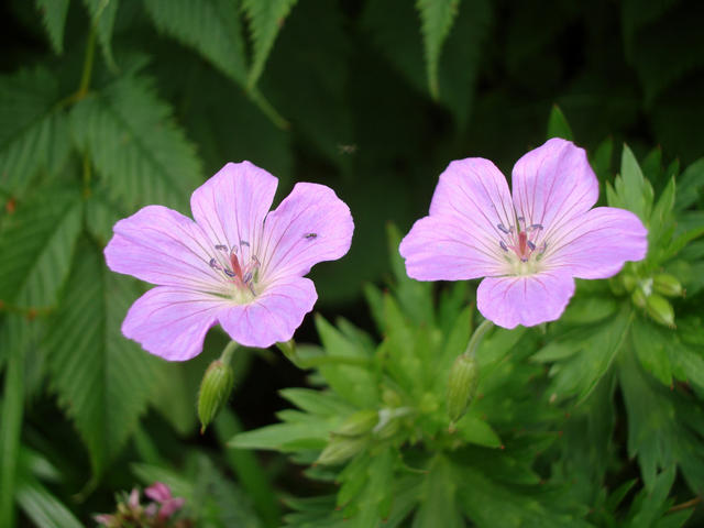
Mt. Hakusan is also popular due to its beautiful flowers. A variety of alpine flora blooms through July and August. Some like Hakusanfuuro (Geranium nipponicum) and Hakusanzakura (Primula cuneifolia) bear the mountain’s name. You can also see kuroyuri (Kamchatka fritillary), Iwagikyo (Campanula lasiocarpa), and Takanematsumushiso (Scabiosa japonica).
High Season:June to October
Notes
Hakusan Murodo has several buildings providing accommodation for large numbers of people. However, there is a strict system requiring reservations for anyone planning to stay. When planning your visit be sure to reserve lodgings ahead of time.
Route Map
Elevation Map
Spec
- Duration
- 2Days / 9.5Hours
- Highest Point
- 2702m(Hakusan Mt. Gozengamine)
- Elevation Gain
- 1444m
- Horizontal Distance
- 11.7Km
- Skill Level
- Fitness Level
- Gear Level
On the Trail
- Sleeping
Tonogaike-hinan-goya, Hakusan Murodo Visitor Center
- Eating
Hakusan Murodo Visitor Center
- Hot-Springs
Hakusan Onsen


