


Mt. Karamatsu and Mt. Goryu Traverse of Happo-one Ridge to Tomi-one Ridge
-
- Duration
- 2Days / 13Hours
- Highest Point
- 2814m
- Elevation Gain
- 1288m
-
- Skill Level


- Fitness Level
- Gear Level
Take the gondola and two ski lifts from the foot of the mountain and start walking from the Happoike Sanso mountain hut.
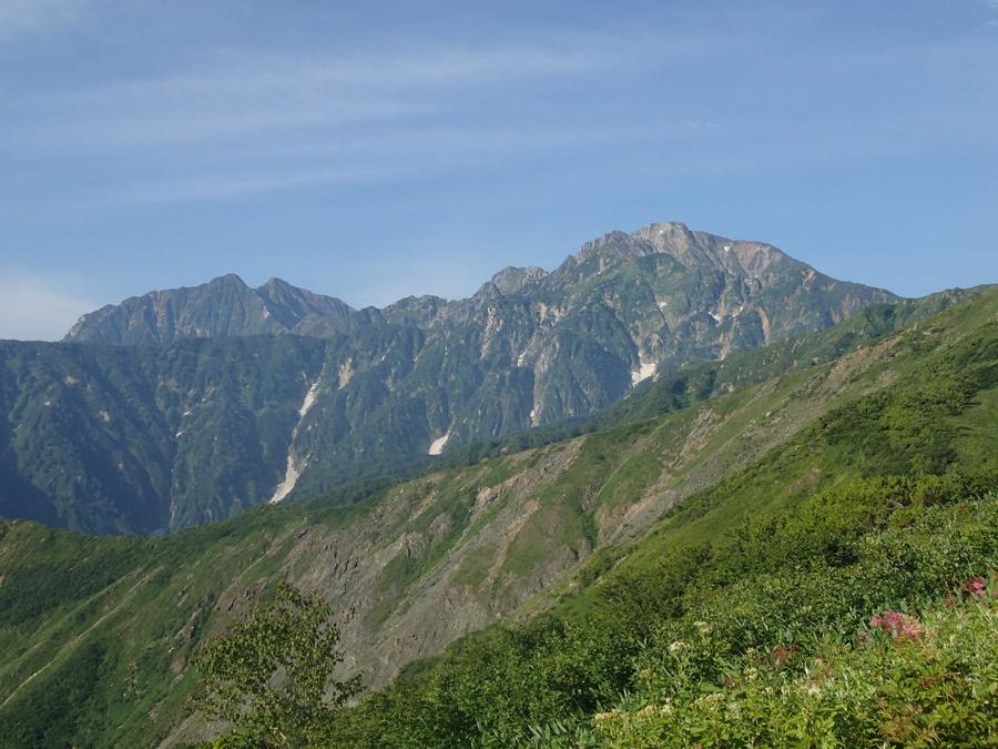
There is a ridge trail and a traverse trail but proceed along the boardwalk, which is easier to walk. The trails come together at the 2nd cairn, which is equipped with restrooms. Ascend the gentle scree slope amongst the creeping pines before ascending from the 3rd cairn while enjoying the view of Happo-ike Pond to the bottom right.
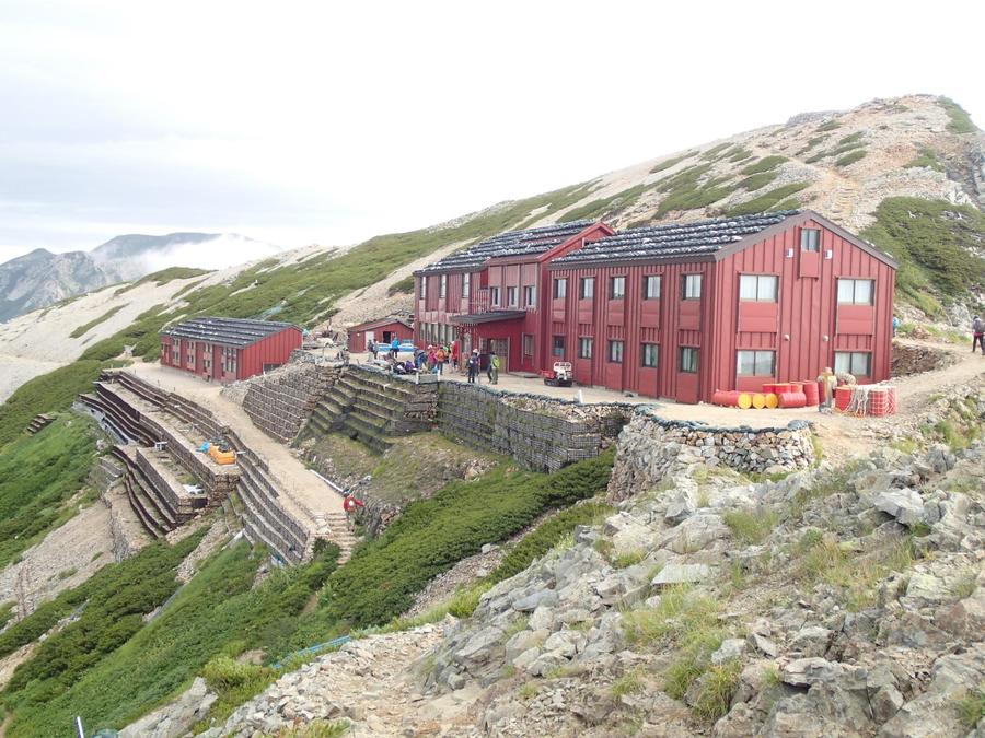
As you ascend from Happo-ike Pond through the forest to Shimonokanba, you will again be in the creeping pine zone and be treated to a great view. After ascending the scree slope over Maruyama and traversing the ridge you will arrive at the Karamatsudake Chojo Sanso. This is where you will stay the night.
The next day, you will make a round trip to Karamatsudake Chojo Sanso beyond the scree slope.
From the Karamatsudake Chojo Sanso, first pass through the perilous Ushikubi, then descend the scree slope before ascending and descending the rocky ridgeline, which has chains to assist your climb. As you cross Mt. Daikoku (Daikoku-dake) you will eventually arrive at a gentle scree trail, which you will descend to the mountain’s lowest saddle.
From here, you will climb up the other side amongst the shrubs and creeping pines and arrive at the Goryu Sanso mountain hut after passing over Mt. Shiratake. From Goryu Sanso, you will climb the rocky area, which has a number of chains to assist your climb, up to Mt. Goryu. Reaching the summit takes around an hour.
The return trip will start with a descent from Mt. Goryu before descending Tomi-one (Tohmi-one) Ridge from a fork in the trail located at Mt. Shiratake. After passing beyond a chain area and then passing Mt. Nishitomi (Nishi-tohmi-yama), which features a succession of narrow ridges, you will reach a gentle downward slope amongst the shrubs.
After passing over Mt. Otomi (Tohmi-yama), passing over Mt. Nakatomi (Naka-tohmi-yama) and Mt. Kotomi (Kotohmi-yama) via boardwalks and scree trails, and walking past Jizo-no-kashira, you will arrive at a gondola station. Take the gondola down the mountain.
Gallery
Other Info
There is also a route that loops around Happo-ike Pond from the 3rd cairn before coming together with the other routes at Happo-one Ridge. The pond has good views and is also a popular photo spot on days with no wind as the three mountains of the Hakuba Sanzan (Hakuba Three Peaks) are reflected in the pond’s surface. Happo-one Ridge and Tomi-one Ridge both offer beautiful alpine plants in summer as well as beautiful autumn.
High Season:July to September
If you go to this trail outside of the best season, you should pay attention to weather and trail conditions, as the mountain is located in a snowy area; there may still be snow on the trail in July, and it may start snowing from October. Snow mountaineering equipements and experience are required during the winter season.
Notes
Route Map
Elevation Map
Spec
- Duration
- 2Days / 13Hours
- Highest Point
- 2814m(Mt. Goryu)
- Elevation Gain
- 1288m
- Horizontal Distance
- 22.3Km
- Skill Level
- Fitness Level
- Gear Level
On the Trail
- Sleeping
Happoike Sanso, Karamatsudake Chojo Sanso, Goryu Sanso
- Eating
Happoike Sanso, View Point Restaurant ALPS360
- Hot-Springs
Mimizuku-no-Yu


