


Mt. Tsurugi (Tsurugi-san) is in Tokushima prefecture, Shikoku, and has been selected as one of Japan’s 100 most famous mountains. It boasts the second highest peak not just in Shikoku, but in West Japan second to Mt. Ishizuchi (Ishizuchi-san) that is also in Shikoku. It is the object of mountain asceticism, and is used as a place of ascetic training for devotees of Shugendo, so there are lots of such remnants spotted across the mountain. The main route is a round-trip route that uses a chairlift and features few height differences.
Round Trip Hike of Mt. Tsurugi from Minokoshi
Use the lift and enjoy a hike on the ridgeline with great views.
-
- Duration
- 1Day / 3.5Hours
- Highest Point
- 1955m
- Elevation Gain
- 241m
-
- Skill Level


- Fitness Level
- Gear Level
Use the chairlift to go up to Nishijima from the Minokoshi trailhead, which features tea shops and Tsurugi-jinja Shrine. There are multiple hiking routes, such as a route that traverses the ridgeline from Nishijima left and right, but the main route is the flattest route, and it runs directly up the ridgeline through Katanakakeno-matsu.
Go up the stepped mountain path in the field of bamboo grass to find an oddly-shaped pine tree called Katanakake-no-matsu, literally means “Sword-resting Pine Tree.” Going up the steps further, and proceed below the shrine gate of Tsurugisan-hongu-hozoseki-jinja Shrine, and about 45 minutes after exiting the lift, you will arrive at the Tsurugisan-chojo Hutte.
You can stay overnight at the hutte, or you can just have a meal. After hiking the wooden path for 5 minutes, you will arrive at the flat peak of Mt. Tsurugi.
Head for the peak of Mt. Jirogyu which you can see nearby from Mt. Tsurugi. Mt. Tsurugi is also called “Mt. Tarogyu”, and Mt. Jirogyu and Mt. Tarogyu are considered brothers. Descend the bamboo grass mountain path for 40 minutes to get to Jirogyu-toge Pass. Ascend the steep face from Jirogyu-toge Pass for 30 minutes to arrive at the peak of Mt. Jirogyu.
Looking back, you can get a great view of the smooth ridgeline from Mt. Tsurugi covered in bamboo grass, the ridgeline you just traversed.
To descend the mountain, go back along the route you came.
Gallery
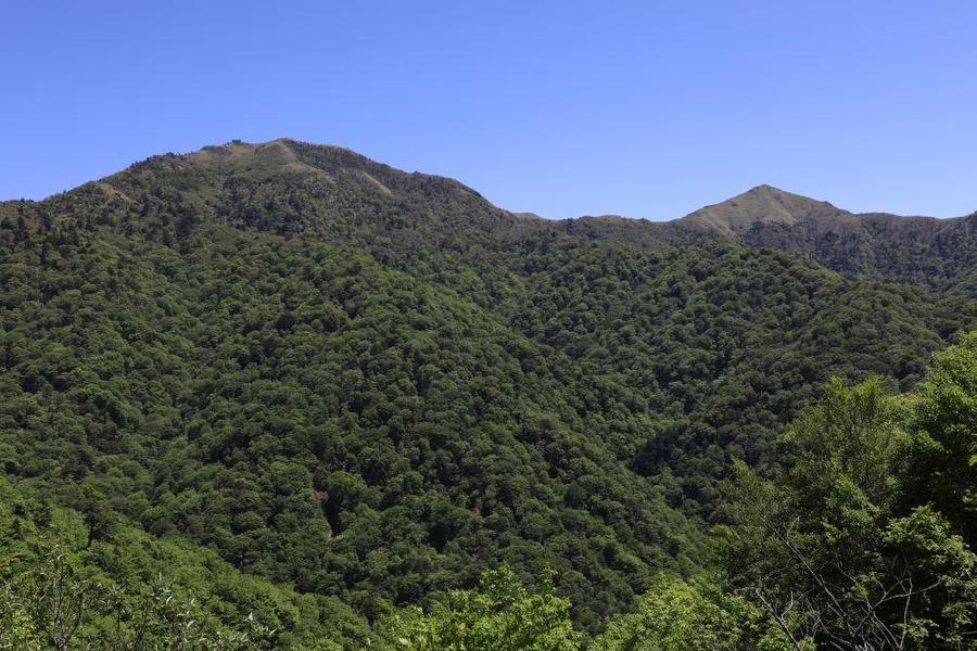
Tarougyu(Mt.Tsurugi/left) and Jirogyu(right) are considered brothers(Photo by K.Mizutani)
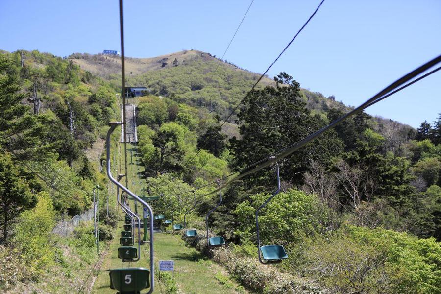
The chairlift to go up to Nishijima (Photo by K.Mizutani)
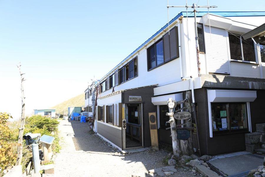
Tsurugisan-chojo Hutte, located directly below the top of the mountain(Photo by K.Mizutani)
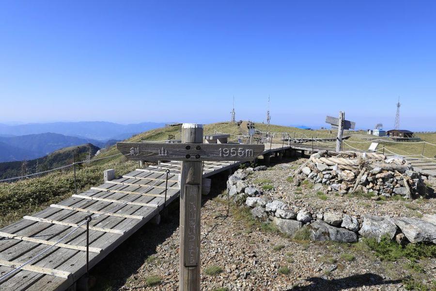
Top of the Mt. Tsurugi.(Photo by K.Mizutani)
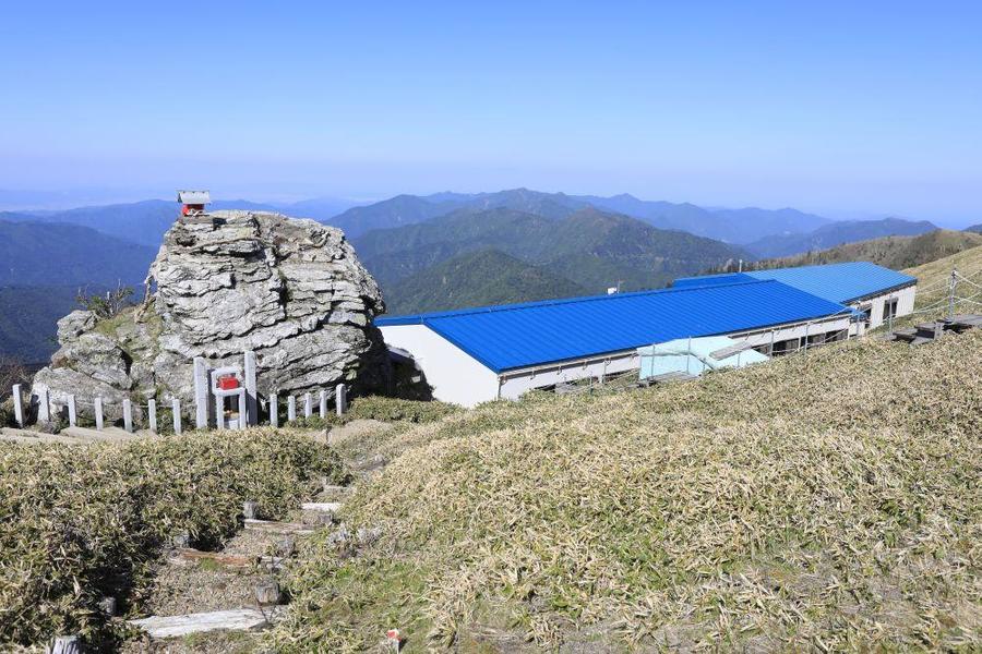
Roof of the Hutte and the sacred boulder(Photo by K.Mizutani)
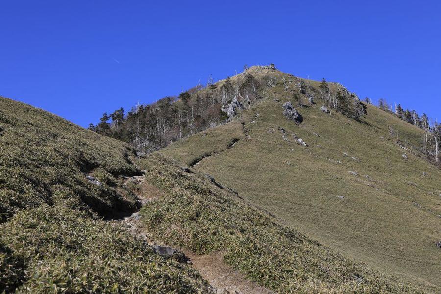
Mt.Tsurugi (Tsurugi-san) looking up from the col between Jirogyu (Photo by K.Mizutani)
Other Info
The main route of Mt. Tsurugi features Tsurugisan-hongu-hozoseki-jinja Shrine, as well as Otsurugi-jinja Shrine with sacred water known as “Tsurugisan-goshinsui.”
When descending from the peak hutte toward Nishijima, it might be a good idea to walk the route that passes through these shrines.
High Season:April to November
Notes
From Mt. Tsurugi to Mt. Jirogyu, the ridgeline extends as a field of bamboo grasses and no trees. Especially during the hot summer from July to September, be careful to avoid suffering from heat stroke and being hit by lightning.
Route Map
Elevation Map
Height (m)
Horizontal Distance (km)
Spec
- Duration
- 1Day / 3.5Hours
- Highest Point
- 1955m(Mt. Tsurugi)
- Elevation Gain
- 241m
- Horizontal Distance
- 6.6Km
- Skill Level
- Fitness Level
- Gear Level
On the Trail
- Sleeping
Tsurugisan-chojo Hutte
- Eating
Tsurugisan-chojo Hutte
- Hot-Springs
La foret Tsurugi San


