


Hike Up to Mt. Tsurumi from Matogahama
-
- Duration
- 1Day / 5.5Hours
- Highest Point
- 1375m
- Elevation Gain
- 1375m
-
- Skill Level


- Fitness Level
- Gear Level
The starting point for this hike is Matogahama Park, a “spa beech” that looks out onto Beppu-wan Bay. Take a moment to touch the water where the waves crash on the shore and then get started with your hike.
Walk along Route 10 in the direction of Hinode, then cross a bridge, take a left turn, and follow the footpath that runs along the left bank of the Sakai-gawa River. When you get to pedestrian bridge called Inachus Bridge (Inakosu-no-hashi), cross back over to the right bank of the river, and continue on through Minamitateishi Park.
Pass through the Horita-tenman-jinja Shrine, located at 250 m above sea level, and pass under the expressway. There is a road called the “Yamanami Highway” which links Beppu City with the Beppu Ropeway and also a hiking trail running alongside it. Traverse the grassy slope and pass under the Yamanami Highway to reach the Beppu Ropeway’s Beppu Kogen Station. In total, it’s about a two hour and 40 minute walk from your starting point of Mato-ga-hama Park.
Continue on through a forest of Japanese cedars and climb a steep series of stone steps. In about 30 minutes you will come to a shrine called Otake Gongen-sha (Shrine). Follow a ridgeline path through a wooded area, turn right at the junction and hike up a steep, zigzagging section of trail until the surrounding trees thin out near the summit. From Otake Gongen-sha, it takes about an hour and 20 minutes to reach the peak of Mt. Tsurumi. From the west side of the mountaintop, you should be able to see the two horn-like points of Mt. Yufu (Yufu-dake)’s peak.
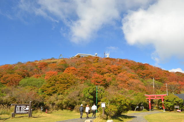
From the peak of Mt. Tsurumi, head down the footpath for about 10 minutes and pass through the torii gate to reach the Beppu Ropeway, Tsurumi Sanjo Station. Take the ropeway down the mountain to complete your descent.
Gallery

Other Info
Mt. Tsurumi is an object of religious devotion. Including the Tsurumi Sanjo Gongen Ichinomiya Shrine, there are statues of shichi-fuku-jin (Seven Gods of Fortune) as well as stone statues of Buddha and Shinto gods in the area around the peak. You can walk all the way around the mountain top area in about 40 minutes by following a purpose-built footpath.
Season:All Year around
Notes
A special event called the Beppu Mt. Tsurumi Ikki Tozan (“One shot mountain hike”) is held each April and follows a trail specially prepared for the event. The trail extends from the sea all the way to the summit and, unusually for such a route, does not involve walking on any large motorways.
While there are no personnel directing traffic except during events, there are signs and other forms of direction (in Japanese) along the route. Please take care not to get lost as you hike to the ropeway Beppu Kogen Station.
Route Map
Elevation Map
Spec
- Duration
- 1Day / 5.5Hours
- Highest Point
- 1375m(Mt. Tsurumi)
- Elevation Gain
- 1375m
- Horizontal Distance
- 12.6Km
- Skill Level
- Fitness Level
- Gear Level
On the Trail
- Sleeping
- -----
- Eating
Shops at Beppu Ropeway Kogen and Sanjo
- Hot-Springs
Beppu Onsen


