


The Tanzawa mountain range (Tanzawa-sankai) runs about 40 kilometers east-west through northwestern Kanagawa Prefecture. Most of it is incorporated into Tanzawa-Oyama Quasi-National Park. Mt. Tonodake (Tohno-dake) is the highest peak along the Omote Ridge (Omote-one) that runs between Mt. Oyama (Oh-yama) and Nabewari Ridge (Nabewari-sanryo). It has easy access, being about 80 minutes to Shibusawa Station from both Shinjuku and Tokyo on the Odakyu Line. From there frequent buses depart for the Okura trailhead. The view from the summit takes in the peaks of Mt. Fuji (Fuji-san) and the Southern Japanese Alps, the Miura and Izu Peninsulas, and the Pacific Ocean.
Mt. Tonodake, Beginning at Okura Ridge (Round Trip)
Shortest trail to the highest peak on the Tanzawa-Omote Ridge.
-
- Duration
- 1Day / 6Hours
- Highest Point
- 1491m
- Elevation Gain
- 1202m
-
- Skill Level


- Fitness Level
- Gear Level
The Okura trailhead is about a 10-minute walk along a paved road from the Hadano Visitor Center at the Okura bus stop. The pavement eventually gives way to a mountain trail which branches in two at Kannon Chaya (Japanese Soba restaurant and wagashi confectioner).
Either trail will bring you to Komadome Chaya mountain hut. From there it's a steep hike with an elevation gain of about 300 meters up occasional wooden stairs. Between Komadome Chaya and Horiyama-no-Ie mountain hut, the trail is relatively flat with a view of Omote Ridge opening on the right. From Horiyama-no-Ie you ascend a boardwalk, and where the path diverges at Tenjin Ridge (Tenjin-one), it levels out briefly before turning to a steep slope that leads on to Hanatate Sanso mountain hut. Ascending a scree slope, you pass through a wooded area and then go up a boardwalk along a slope with earthworks to prevent landslides.
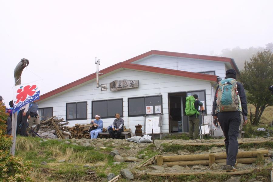
From the wooden trail at Hanatate with its fine view, you descend briefly, heading towards Kinhiyashi hiking back up the wooden stairs, you reach the summit of Mt. Tonodake with a spectacular 360-degree view. You can often spot deer here, which some Japanese people consider pests because they sometimes damage certain crops. The mountain-top Sonbutsu Sanso mountain hut sells souvenirs and light meals, and there's a toilet to the side of the building. To return, just retrace your steps back the way you came.
Gallery
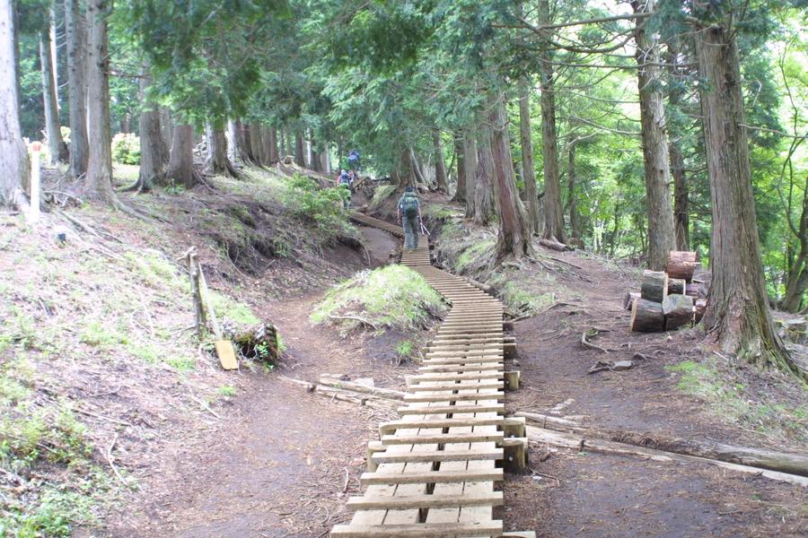
Some areas have wooden walkways
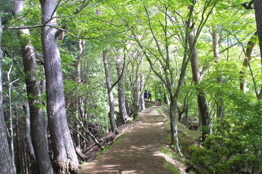
Hiking through the fresh green of a ridge trail
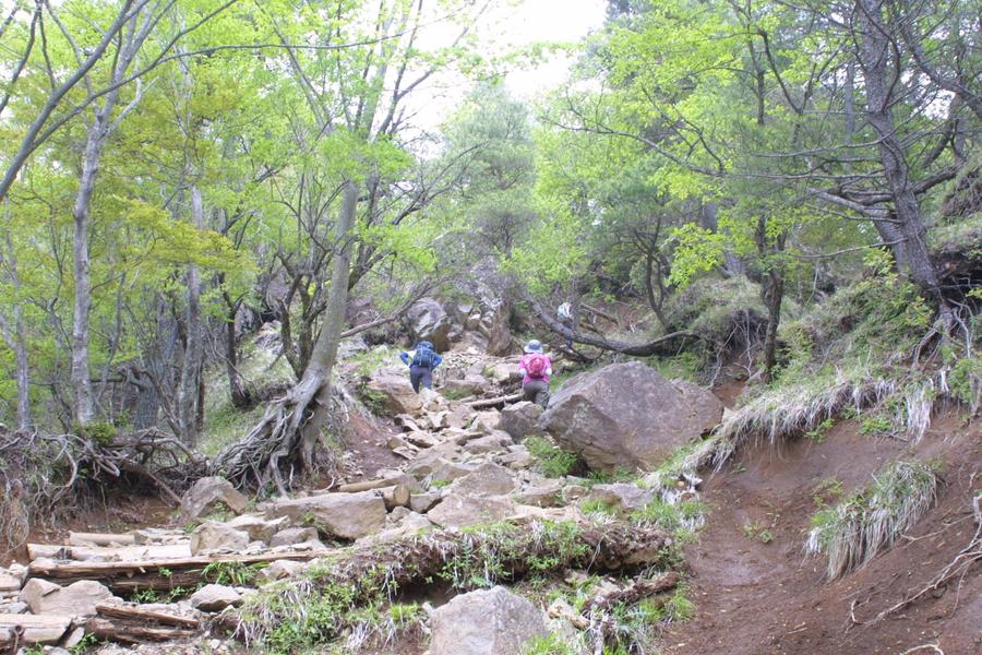
Hiking through a rocky area
Once you reach Hanatate Sanso, the summit is close
Other Info
This trail hikes continuously with an elevation gain of about 1200 meters. As there are 6 huts along the way, you can adjust your pace according to the weather, your fitness level, and your physical condition .
High Season:April to May, November to January
Notes
From the summit of Mt. Tonodake, Omote Ridge runs to the east, and the Nabewari Ridge to the west. To the north you can traverse the Tanzawa Mountain Range including Mt. Tanzawa (Tanzawa-san) and Mt. Hirugatake , the highest peak in the range. Because of the distance and long hike times, depending on the trail you choose, extending the hike means you may need to spend a night at a hut along the way.
Route Map
Elevation Map
Height (m)
Horizontal Distance (km)
Spec
- Duration
- 1Day / 6Hours
- Highest Point
- 1491m
- Elevation Gain
- 1202m
- Horizontal Distance
- 13.1Km
- Skill Level
- Fitness Level
- Gear Level
On the Trail
- Sleeping
Sonbutsu Sanso (summit), Hanatate Sanso, Horiyama-no-Ie, Komadome Chaya, Miharashi Chaya, Kannon Chaya
- Eating
Six mountain huts providing meals are along the trail to the summit.
There is soba noodle shop “Sakama” at Okura trail head
- Hot-Springs
The hot spring facility Kobo-no-sato-yu is near Tsurumaki-Onsen Station, three stops away from Shibusawa Station in the direction of Shinjuku


