


Mt. Odaigahara (Ohdaigahara-yama) is located on the border between Nara and Mie prefectures in the Kansai Region, inside the Yoshino-Kumano National Park.
Selected as one of Japan’s 100 most famous mountains, Mt. Odaigahara is a mountain featuring one of the highest amounts of rainfall in Japan as well as Yakushima Island.
The Odaigahara Driveway is maintained, so day-trips from the Nara prefecture side are possible for this mountain. On this route, you pass through Osugidani Valley, a beautiful valley that is one of Japan’s top three valleys, from the Mie prefecture side to a two-day traverse route that heads towards Mt. Odaigahara.
Traverse Hike of Mt. Odaigahara from Osugidani Valley
Headed for a mysterious primeval forest through the deep valley.
-
- Duration
- 2Days / 12.5Hours
- Highest Point
- 1695m
- Elevation Gain
- 1401m
-
- Skill Level


- Fitness Level
- Gear Level
Walk along the paved road from the trailhead, and when you pass a power plant, a hiking path that traverses the sloped face of the left side of the valley begins. It is a narrow path carved into the rock wall of a steep slope, so be very careful to avoid falls while hiking this path. There are chains installed where necessary.
Cross three suspension bridges, and about 2 hours from the power plant, you’ll arrive at Senpirono-taki Falls. These falls have the biggest drop on the Osugidani route. About an hour from Senpiro Falls, you’ll arrive at Shishi-buchi abyss . It features a b eautiful view of clear blue waters flowing in a narrow valley between sheer cliffs.
Proceeding 45 minutes from Shishi-buchi abyss, you’ll find the largest suspension bridge in the valley right in front of a rock wall. Cross the suspension bridge, proceed along the right wall of the valley, and in about 40 minutes, come to Momonoki-yamanoie (also named as “Momonoki-goya”) mountain hut. Stay overnight here on the first day.
On the second day, first proceed along the left wall of the valley. About 25 minutes from Momonoki-yamanoie, you’ll arrive at Nanatsugama-taki Falls, a waterfall that flows down several stages. Cross four suspension bridges to proceed along the right and left walls of the valley.
You will arrive at Dokura-taki Falls from Nanatsugama-taki Falls in about one and a half hours. At Dokura-taki Falls, diverge from Osugidani Valley and proceed along the steep hiking path. Go into the forest path, and after walking about one and a half hours from Dokura-taki Falls, you’ll arrive at Awadani-goya mountain hut.
From Awadani-goya, hike the steep face called “Shakunage-zaka (rhododendron hill)” towards the ridgeline. As indicated by the name, rhododendron bloom here from late May to early June.
Hiking up and down along the large and small peaks along the mountain ridge, you will arrive at the highest peak of Mt. Odaigahara, Mt. Hidegadake, in about 2 hours from the Awadani-goya.
From Mt. Hidegadake, descend the wooden stairs, and in about 30 minutes you’ll arrive at a grassy field with withered trees dotting the area. Proceed from here to a fork in the saddle of the mountain in about 10 minutes, go right, and after a 30-minute descent down the well-kept stone hiking path, you’ll arrive at the Odaigahara bus stop.
Gallery
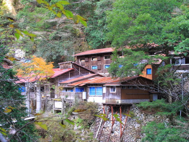
Momonoki-yamanoie mountain hut
Other Info
If you want to enjoy the views made by the richly diverse plantlife of Odaigahara, flowers of rhododendron and azalea bloom from late May to early June, and the fall leaves are beautiful from mid-October to later October.
Although not introduced on this route, there is a circuit hike you can walk to enjoy a suspension bridge from Odaigahara bus stop across the valley, and the rock wall named “Daijya-gura.”
High Season:May to November
Notes
Osugidani Valley has a hiking path along a steep valley and features many dangerous locations, such that accidents where hikers fell and died have occurred.
The walking time is long too, so you may need to reconsider entering the valley during poor weather.
There is also a danger of rocks falling from above, so bring a helmet just to be safe.
Route Map
Elevation Map
Height (m)
Horizontal Distance (km)
Spec
- Duration
- 2Days / 12.5Hours
- Highest Point
- 1695m(Mt. Hidegadake)
- Elevation Gain
- 1401m
- Horizontal Distance
- 14.6Km
- Skill Level
- Fitness Level
- Gear Level
On the Trail
- Sleeping
Momonoki-yamanoie, Awadani-goya
- Eating
Odaigahara product store
- Hot-Springs
Kamikitayama-onsen Yakushi-yu


