


Round Trip of Mt. Homan from Kamado-jinja Shrine
-
- Duration
- 1Day / 4Hours
- Highest Point
- 829m
- Elevation Gain
- 661m
-
- Skill Level


- Fitness Level
- Gear Level
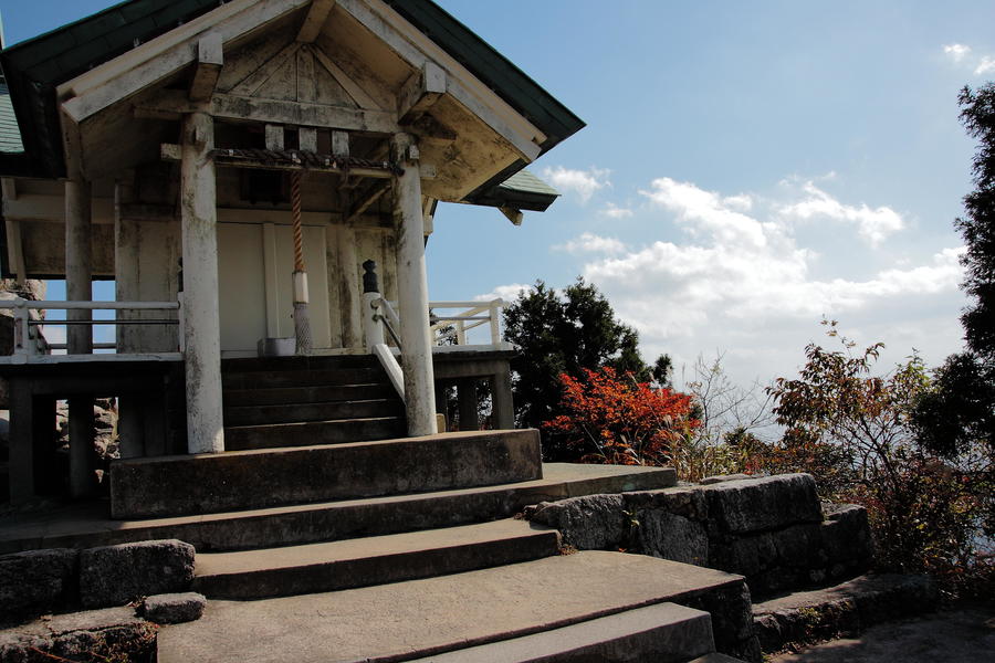
Entering the grounds of Kamado-jinja Shrine and proceeding to the left of the main hall, hikers will find the trailhead with a torii gate. Proceed on the trail extending through bedrock until it merges with the paved forestry road, which ends at Ichino-torii. It is approximately 40 minutes away from the trailhead. Giant trees and rocks are scattered about around the stone-step staircase trail that ascends through the forest. Hike all the way up the steep stone steps named Hyakudan Gangi for approximately an hour from Ichino-torii, and hikers will arrive at Chugu-ato, or the “middle shrine ruins.” It used to be the place for ascetic practices for Yamabushi, or the practitioners of austerities, and now houses a stone monument. Continue ascending for approximately 30 minutes on the rocky trail to get to Mt. Homan. The summit is an open space with a giant rock decorated with a sacred straw rope. The view is superb, with the city of Fukuoka and mountains such as Mt. Hiko (Hiko-san) in sight. The summit houses the upper shrine building of Kamado-jinja Shrine, to which offering prayer along with the lower shrine is recommended. Take the same route back for the descent.
Gallery
Other Info
Many buildings and small shrines are interspersed inside the vast grounds of Kamado-jinja Shrine, each enshrining various deity that are believed to bring a variety of profits. Purchasing different types of amulets or experiencing the Japanese religion by participating in prayer ceremonies may be a good souvenir of the trip. Season:All year around
Notes
Mt. Homan is one of the most popular mountains among hikers in the Kyushu region, but some of the many trails include difficult rocky spots and chain-supported areas. Hikers need to be cautious not to wander in accidentally.
Also be aware not to slip and fall on staircases.
Route Map
Elevation Map
Spec
- Duration
- 1Day / 4Hours
- Highest Point
- 829m(Mt. Homan)
- Elevation Gain
- 661m
- Horizontal Distance
- 5.2Km
- Skill Level
- Fitness Level
- Gear Level
On the Trail
- Sleeping
- -----
- Eating
Homan-chaya Yamako, Tsukushino-yu
- Hot-Springs
Tsukushino-yu


