


The Tanzawa mountain range (Tanzawa-sankai) runs about 40 kilometers east to west through northwestern Kanagawa Prefecture. Most of it is incorporated into Tanzawa-Oyama Quasi-National Park (Tanzama-Ohyama Kokutei Kohen).
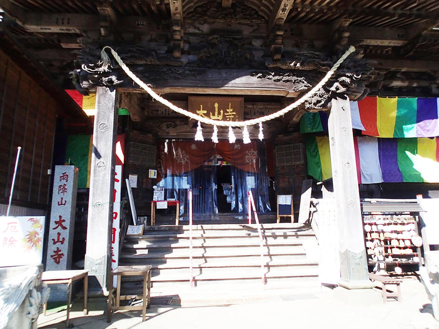
With its triangular shape, Mt. Oyama (Oh-yama) is a Tanzawa landmark in the surrounding mountains and towns. Its Oyama-Afuri-jinja Shrine has a history that's said to go back more than 2,200 years, and it's been a popular pilgrimage spot since the mid-18th century during the Edo period (1603–1868). Here we'll introduce a circuit that lets you take in the mountain's nature and sacred history both.
Pyramidal Mt. Oyama, One of the Easier Tanzawa Peaks
A Sacred Mountain and Japan Heritage Site.
-
- Duration
- 1Day / 4Hours
- Highest Point
- 1252m
- Elevation Gain
- 939m
-
- Skill Level


- Fitness Level
- Gear Level
From the bus stop, you walk up the stone stairs of the shrine approach known as the Koma-sando. It's lined with tea shops serving tofu cuisine, a local specialty, as well as souvenir shops and shukubo temple lodges.
From Oyama Cable Station, proceed down the easier route to the left. After ascending some stone steps, you'll arrive at Aburisan Oyama-dera Temple. Here you can take part in a custom known as "kawarake nage," throwing small ceramic plates from a cliff to ward off misfortune and invite good luck. Keep going up the stone steps from Oyama-dera Temple. It's a steep ascent, but chains and handrails are there to help you along.
After about an hour's hike up from the bus stop, you'll arrive at Oyama-Afuri-jinja Shrine. Pay your respects at the large main hall, and then ascend the stone stairs on the left. You'll soon be on a regular mountain trail.
From there you'll hike through an area of exposed rock faces with large trees like the Meoto-sugi (the husband and wife cedar). You'll arrive at the 16 Chome junction, and from there you'll walk along a ridgeline with occasional wooden staircases and boardwalks. Pass 25 Chome and ascend through the torii gate by the first part of Afuri-jinja Shrine, past the main shrine with its shop and head office and continue hiking until you reach the summit and the shrine's inner sanctum.
Descending from Mt. Oyama's summit, you'll pass through broad leaf forest and a wooden staircase through a shrub zone. After about an hour you'll reach a lookout platform. It has plenty of benches and is a good spot for a rest.
The fabulous view includes the lower Afuri-jinja Shrine (Afuri-jinja Shimosha) and Mt. Oyama's Mt. Mitsumine (Mitsumine-yama) with its distinctive appearance. The gentle descent from the lookout passes through a conifer forest belt.
Once you're past Niju Falls (Niju -taki), in about 30 minutes you'll arrive back at the lower Afuri-jinja Shrine. You can use the cable car to descend from there.
Gallery
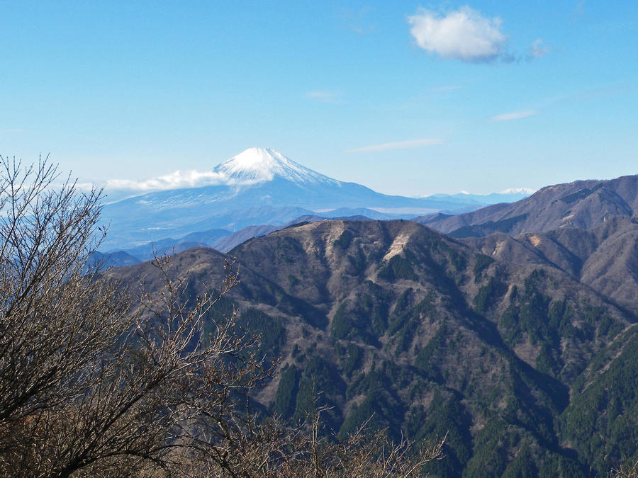
On clear days, you can see the Tanzawa mountain ridges and Mt. Fuji beautifully from the summit of Mt. Oyama.
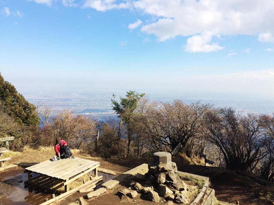
Mt. Oyama's summit has a bench and a great view. It's a good spot for a rest.
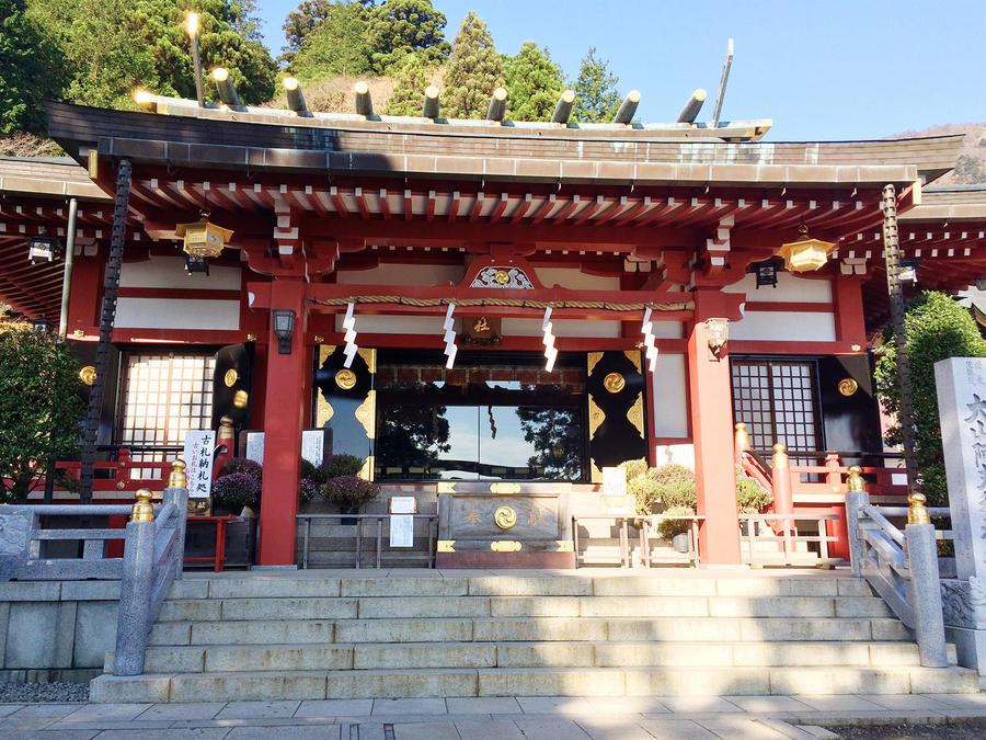
Oyama-Afuri-jinja Shrine is known as a power spot.
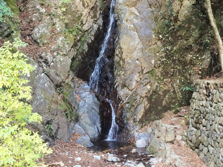
Niju Falls, where practitioners of Shugendo used to purify themselves.
Oyama-dera Temple, counted among the top three temples in Kanto dedicated to the deity Fudo Myo-o.
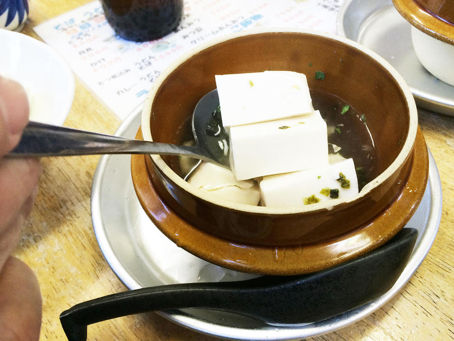
Tofu, a specialty of the Mt. Oyama area.
Other Info
Don't miss this chance to try Oyama Tofu, a local specialty made with pure water from the Tanzawa mountain system (Tanzawa-sankei). The toy tops known as Oyama Koma, designed to spin rapidly on the ground, have a lovely striped pattern and are popular talismans as well as souvenirs.
High Season:November to May
Notes
The geographical features of the Tanzawa mountain range are relatively fragile and the Omote-sando Trail (Omote-sandoh) has been subject to erosion from the many pilgrims visiting since ancient times as well as all the hikers passing along it today. There are lots of exposed rocks and loose stones, so you need to take care while walking. Since there's a significant difference in elevation, depending on your physical condition and stamina, you may want to use the cable car round trip.
Route Map
Elevation Map
Height (m)
Horizontal Distance (km)
Spec
- Duration
- 1Day / 4Hours
- Highest Point
- 1252m(Mt. Oyama)
- Elevation Gain
- 939m
- Horizontal Distance
- 8.4Km
- Skill Level
- Fitness Level
- Gear Level
On the Trail
- Sleeping
There is a shop just below Mt. Oyama's summit
- Eating
Between the Oyama Cable bus stop and cable car station there are lots restaurants where you can try Oyama Tofu
- Hot-Springs
Tougakubo (Tohgakuboh)


