


Mt. Fuji (Fuji-san) is Japan’s highest mountain. Straddling both Yamanashi and Shizuoka prefectures, Mt. Fuji has a beautiful form whether viewed from east, west, south, or north, and is beloved by many as a symbol of Japan. Mt. Fuji became a UNESCO World Cultural Heritage Site in 2013. The Fujinomiya Trail is the shortest of the four routes leading to the peak of Mt. Fuji, both in distance and the time needed to complete it. It is second only to the Yoshida Trailhead Route in popularity.
Mt. Fuji, Fujinomiya Trail Route
The shortest route to the top of Japan’s highest mountain.
-
- Duration
- 2Days / 10Hours
- Highest Point
- 3776m
- Elevation Gain
- 1386m
-
- Skill Level


- Fitness Level
- Gear Level
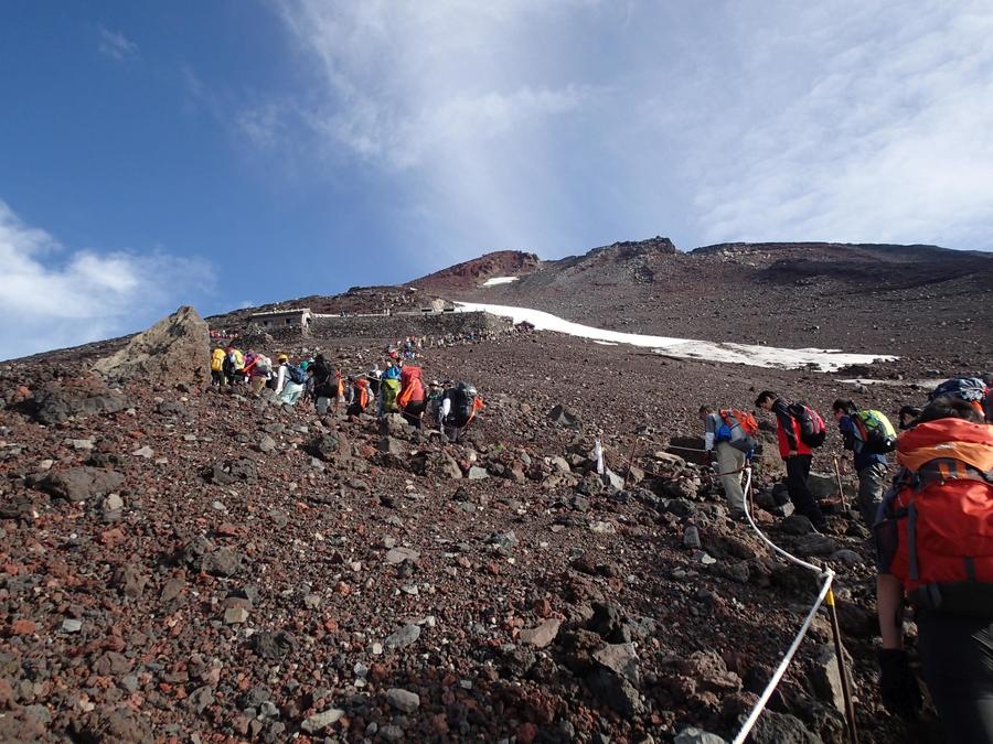
Soon after you start along the Fujinomiya Trailhead from the Fifth Station, the scenery opens up to a flat and easy trail leading to the Sixth Station. Just beyond the mountain huts at the Sixth Station the slope gets steeper and the paths becomes an intricate series of switchbacks leading toward the summit. The zigzagging path between the Seventh and Eighth stations winds through a dynamic, rocky area.
There are several mountain huts around the Seventh and Eighth stations where you can spend the night if you book in advance. On clear days, the view is great, but foggy conditions can make the route harder to follow. In such cases, keep your eye on the rope lining the path as well as the directional arrows painted on rocks to ensure you don’t lose your way.
In the area of the Ninth Station, you can look down at Mt. Hoei (Hohei-zan), which was created by the great Hoei volcanic eruption of 1707 (year 4 of the Hoei Era in Japan). At the summit, you will pass through a torii gate and to the sight of the Fujisan Hongu Sengen Taisha shrine atop Mt. Fuji.
A steep hike from the summit area brings you to the top of Kengamine, the highest point in Japan. The return route leads back to the main path.
Gallery
View of the summit from Fujinomiya Trail Route's 7th station
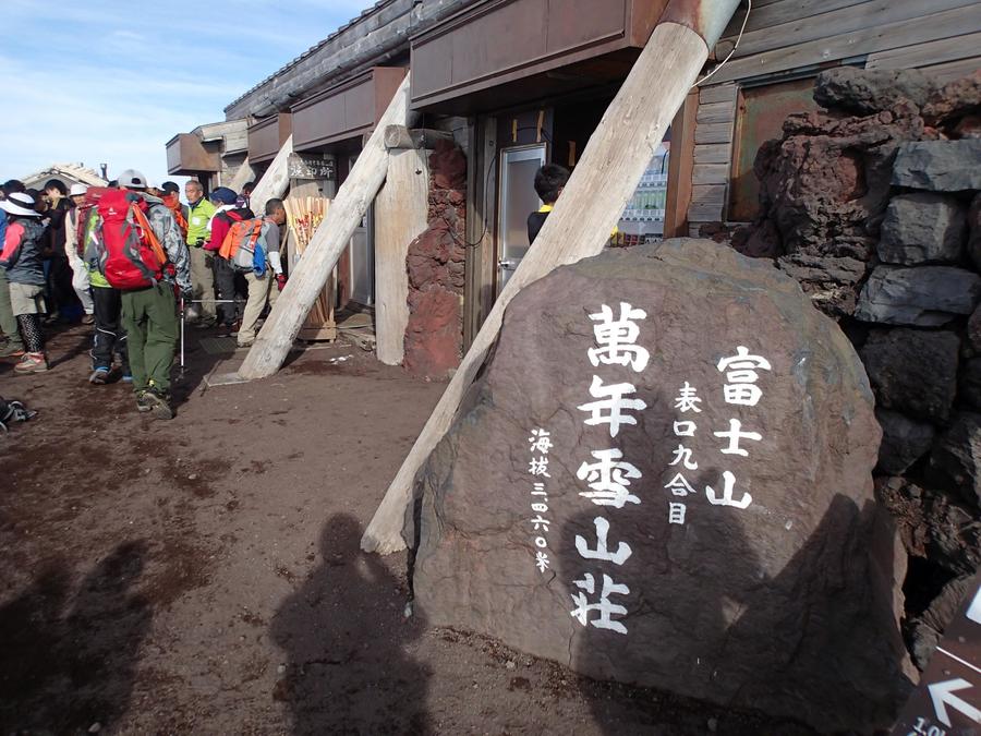
The mountain hut at Fujinomiya Trail Route's 9th station at an altitude of 3,400 meters
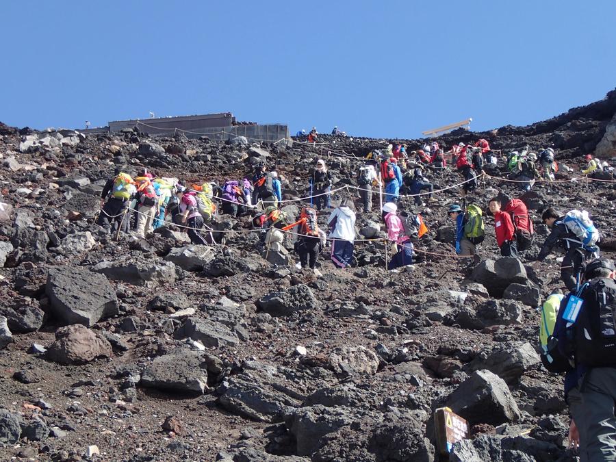
It's a steep climb from Fujinomiya Trail Route's 9th station to the summit
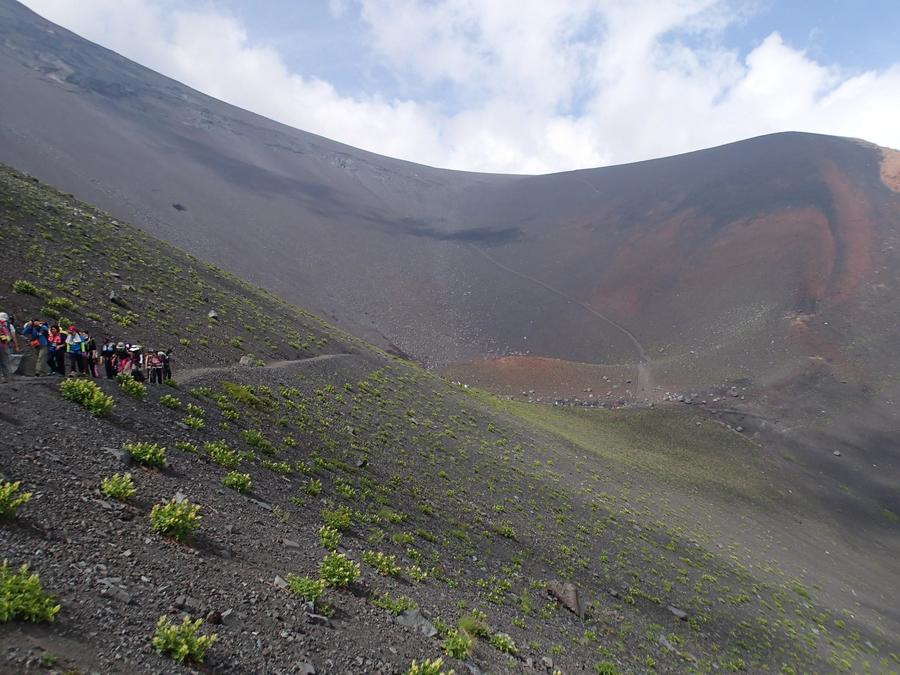
Walking towards the Hoei Crater
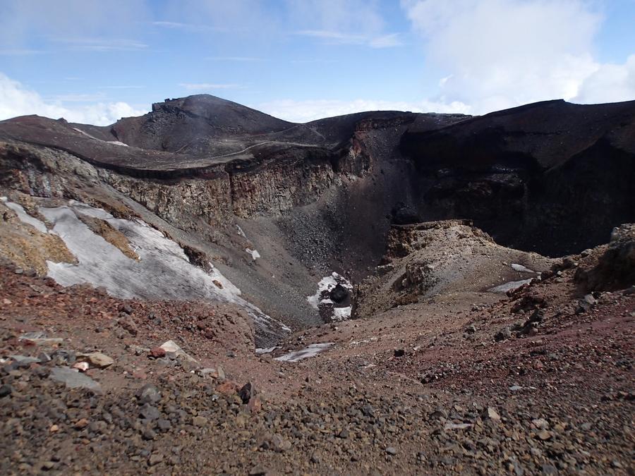
Mt. Fuji's summit and its gaping crater
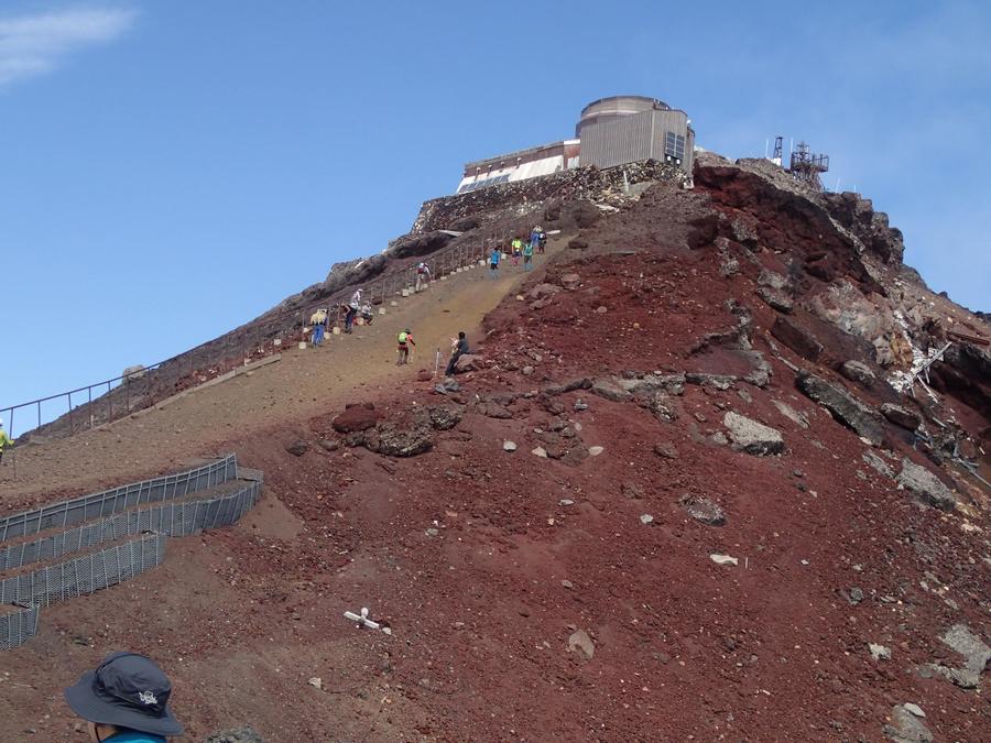
The steep slope to Kengamine, Mt. Fuji's highest peak
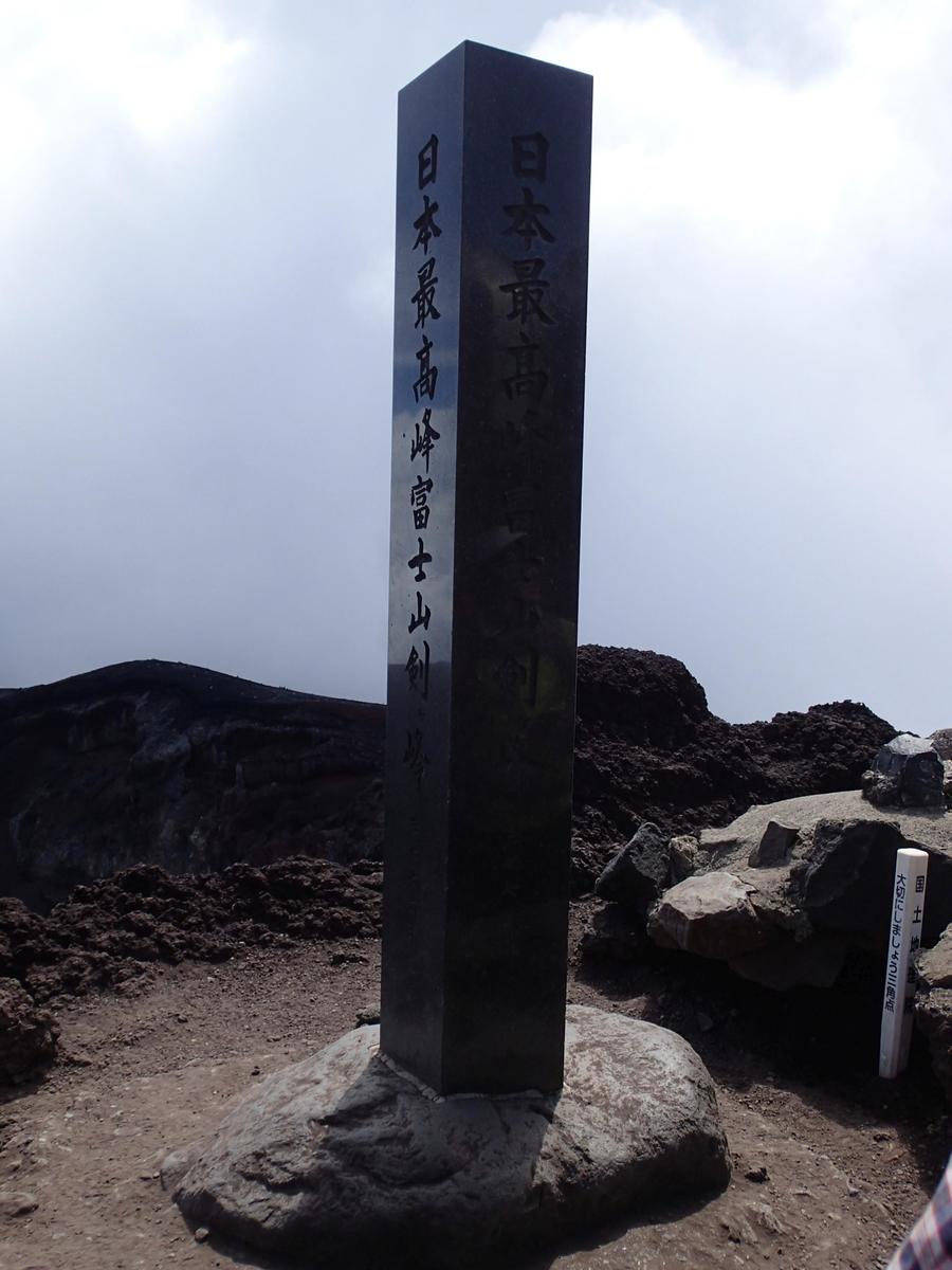
At 3,776 meters, Kengamine is Mt. Fuji's highest peak and the highest point in Japan
Other Info
Mt. Hoei, which was created by a huge volcanic eruption in 1707, can be seen from the route. The largest crater created by eruption, called Crater #1, is around 1.3 kilo meters in diameter.
High Season:July to August
Notes
Mt. Fuji’s climbing season is only from early July to end of August. Reservations to stay at mountain huts must be made in advance. Since the Fujinomiya’s return route follows the same path as the route to the summit, congestion can occur as people pass each other along the narrow path. Please be aware that sudden altitude gain over a short period of time can cause altitude sickness. The Health Center at the Eighth Station houses the Mt. Fuji Summer Temporary Medical Examination Center, where a resident doctor offers treatment during the summer season. On entering Mt. Fuji’s trails, you are required to give a 1000-yen donation to a mountain preservation fund. When using the public toilets, you are asked to pay a gratuity of between 100 and 300 yen.
Route Map
Elevation Map
Height (m)
Horizontal Distance (km)
Spec
- Duration
- 2Days / 10Hours
- Highest Point
- 3776m
- Elevation Gain
- 1386m
- Horizontal Distance
- 8.6Km
- Skill Level
- Fitness Level
- Gear Level
On the Trail
- Sleeping
Yamaguchi Sanso, Goraiko Sanso, and more
- Eating
Omoteguchi Gogome Rest House
- Hot-Springs
Fugaku Onsen, Hana-no-Yu


