


Mt. Naeba (Naeba-san) is located on the border between Niigata and Nagano prefectures, and is in Joshin’etsukogen National Park. It is selected as one of Japan’s 100 most famous mountains. The summit area is a wetland, where hikers can enjoy the view of pond and grassy field while walking on wooden walkway. Some suggests that this pastoral scenery resembling the rice nursery “苗代” (nawashiro) that raises the seedlings of the staple cereal for the Japanese is the source of the name of the mountain, “苗場山” (Naeba-san). This route introduces the Haraigawa River round trip course that starts from Wada-goya mountain hut located halfway up on the Niigata side of the mountain, which is easy to access.
Round Trip Hike of Mt. Naeba from Wada-goya
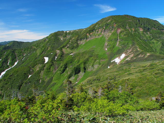
Set out for a walk towards the wetland stretching at the summit.
-
- Duration
- 1Day / 7.5Hours
- Highest Point
- 2145m
- Elevation Gain
- 772m
-
- Skill Level


- Fitness Level
- Gear Level
Proceeding through the grassy field of the ski slope from Wada-goya and onto the trail in the valley through broadleaf forest and bamboo grass field, hikers will arrive at a flatland with wooden walkway named Shimonoshiba, in about an hour and 10 minutes.
Continue hiking on the trail through bamboo grass field and shrubs, it takes about 45 minutes to Nakanoshiba, and another 25 minutes on wooden walkway to Uenoshiba. Approximately 20 minutes walk from Uenoshiba on the ridgeline will take hikers to Kaguragamine peak, from where the summit of Mt. Naeba is visible.
Descending from Kaguragamine peak for about 20 minutes, hikers will reach a water place named Kaminari-shimizu. The area around the col on the course is famous for beautiful alpine flowers that bloom in July and August.Hiking through the rocky section and wooden walkway and climbing over the rope-equipped steep rocky slope, hikers will reach the flat wetland on the summit.
Walking on wooden walkway through the pond-dotted grassy field, and back into the forest area, hikers will reach Mt. Naeba in about 50 minutes from Kaminari Shimizu.
Naeba Sancho Hutte (Natural Environment Experience Center) is located at the summit, in which hikers can rest or stay overnight. Take the same route for descending.
Gallery
Heading to the peak on a steep rocky slope
Other Info
The greatest appeal of Mt. Naeba is the wetland in the summit area. Various alpine plants grow in the grassy field, blooming from June to August to bring joy to the eyes of hikers. From late September to early October, autumn colors of grassy field and shrubs vividly decorate the entire wetland.
High Season:June to October
Notes
Though this route suggests a day trip, staying over at Naeba Sancho Hutte and making it two-day hike is also recommended, considering the long walking time.
The location of the hutte on the summit allows hikers to enjoy both sunset and sunrise, as well as to take time to stroll around the wetland in the area.
Hikers are advised to bring their own lunch, since Naeba Sancho Hutte does not provide lunchtime dining.
Route Map
Elevation Map
Height (m)
Horizontal Distance (km)
Spec
- Duration
- 1Day / 7.5Hours
- Highest Point
- 2145m(Mt. Naeba)
- Elevation Gain
- 772m
- Horizontal Distance
- 11.4Km
- Skill Level
- Fitness Level
- Gear Level
On the Trail
- Sleeping
Wada-goya, Naeba Sancho Hutte
- Eating
Wada-goya, Restaurant Kagura
- Hot-Springs
Natural Hot Spring Komakusano-yu, Yamano-yu


