


This site uses cookies to analyze site usage, to optimize content and advertising, and to provide social media functions.
In order to access this site, you need to agree to the use of cookies.
The Southern Japanese Alps
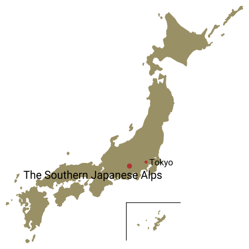
The Southern Japanese Alps is a vast mountain range that spans over the prefectures of Nagano, Yamanashi and Shizuoka, including 13 peaks that are over 3,000 meters in altitude, and 10 of Japan’s 100 most famous mountains being interspersed from north to south.
The range is also selected as Minami Alps National Park and UNESCO’s Eco Park (Biosphere Reserve), and is characterized with less-eroded, gentle slopes of massive mountains, compared to the sharp ridges of the mountains of the Northern Japanese Alps.
The ridgeline extending from Mt. Kai-Komagatake in the north towards the Three Peaks of Mt. Houou (Houou Sanzan) in the southeast via Hayakawa-one Ridge is composed of granite, and is characterized by a white mountain surface.
On the other side of the Noro-gawa River, facing the southwest of this ridgeline are the Three Peaks of Mt. Shirane (Shirane Sanzan), which contains a row of mountains over 3,000 meter-high, including Japan’s second and third tallest mountains, Mt. Kitadake and Mt. Ainodake respectively, along with Mt. Notori (Notori-dake).
On the southwest of Mt. Kai-Komagatake, across the Kitazawa-toge Pass is serviced by a forestry road up to a point just above 2,000 meters in altitude, is Mt. Senjogatake, interspersed with several glacial valleys. The Senshio-one Ridge that extends from Mt. Senjogatake to Mt. Shiomi (Shiomi-dake) in the south is the main ridgeline of the northwestern part of the Southern Japanese Alps, which is located to the west of the Three Peaks of Mt. Shiramine across the Oi-gawa River Higashimata area. It leads the way to the Sanpuku-toge Pass, which is considered to be located at the highest elevation.
The Sanpuku-toge Pass is also the border between the northern and southern parts of the Southern Japanese Alps. From here on, the range of mountains over 3,000 meters in elevation, including the Arakawa Three Mountains, Mt. Akaishi and Mt. Hijiri (Hijiri-dake) extend southward, composing the main ridgeline of the southwestern end of the Southern Japanese Alps.
Mt. Tekari (Tekari-dake), located on the southwest of Mt. Hijiri, has a forest-covered peak and is Japan’s southernmost mountain over 2,500-meters high, as well as the world’s southernmost natural habitat of stone pine.
- Mt. Kitadake Loop from Hirogawara This loop course of Japan’s 2nd highest mountain offers plenty of variety.
- The Southern Japanese Alps: a Traverse of Mt. Kitadake, Mt. Ainodake, and Mt. Notori The alpine traverse with Japan’s second and third highest peaks.
- A Circuit Hike of Houou Sanzan from Aoki Kosen Traverse across three vantage points atop unique rock formations.
- Round Trip Hike of Mt. Kai-komagatake and Mt. Senjogatake from the Kitazawa-toge Pass. Hike Two of Japan’s 100 Famous Mountains from the Kitazawa-toge Pass.
- Round Trip Hike of Mt. Kaikomagatake from the Kuroto-one Ridge Hike up beyond a rocky ridgeline to a granite mountain peak.
