


Round Trip Hike of Mt. Nikko Shirane via Ropeway
-
- Duration
- 1Day / 5Hours
- Highest Point
- 2578m
- Elevation Gain
- 580m
-
- Skill Level


- Fitness Level
- Gear Level
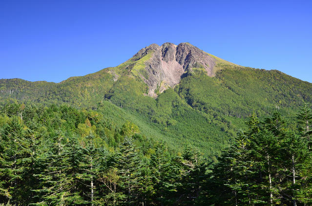
There is a plaza with a public footbath and other facilities in the area around the Ropeway Sancho station. From here, you can see Mt. Nikko Shirane to whose peak you will be hiking.
Pass through red torii gate of the Nikko Futarasan-jinja Shrine and continue on beyond the fence for keeping deer out. Soon you will be starting your hike along a gentle trail through a conifer forest belt. After about an hour of walking from the Sancho Station, you will pass by a stone statue of Dainichinyorai (Mahavairocana, or “celestial Buddha”) which sits atop a large rock formation and arrive at a shelter hut.
Hike up a traverse with a series of wooden stairways along it and then continue up the steep zigzagging path which extends beyond the treeline. From here, follow the gravel trail which is roped off on either side from the surrounding grasslands and woods.Continue on further beyond the grassy and wooded areas where the gravel trail passes through rocky slopes. After about an hour and 40 minutes walk from the shelter hut, you will reach Mt. Nikko Shirane’s summit which has many large rocks scattered around it.
On a clear day, you can see the blue surfaces of Lake Suganuma and Lake Marunuma at the base of the mountain on the Gunma side. And looking down on sights like the Senjo-ga-hara wetland, Lake Chuzenji, and Mt. Nantai (Nantai-san) at the base of the mountain on the Tochigi side, the peak also offers a fantastic view of the Nikko area.
For your return hike, simply follow the same route in reverse back to the starting point.
Gallery
Other Info
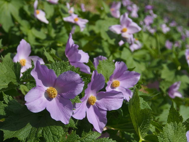
Mt. Nikko Shirane is known for the beauty of both its flowers and its autumn foliage
Throughout June and July, you can see the various kinds of alpine flora which are cultivated at the plaza near the Ropeway Sancho Station. These include Shirane aoi (an endemic species of buttercup which bears the mountain’s name) and komakusa (Dicentra peregrina).
Along the steep, rocky slope just beneath the summit, you can see other plant species in bloom from June to July, including: iwakagami (Fringed galax) and Hakusan fuuro (an alpine geranium native to Japan).
From late September until mid-October, you can admire a wide variety of colorful autumn foliage decorating the mountain side from the window of the ropeway car on the ride up.
High Season:May to October
Notes
Although the route introduced here is a relatively easy one with only a minor change in altitude, it nevertheless involves a hike to a mountaintop above the treeline.
Since the peak period for viewing alpine flora is in late June through early July when there may still be snow on the trails, it is necessary to research conditions on the route when planning your hike.
Route Map
Elevation Map
Spec
- Duration
- 1Day / 5Hours
- Highest Point
- 2578m
- Elevation Gain
- 580m
- Horizontal Distance
- 11Km
- Skill Level
- Fitness Level
- Gear Level
On the Trail
- Sleeping
- -----
- Eating
Nikko Shiranesan Ropeway Sancho Café
- Hot-Springs
Nikko Shiranesan Ropeway Center Station Zazen Onsen


