


Koyasan is located in the mountain basin at an altitude of approximately 800m in the northeastern part of Wakayama Prefecture. Stretching 6km from east to west and 3km from north to south, it is known as a sacred place for Shingon Buddhism, which was founded by Kukai (Kobo Daishi) 1200 years ago. Koya-Sanzan are the three mountains such as Mt. Tenjiku(Tenjiku-san), Mt. Yoryu(Yoryu-san), and Mt. Mani(Mani-san), and sit behind the mausoleum of Kukai (Kobo Daishi). Trekking around Koya-Sanzan is especially popular.
Round Trip of Koya-sanzan, the Sacred Sites of Shingon Buddhism
Tour the three cute mountains that surround the sacred area of Koyasan
-
- Duration
- 1Day / 3.2Hours
- Highest Point
- 1009m
- Elevation Gain
- 644m
-
- Skill Level


- Fitness Level
- Gear Level
Generally, from the monument of Koya-Sanzan Route, one goes around the three mountains counterclockwise to Mt. Mani, Mt. Yoryu, and Mt. Tenjiku. Start from the Okunoin-mae bus stop at the Nakanohashi approach entrance.
Proceeding along the approach lined with relatively new tombstones, you will arrive at Gobyo Bridge. Beyond the bridge is the most sacred place in Koyasan, where the mausoleum of Kukai (Kobo Daishi) is enshrined. To the right of Gobyo Bridge, next to the Mizumuke Jizo statue, there is a stone monument of Koya-Sanzan route. Koya-Sanzan trek begins from the right of it towards Okunoin Pass.
A short trek from Okunoin Pass will take you to the summit of Mt. Mani, and after visiting Nyoirin Kannon, head for the next mountain, Mt. Yoryu. After a gentle ups and downs, climb a steep slope and reach Mt. Yoryu, the highest peak of “Koya-Sanzan”.
Descend again to Kotsuki Pass. The road on the right is Kurokomichi, and from here go down the road along Hirotani on the left. It's an open road through pampas grass fields. Cross the road at the Ipponsugi junction and start climbing the third mountain, Mt. Tenjiku. Mountaintop is surrounded by cedar forests, and the Bodhisattva Maitreya is enshrined here. Descend to the rhododendron garden, pass through Nakanohashi cemetery, and enter Okunoin approach. The approach path, lined with old cedar trees, is cool even in summer, giving off a solemn atmosphere. If you turn right just before the Nakanobashi Bridge, you will arrive at Okunoin-mae bus stop soon.
Gallery
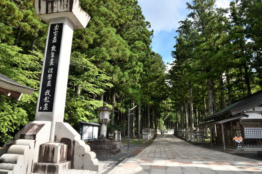
The Nakanohashi approach entrance
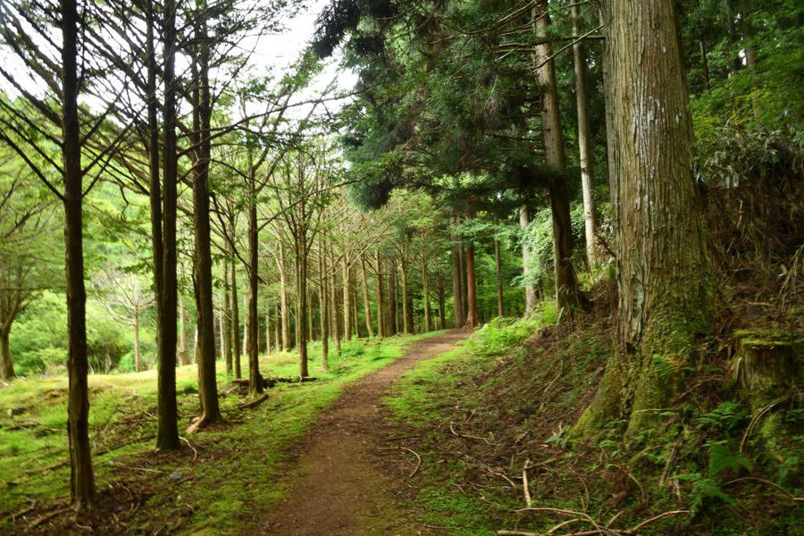
The road along Hirotani to Mt. Tenjiku
Other Info
As for gourmet information after the Koya-Sanzan trekking, although it is a little far from this course, Tsukumo Shokudo's kamameshi is well-known. Regarding sweets, Yakimochi and Mirokuishi are popular.
Season : All year around
Route Map
Elevation Map
Height (m)
Horizontal Distance (km)
Spec
- Duration
- 1Day / 3.2Hours
- Highest Point
- 1009m(Mt. Yoryu)
- Elevation Gain
- 644m
- Horizontal Distance
- 7.8Km
- Skill Level
- Fitness Level
- Gear Level
On the Trail
- Sleeping
- -----
- Eating
- -----
- Hot-Springs
- -----


