


This trek is on the Nagano Prefecture side of the Northern Japanese Alps. Mt. Tsubakuro (Tsubakuro-dake), Mt. Otensho (Ohtensho-dake), Mt. Jonen (Johnen-dake), and Mt. Chogatake (Chohga-take) are visible from the cities of Matsumoto and Azumino at the foot of the range. As such they're known as the Jonen Mountains (Jonen-sanmyaku) and have a special place in the hearts of the locals. The whole trail has a superb view of Mt. Yarigatake and the Hotaka peaks to the right as you walk along.
Panorama Ginza Traverse From Mt. Tsubakuro to Mt. Chogatake via Mt. Otensho and Mt. Jonen
A traverse with outstanding views of Mt. Yarigatake and the Hotaka peaks.
-
- Duration
- 4Days / 22.5Hours
- Highest Point
- 2922m
- Elevation Gain
- 1422m
-
- Skill Level


- Fitness Level
- Gear Level
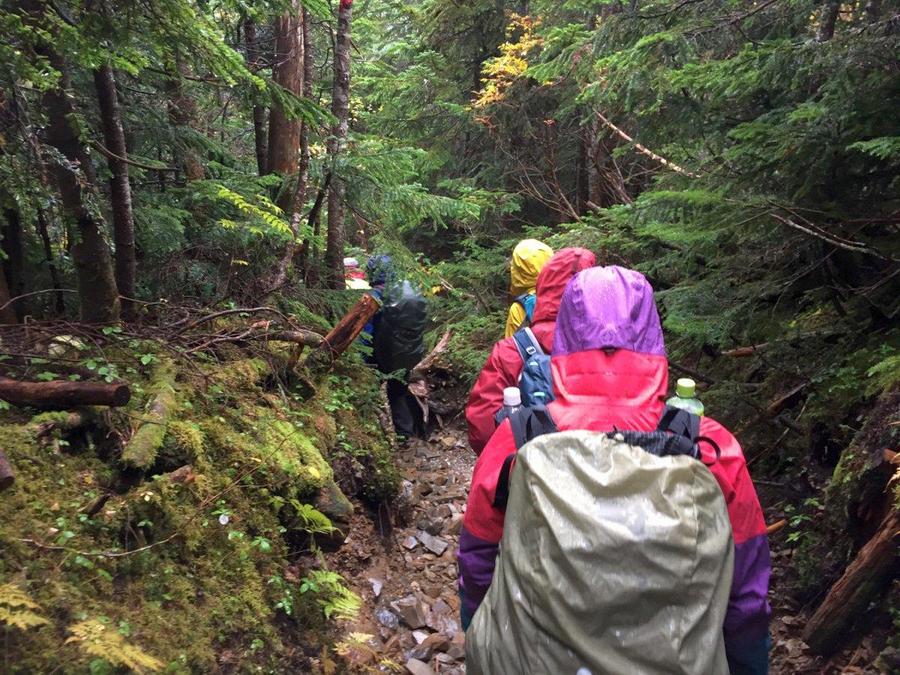
The trail begins with a steep climb through the forest. For about three hours until you reach Kassen-goya mountain hut. From there the trail leaves the forest and hikes gently. After a while, it passes an area with chains installed to help you along. After another gentle slope you arrive at Enzan-so mountain hut where you'll spend your first night. (Find a detailed write-up of the hike to Enzan-so here.) A round trip hike from the hut to the summit of Mt. Tsubakuro takes approximately an hour.
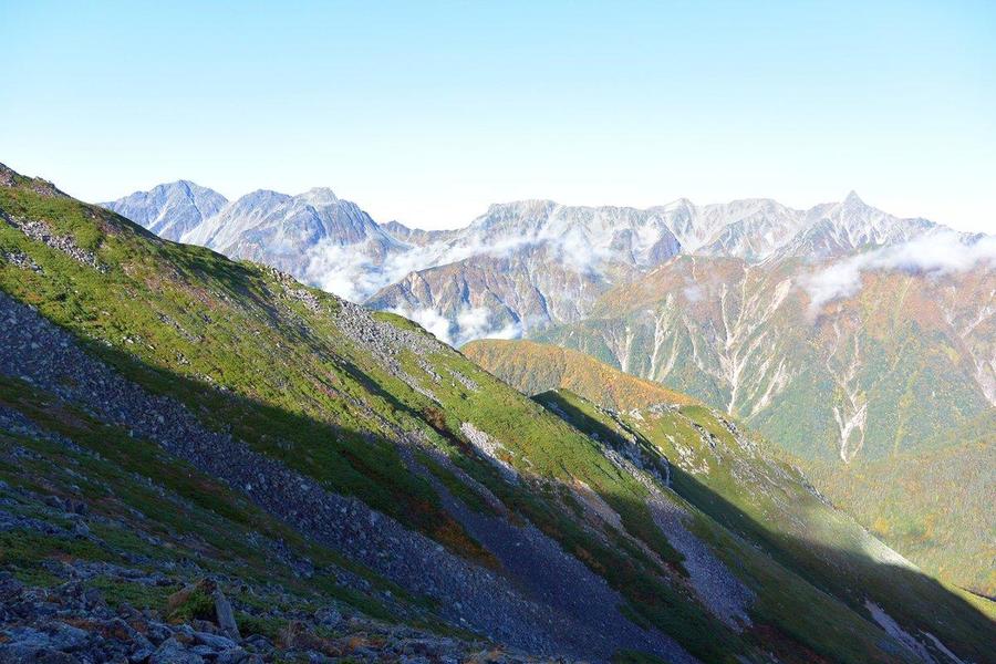
The second day proceeds along rocky section slopes with lots of ups and downs through a landscape of shrubs and creeping pine. Approximately 3 hours from Enzan-so, you ascend a rocky area with chains and ladders and arrive at Daiten-so mountain hut. From here you set out on the roughly ten-minute hike up a rocky section slope to the summit of Mt. Otensho. You then return to Daiten-so and continue the hike along a gentle trail of rocky section and gravel through creeping pine. It takes about another 3 hours to get to Jonen-goya mountain hut, the hut where you'll spend the second night.
On the third day, the trail zig-zags for approximately 70 minutes up a rocky section slope until you reach the summit of Mt. Jonen. From there you descend among granite outcrops and pass through a shrub zone with areas of wetland. A gentle roughly four-hour hike through a landscape of creeping pine will bring you to Chogatake Hutte where you'll spend the night.
On the fourth day, you cross another creeping pine zone and arrive at a swampy area called Yoseino-ike Pond. From there you hike Mt. Nagakabe (Nagakabe-yama) and descend on a ridge trail with occasional ladders through the forest until you reach Tokusawa. The two mountain huts there are great for a break. You then continue along a flat road for about 2 hours before arriving at Kamikochi.
Gallery
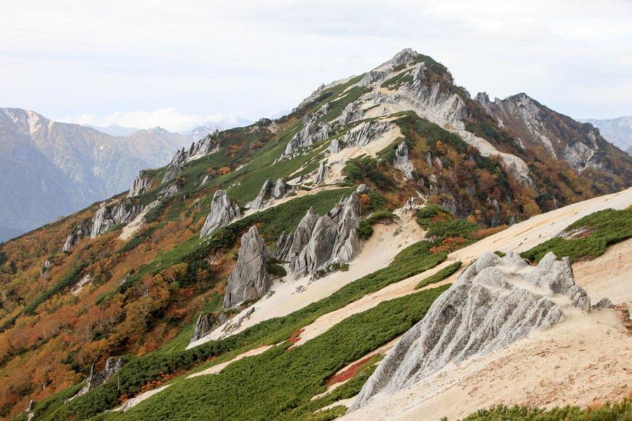
Mt. Tsubakuro in autumn
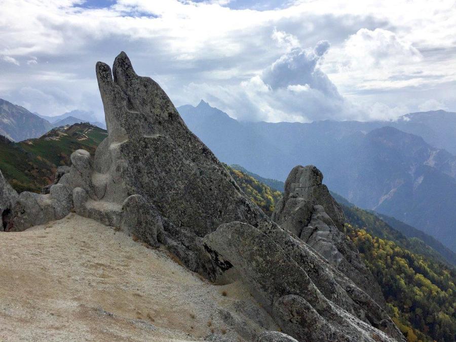
Dolphin Rock
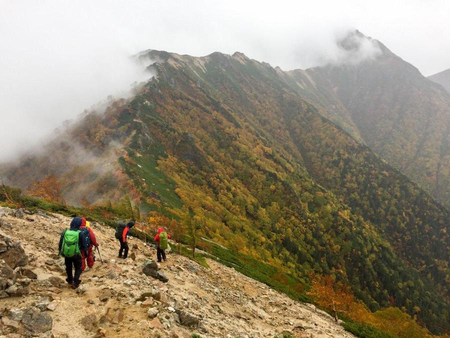
Traversing a ridgeline
Looking back over the ridgeline walked from Mt. Jonen
Amazing panoramic view of Mt. Yarigatake and Mt. Hotaka mountains
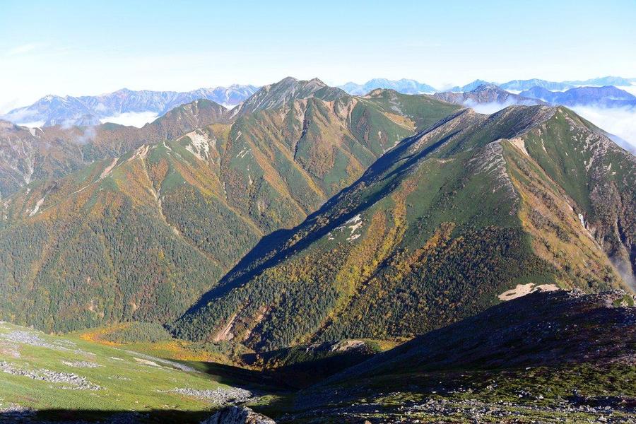
You get a sweeping view of the mountains you've hiked through
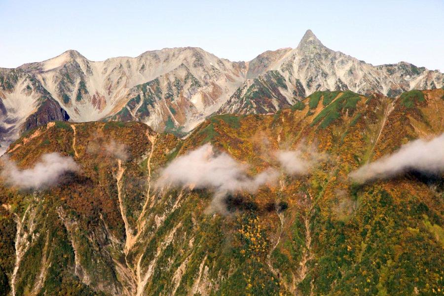
Mt. Yarigatake is right before your eyes
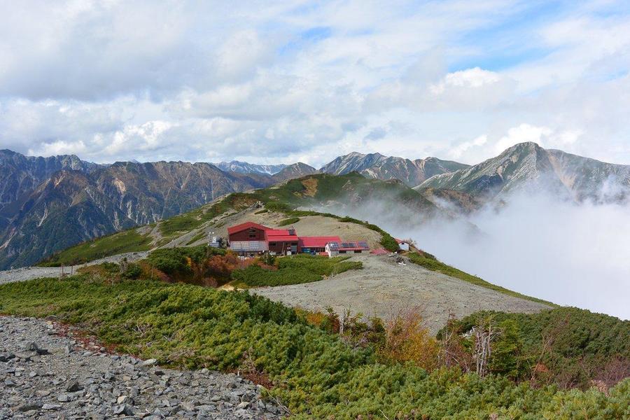
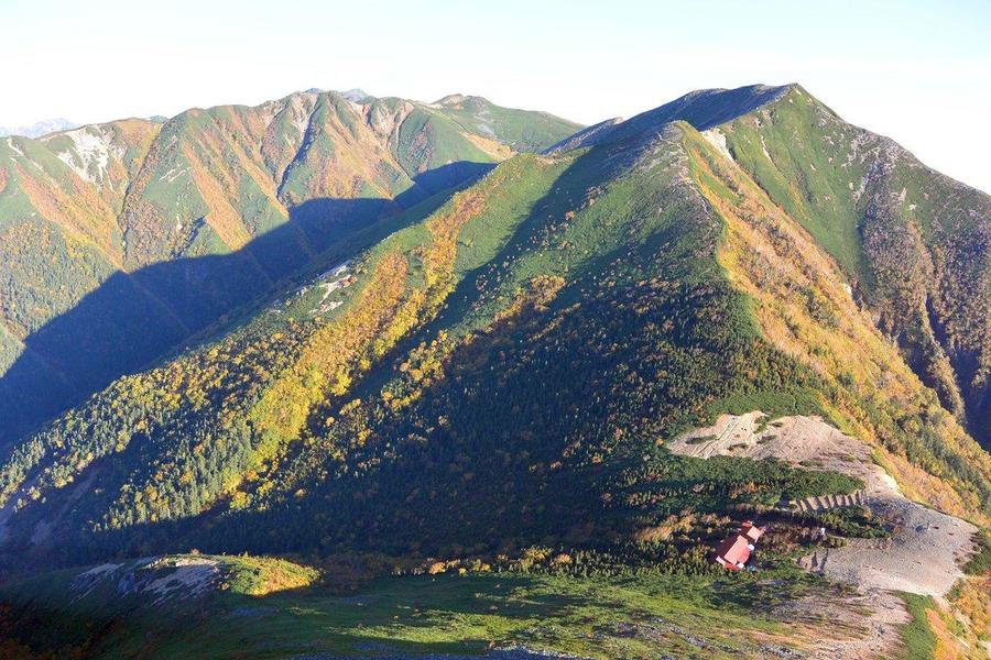
Chogatake Hutte is on a ridgeline
Trail descending from Chogatake Hutte
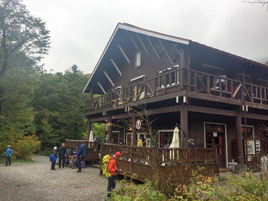
Tokusawa-en hut in the Tokusawa area
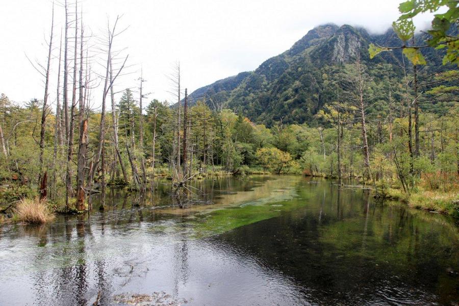
Descend to Kamikochi. Flowing towards the Azusa River
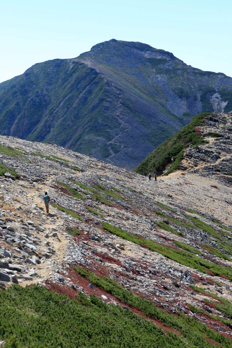
Ridgeline running to Mt. Jonen
Other Info
In summer the heights bloom with alpine plant like Dicentra peregrine (Komakusa) bleeding hearts.If you are lucky, you may encounter a ptarmigan in one of the zones of creeping pine. These birds are a protected species designated as special natural treasure.
Best Season:July to September
If you go to this trail outside of the best season, you should pay attention to weather and trail conditions, as the mountain is located in a snowy area; there may still be snow on the trail in June, and it may start snowing from October. Snow mountaineering equipements and experience are required during the winter season.
Notes
Route Map
Elevation Map
Height (m)
Horizontal Distance (km)
Spec
- Duration
- 4Days / 22.5Hours
- Highest Point
- 2922m(Mt.Otensho)
- Elevation Gain
- 1422m
- Horizontal Distance
- 32.2Km
- Skill Level
- Fitness Level
- Gear Level
On the Trail
- Sleeping
Kassen-goya , Enzan-so, Daiten-so, Otensho Hutte, Jonen-goya, Chogatake Hutte, Tokusawa-en, Tokusawa Lodge, Myojin-kan and more
- Eating
Tokusawaen, Kamikochi Shokudo
- Hot-Springs
Konashi-no-yu


