


Mt. Hiuchigatake Round trip from Miike Trailhead
-
- Duration
- 1Day / 7Hours
- Highest Point
- 2356m
- Elevation Gain
- 847m
-
- Skill Level


- Fitness Level
- Gear Level
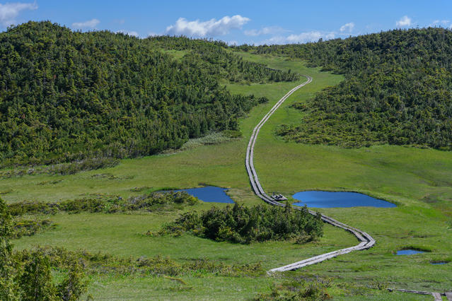
Walk along the Ura-hiuchi Forestry Road's boardwalk from Miike trailhead. Take the fork to the left and go up through the conifer forest belt. After a time, there will be a steep hike up a scree slope before reaching a boardwalk passing through a shrub zone. About an hour after leaving Miike trailhead you'll reach a wetland known as Hirosawa-tashiro.
The meadow is dotted with ponds, and a variety of alpine plants bloom in July and August. As you continue along the boardwalk, you'll ascend through coniferous forest again. The boardwalk flattens out briefly and then back to steep again, and you'll enter a broad-leaf forest. About 50 minutes after leaving Hirosawa-tashiro you’ll reach a wetland known as Kumazawa-tashiro.
The boardwalk continues through Kumazawa-tashiro as Mt. Hiuchigatake rises before you.
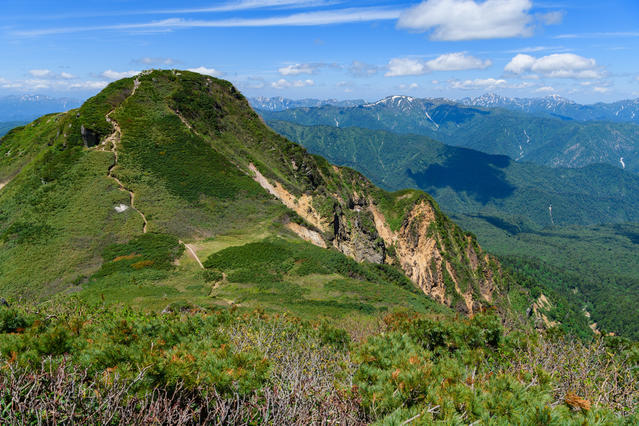
Traverse a forest belt and hike up a slope with sasa bamboo and stone pine. About an hour and 40 minutes after leaving Kumazawa-tashiro you’ll reach the summit of Manaitagura, one of the Mt. Hiuchigatake peaks.
Descend a scree slope through a stone pine belt and ascend another steep slope, and you will reach the summit of Shibayasugura, Mt. Hiuchigatake's highest peak.
Return the way you came.
Gallery
Other Info
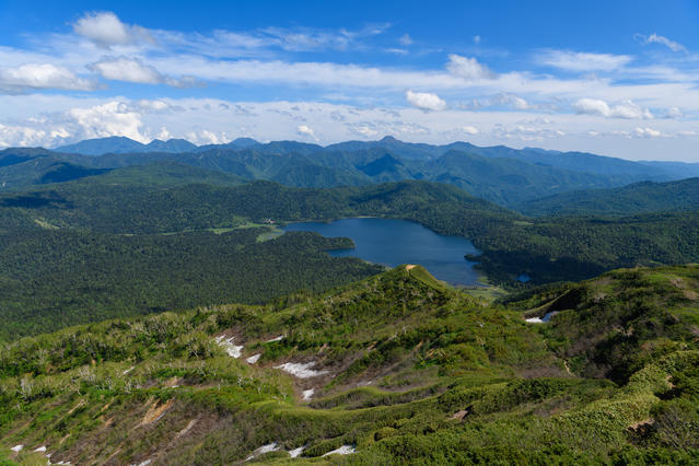
You might also want to do a 2-hour round trip hike out to Lake Ozenuma from Mt. Hiuchigatake.
You can reach the Numayama-toge Pass with a 20-minute shuttle bus from Miike trailhead.
Near Lake Ozenuma, the Oe Wetland (Ohe-shitsugen) has lots of Nikkoh-kisuge (day lilies) that bloom in mid-July.
High Season:July to September
Notes
Route Map
Elevation Map
Spec
- Duration
- 1Day / 7Hours
- Highest Point
- 2356m(Mt. Hiuchigatake Shibayasugura)
- Elevation Gain
- 847m
- Horizontal Distance
- 9Km
- Skill Level
- Fitness Level
- Gear Level
On the Trail
- Sleeping
Oze Miike Lodge
- Eating
Ozen-sato Koryu Center, Mizubasho
- Hot-Springs
Aruza Ozeno-sato


