


Mt. Tanigawa (Tanigawa-dake) is located on the border between Gunma and Niigata Prefectures and one of the Japan's 100 most famous mountains. The area around it is known as the Tanigawa Mountain Range (Tanigawa-renpo) that includes Mt. Ichinokura (Ichinokura-dake) and Mt. Shigekura (Shigekura-dake).The summit consists of the twin peaks of “Toma-no-mimi” and “Oki-no-mimi”. Located at a saddle on Mt. Ichinokura, Ichinokura-sawa is one of Japan's major rock faces and a rock-climbing mecca. Lots of climbers have scaled it covering routes like Tsuitate-iwa Rock, and some have even lost their lives in the effort. Here, we introduce the Tenjin-one Ridge trail. It reaches 1,502 meters above sea level and is accessible by ropeway.
Mt. Tanigawa, Tenjin-one Ridge (Round Trip)
Take the ropeway for the shortest route to Mt. Tanigawa.
-
- Duration
- 1Day / 5 Hours
- Highest Point
- 1977m
- Elevation Gain
- 574m
-
- Skill Level


- Fitness Level
- Gear Level
Get off the lift and walk approximately 100 meters to the Tenjinyama Observatory. Follow the ridgeline with its gentle inclines and declines. When you descend into a beech forest, you join the traverse trail from Tenjin-daira ropeway station where a wooden path crosses to the Kumaanazawa-hinan-goya shelter hut.
Next you enter a shrub zone and the path narrows to a regular mountain trail. Before long you leave the tree line and begin climbing through a rocky area assisted by chains. The slope is gradual and there are lots of footholds in the rock, so it's not particularly difficult. From there you pass a flat ridge with a wooden walkway, ascend an easy rock face and a gentle slope, and go up a step-like mountain trail before arriving at a large scree field.
As you walk the wooden path through it, a mountain hut will come into view. Hiking from there through a bamboo grass field, you soon arrive at the summit of Toma-no-mimi, the highest peak on Mt. Tanigawa. A 10-minute walk along the ridge brings you to Oki-no-mimi. On a clear day, you can see Mt. Fuji (Fuji-san) and the Northern Japanese Alps from the summit.
From there retrace your steps to finish the hike.
Gallery
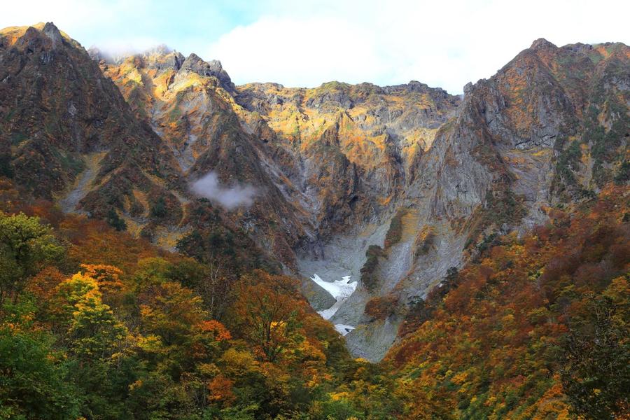
Rocky outcrops of Ichinokura-sawa in Mt. Tanigawa

Tanigawadake Ropeway
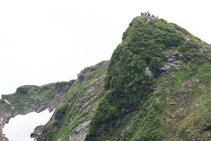
Summit of Mt. Tanigawa
Other Info
The area around Tenjin-daira blooms with lots day lilies and other flowers in summer. Gorgeous fields of alpine flowers come into bloom in early summer closer to the summit. The autumn leaves are also beautiful.
High Season:June to October
Notes
While this hike is a day trip, if you start hiking late, you need to check the ropeway operation schedule to make sure its last run for the day and plan accordingly. There's no other way down the mountain.
Route Map
Elevation Map
Height (m)
Horizontal Distance (km)
Spec
- Duration
- 1Day / 5 Hours
- Highest Point
- 1977m(Toma-no-mimi)
- Elevation Gain
- 574m
- Horizontal Distance
- 11.5Km
- Skill Level
- Fitness Level
- Gear Level
On the Trail
- Sleeping
Tanigawadake-katano-koya
- Eating
View Terrace Tenjin Restaurant
- Hot-Springs
Yu Terume Tanigawa


