


Hike of a Sacred Mountain, Mt. Ontake
-
- Duration
- 1Day / 6Hours
- Highest Point
- 2927m
- Elevation Gain
- 803m
-
- Skill Level


- Fitness Level
- Gear Level
From the ropeway’s Iimori Kogen Station, traverse up through the forest belt and go across the mountain stream to get to the 7th station, with a shrine named Kakumei-sha, in approximately 10 minutes.
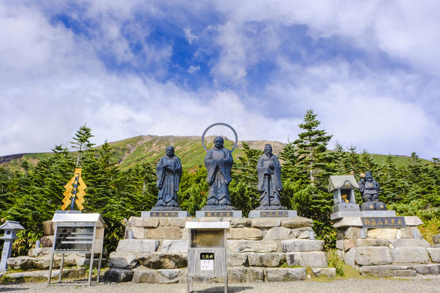
From the 7th station, the trail turns into a staircase road through forest and shrub belts and reaches the 8th station that has a mountain hut called Nyonin-do in approximately an hour and 10 minutes. Many stone statues are placed in the vicinity of the station, and the summit can be viewed from behind. The foliage is beautiful in autumn.
From the 8th station, the trail continues on through the rocky section among a stone pine belt. Plants start to disappear from the surrounding view as hikers hike up straight on the rocky area, and the trail eventually reaches the Kakumei-do small shrine on the 9th station in approximately an hour and 25 minutes, via a mountain hut named Ishimuro-sanso.
Descend gently from the 9th station, on the ridgeline in a northwest direction, and hikers will arrive at Nino-ike Pond, buried under volcanic ash. Proceed on a flat path called Saino-kawara and head for Sanno-ike Pond. Return to the 8th station using the side path and descend back to Iimori Kogen Station.
Gallery
Other Info
Still the object of religious belief today, Mt. Ontake houses numerous stone statues, monuments, torii gates and shrines on its trails, providing hikers with an opportunity to experience the piety of the mountain for its believers.
High Season:July to October
Notes
As a result of the 2014 eruption, wearing helmets as a head protection against cinders is required on Mt. Ontake. In addition, hikers are advised to bring other protective gear when hiking, such as masks to protect your throat from volcanic fumes and goggles to protect your eyes from volcanic ash.
Route Map
Elevation Map
Spec
- Duration
- 1Day / 6Hours
- Highest Point
- 2927m(9th station)
- Elevation Gain
- 803m
- Horizontal Distance
- 8.8Km
- Skill Level
- Fitness Level
- Gear Level
On the Trail
- Sleeping
7th Station Gyoba-sanso, Nyonin-do, Ishimuro-sanso, Ninoike-sanso, Ninoike Hutte
- Eating
Ontake Ropeway
- Hot-Springs
Hotel Kiso Onsen


