


Mt. Fuji (Fuji-san) is Japan’s highest mountain. Straddling both Yamanashi and Shizuoka prefectures, Mt. Fuji has a beautiful form whether viewed from east, west, south, or north, and is beloved by many as a symbol of Japan. In addition to being revered as a sacred mountain, Mt. Fuji has been the subject of ukiyo-e prints and traditional Japanese paintings, and has often appeared as a motif in arts and culture, intimately connected to the people of Japan since ancient times. Mt. Fuji became a UNESCO World Cultural Heritage Site in 2013. There are four different hiking routes to the top of Mt. Fuji, with both trails and roads maintained as far as the Fifth Station.
Mt. Fuji, Yoshida Trailhead Route
The most popular route to Japan’s highest mountain peak.
-
- Duration
- 2days / 11Hours
- Highest Point
- 3776m
- Elevation Gain
- 1471m
-
- Skill Level


- Fitness Level
- Gear Level
Most people follow the Yoshida Trailhead Route to the summit. The Fifth Station area is a bustling tourist hub in its own right with its many restaurants and souvenir shops. The path from the Fifth Station starts out flat and level and continues that way for a while. As you emerge from the forested area, a broad vista opens up before you and a section of path strewn with small pebbles and rocks begins. The Mt. Fuji Center for Safety and Guidance is at the Sixth Station.
Beyond the Sixth Station, there are no more shrubs and the terrain takes on a desolate feeling. A zigzagging path leads to the first of the mountain huts in the Seventh Station area. Continuing on from this point, the path gives way to a steeper, rocky area that continues all the way to the Eighth Station, with the incline getting even steeper along the way.
The path between the Seventh and Eighth Stations is dotted with mountain huts. If you wish to see the sunrise from the peak, staying at a hut ins the Eight Station area is a good option.
Continue along the path past the Ninth Station and you’ll find a torii arch with two komainu (guardian lion-dog) statues standing before it. Pass through the arch to arrive at the summit. There are two mountain huts nearby where you can stop for a rest of a bite to eat.
On the far side of the crater, you can see Kengamine, which is Mt. Fuji’s highest point.Walking all the way around the volcanic crater on the mountaintop (a practice called “ohachi-meguri” in Japanese) takes approximately 70 minutes from start to finish.
When going back down the mountain, you have to take the path used exclusively for descents. So, you should be careful not to take a wrong turn where the paths branch at the Subashiri Trailhead.
Gallery
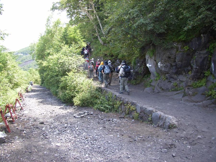
Fork for the 6th station, coming from the 5th station
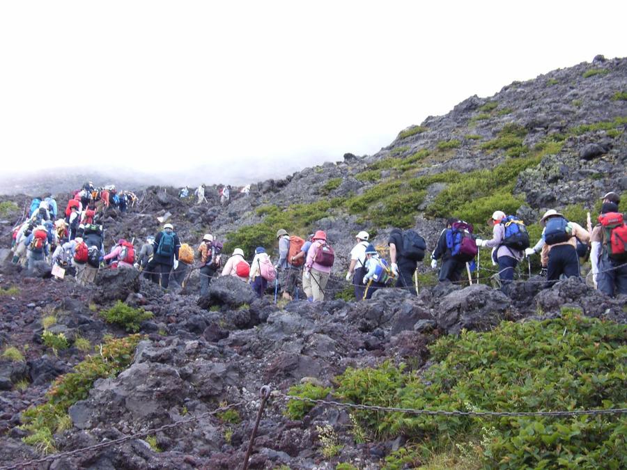
Hikers backed up crossing a rocky area near the 7th station
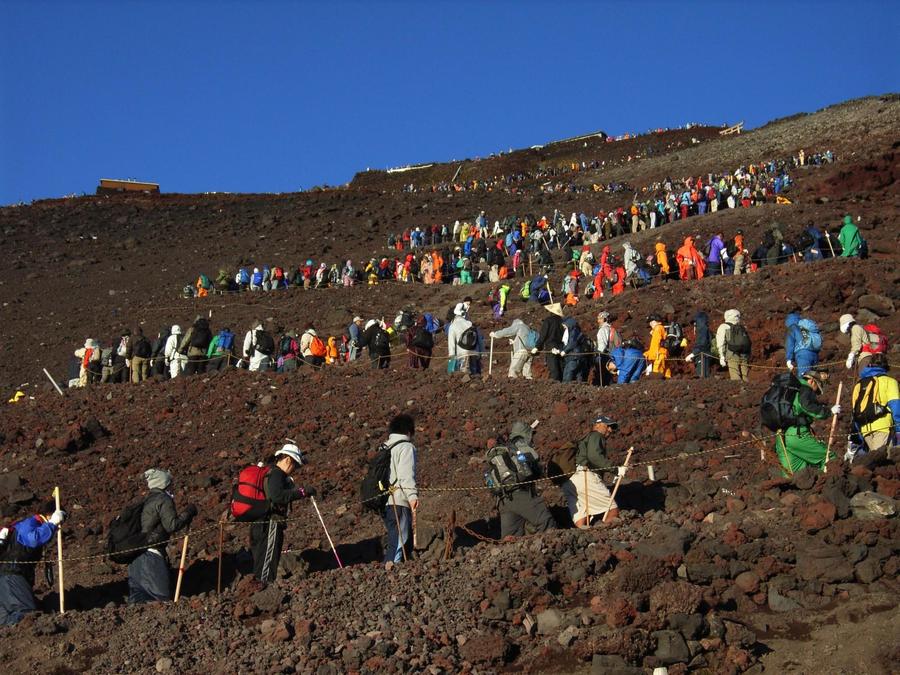
Looking towards the summit from the 9th station. It gets backed up with hikers at certain times
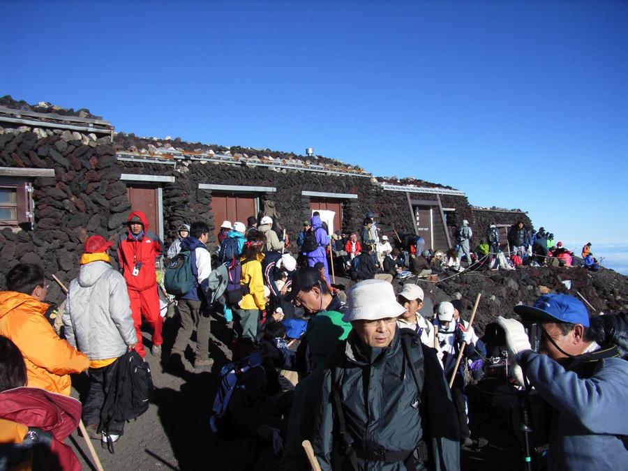
At the top of Mt. Fuji, Yoshida Trailhead Route
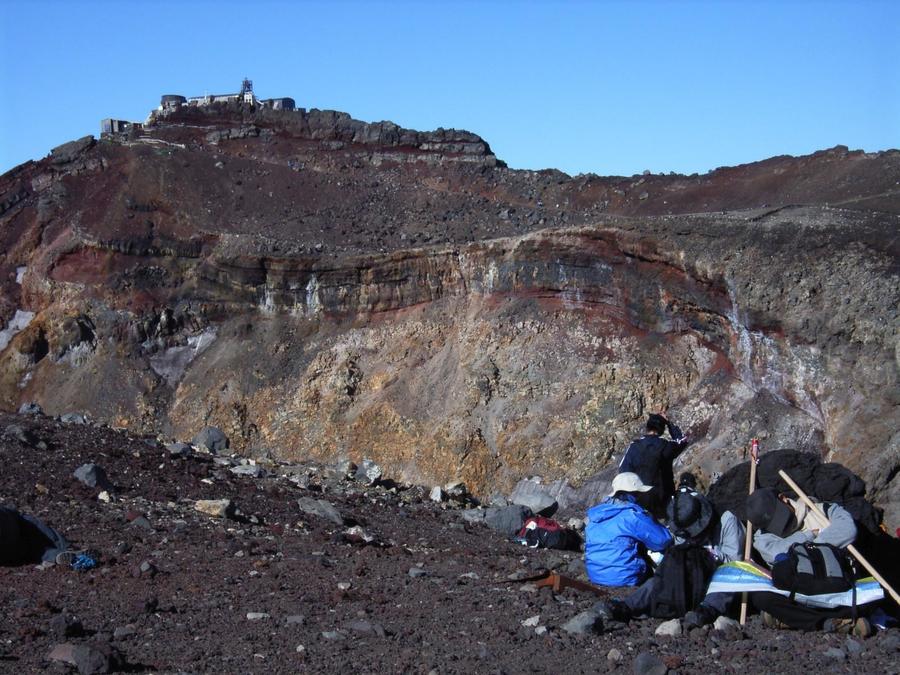
From the top of Mt. Fuji, Yoshida Trailhead Route, looking up at Kengamine across the crater. It's Mt. Fuji's highest peak
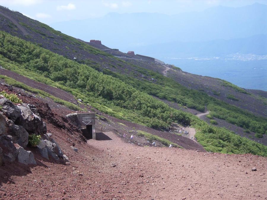
The descent on Yoshida Trailhead Route
Other Info
There are numbers of mountain hut, shops, and information offices on the route, which make it possible for even first time hikers to follow the route to Mt. Fuji’s summit. There are several Sengen Jinja shrines around Mt. Fuji, and you can buy items such as omamori (talismans) and shuin (shinto stamp seals) at the Sengen Jinja on the mountaintop.
High Season:July to August
Notes
Mt. Fuji’s hiking season is only from early July to end of August. Reservations to stay at mountain huts must be made in advance.
Due to many people wanting to watch the sunrise from the summit, the paths around the Eighth Station start to get crowded in the nighttime. And because paths converge at Hon-hachigoume (the first segment for the Eighth Station portion of the route), it gets very crowded between early dawn and early morning.
The Fuji-san Center for Safety and Guidance, located at the Sixth Station, distributes route maps in English, Chinese, and Korean.
The Taishi-kan mountain hut at the Eighth Station has an emergency aid station with a resident doctor providing treatment.
On entering Mt. Fuji’s trails, you are required to give a 1000-yen donation to a mountain preservation fund. When using the public toilets, you are asked to pay a gratuity of between 100 and 300 yen.
There are English and Chinese guide-interpreters and also internet translation service are available at Fuji-Subaru Line 5th Station Management Center.
Route Map
Elevation Map
Height (m)
Horizontal Distance (km)
Spec
- Duration
- 2days / 11Hours
- Highest Point
- 3776m
- Elevation Gain
- 1471m
- Horizontal Distance
- 16Km
- Skill Level
- Fitness Level
- Gear Level
On the Trail
- Sleeping
Taishi-kan, Hourai-kan, Hakuun-sou, Hon-hachigoume Fuji-san Hotel, Hachigoume Tomoe-kan, and more
- Eating
Fuji-san Miharashi, Gogouen Rest House
- Hot-Springs
Fuji-san Choubounoyu Yurari


