


This site uses cookies to analyze site usage, to optimize content and advertising, and to provide social media functions.
In order to access this site, you need to agree to the use of cookies.
Trekking the Kanagoe Mountain Range,
Rich in Warring States Period History
Trekking the Kanagoe Mountain
Range, Rich in Warring States
Period History
Enjoy the historical sites and great views
Photo: Morifumi Sakata and Naoko Oe
Sponsored content
Enjoy the historical sites and great views
Photo: Morifumi Sakata and Naoko Oe
Sponsored content
We trekked Kyushu’s Kanagoe mountain range in Hiji Town, Oita Prefecture.
The mountains are full of historical charm sure to appeal to any fan of Warring States period history! We also introduce some of things you can enjoy after a trek, such as exploring the Hiji Castle Ruins and the Beppu hot springs.
Hiji – A Castle Town Overlooking Beppu Bay
Hiji is a town facing Beppu Bay in Oita Prefecture on the island of Kyushu. It neighbors Beppu City, one of Japan’s most famous hot spring resorts.
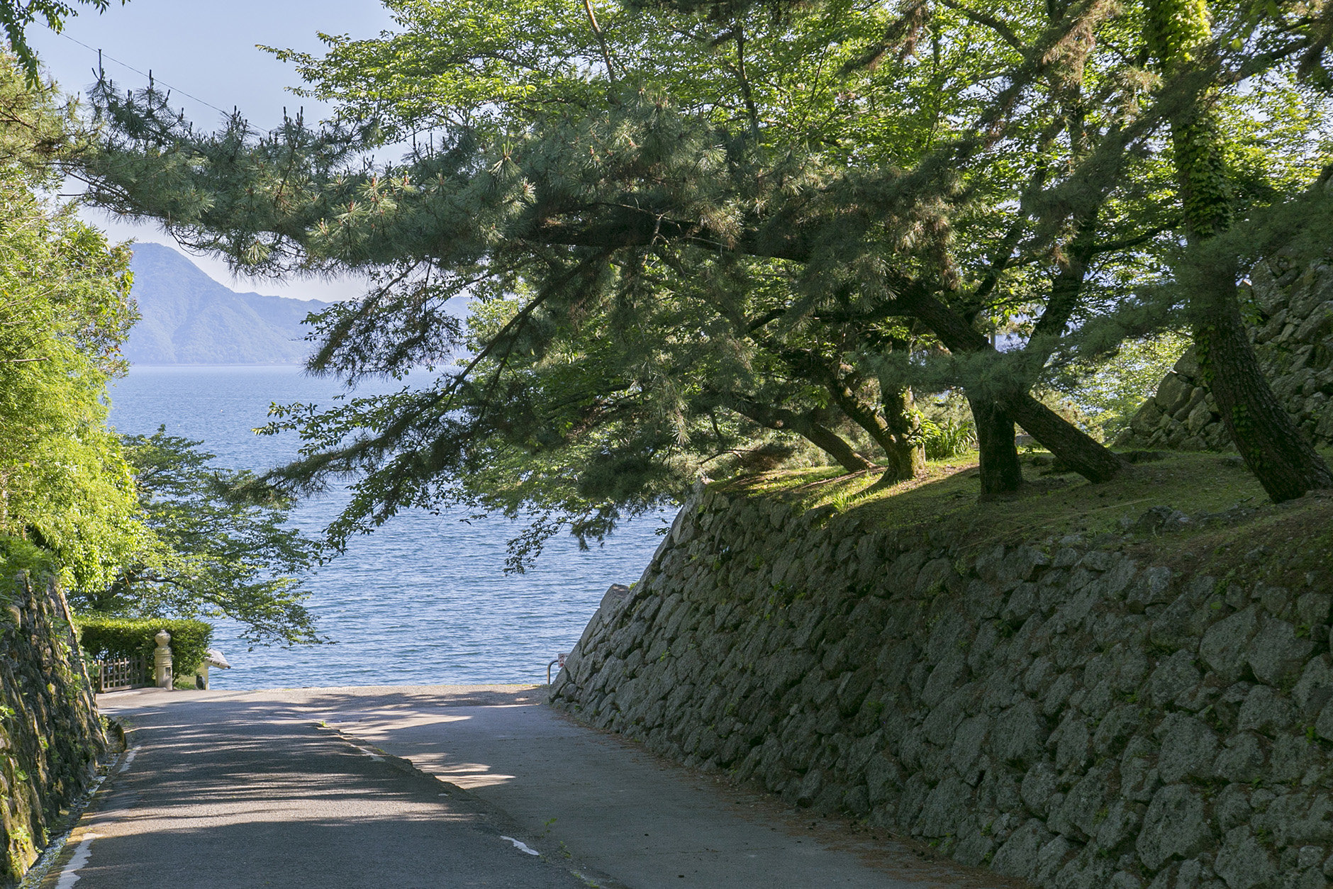
Beppu Bay beyond the ruins of Hiji Castle
The town flourished as a castle town built around Hiji Castle during the Edo period. You can still feel its history in the castle’s ruins. During the Warring States period in the middle of the 16th century, it was the feudal domain of the Otomo Clan. Christian missionaries visited Japan during this period, and Otomo Sorin, the 21st head of the family, converted to Christianity. Hiji Town has a number of places associated with Saint Francis Xavier, the Spanish missionary. The Kanagoe mountain range is one of those places.
Kanagoe Mountain Range is located north of Hiji Town and is centered around Mt. Nanatsuishi (623 m), the main peak. The mountain plays an important role in both the history and livelihood of the town.
During the Warring States Period, the Otomo Clan built mountain castles and a beacon tower in the range as part of its northern defenses. Rainfall in the range soaks into the ground, feeding springs that provide people with the water they need to live. Hiji Town produces an abundance of spring water, which are still its main water source today. Parts of Beppu Bay are brackish because of the mixing of spring water and seawater that springs up from the seafloor. The marbled flounder caught in these waters are known as “shiroshita karei,” which literally means “castle flounder.” As it was forbidden to commoners in the Edo period, shiroshita karei came to also be called “tonosama uo,” which means “lord’s fish” in Japanese.
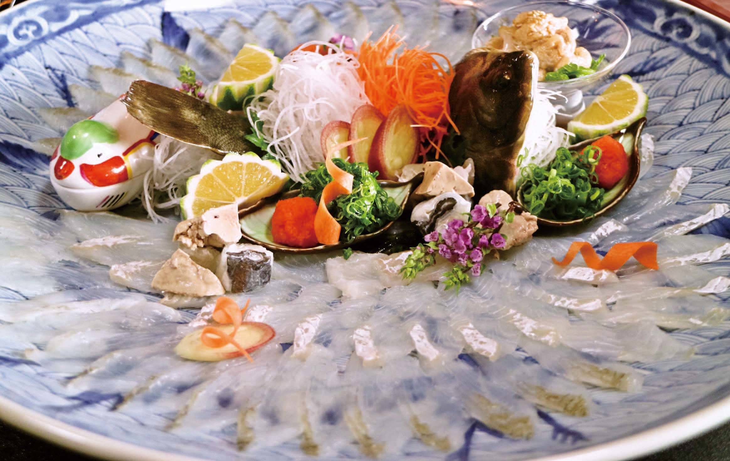
Even today, shiroshita karei is a luxury food served in high-class Japanese restaurants
On to the History and Scenery of the Kanagoe Mountain Range
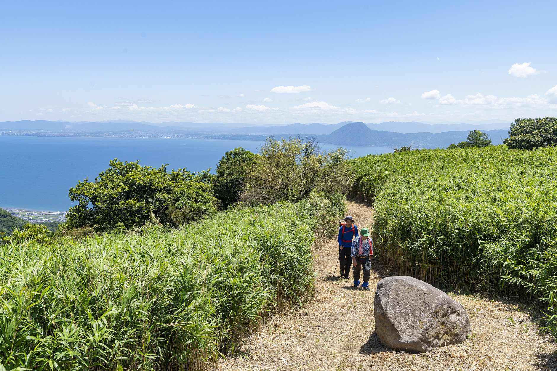
This time, we will introduce a route that takes you from the Yamada Spring Trailhead up the West Kanagoe Trail (also known as “Xavier's Rpad”), across the ridge from Mt. Nanatsuishi, and down the East Kanagoe Pass (also known as “tonosama-do,” or “Lord’s Road”). The route’s historical sites and great views make it well worth the hike.
We walked together with three local guides and Shimon, an Oita Prefecture resident with roots in Japan and Australia.
Our trek starts at the Yamada Spring Trailhead. There were already locals filling many plastic water tanks with spring water when we arrived there in the morning. We found the water to have a pleasantly mild taste. The source of the spring was located just up the trail.
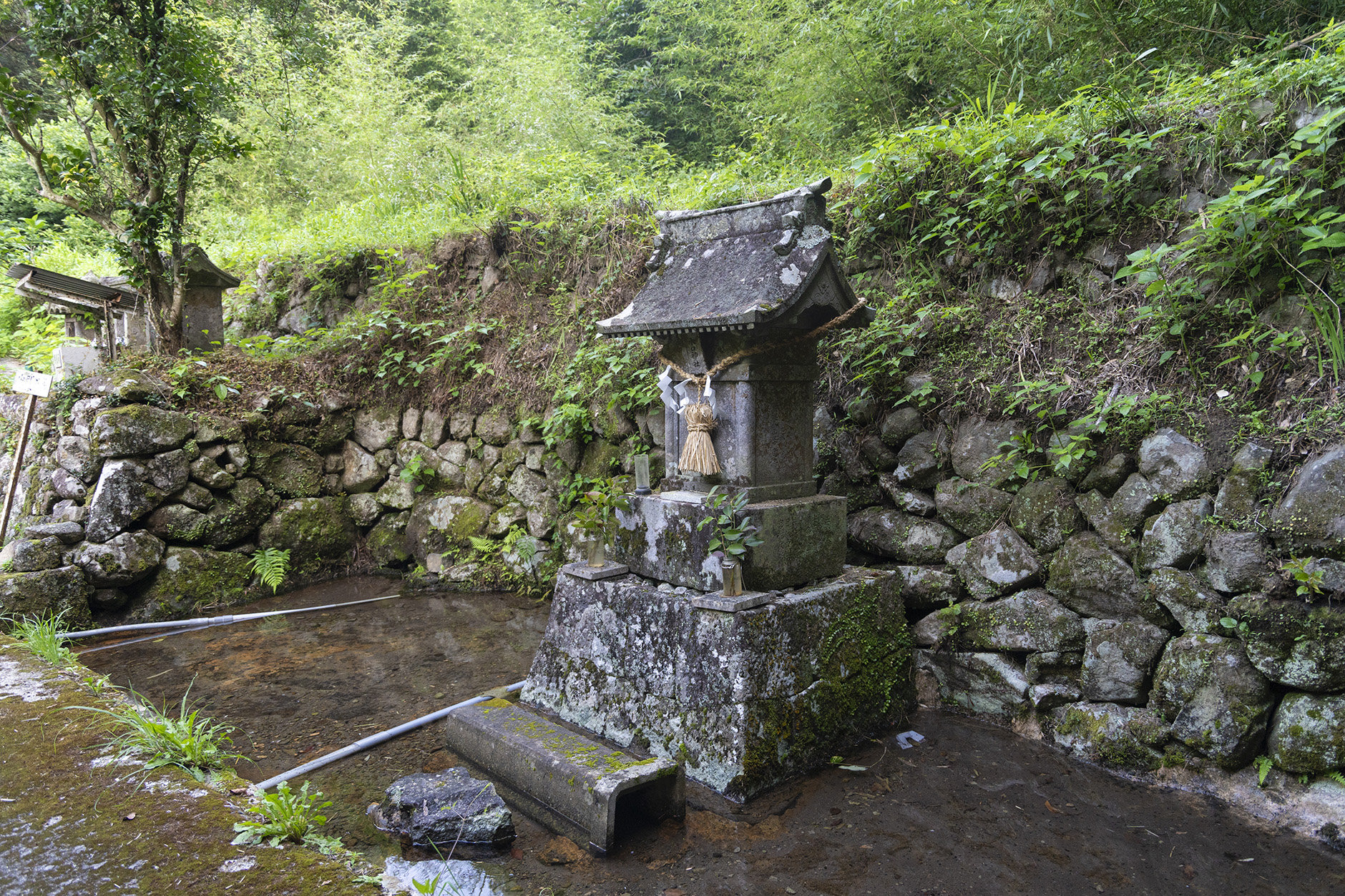
Source of the Yamada Spring
The West Kanagoe Trail is known as “Xavier's Road,” as it is said to be the road that he took on his way to Funai in Bungo Province (present-day Oita City) at the invitation of Otomo Sorin. At the same time, the road was frequently used by people as they went about their lives. It was also a work road used to carry stones out of the quarry.
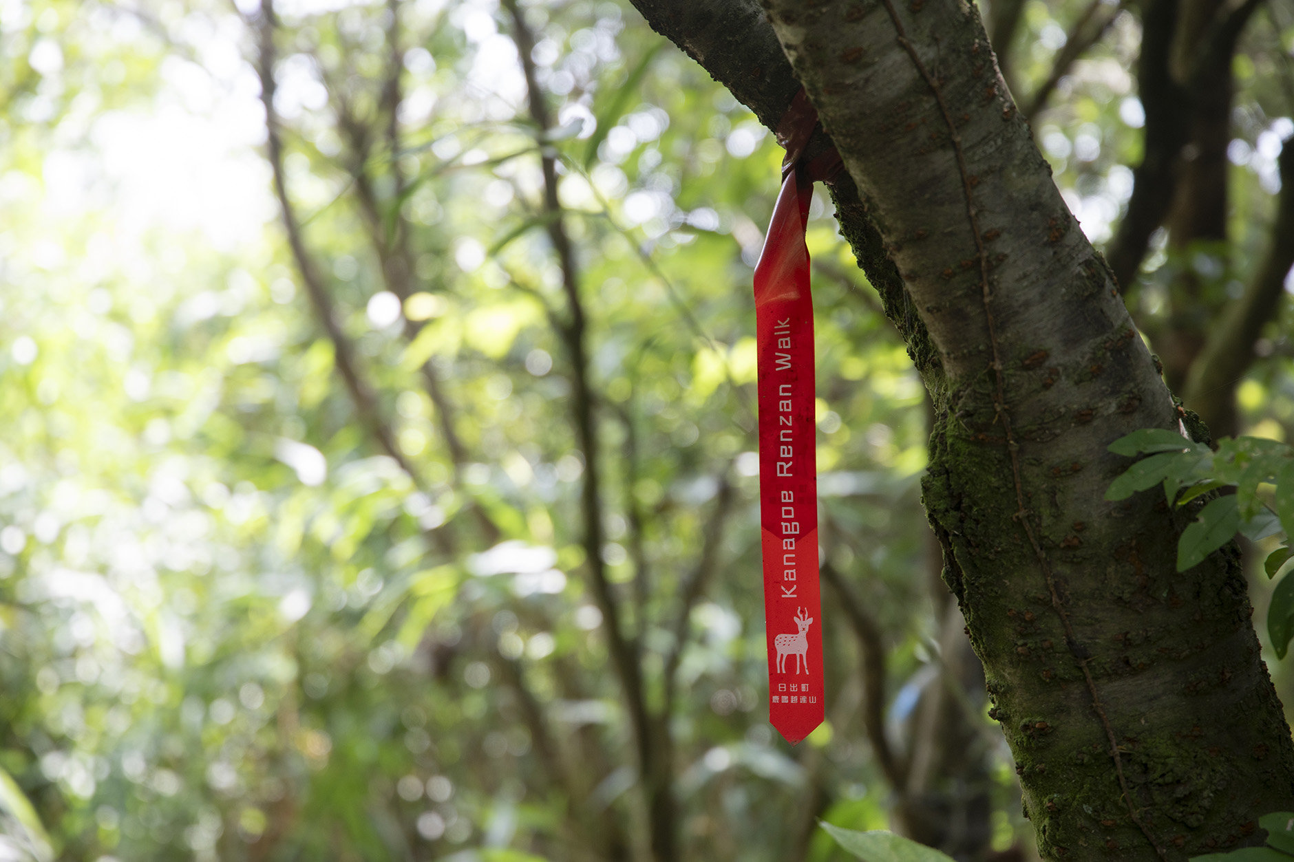
The Kanagoe mountain range’s hiking routes are marked
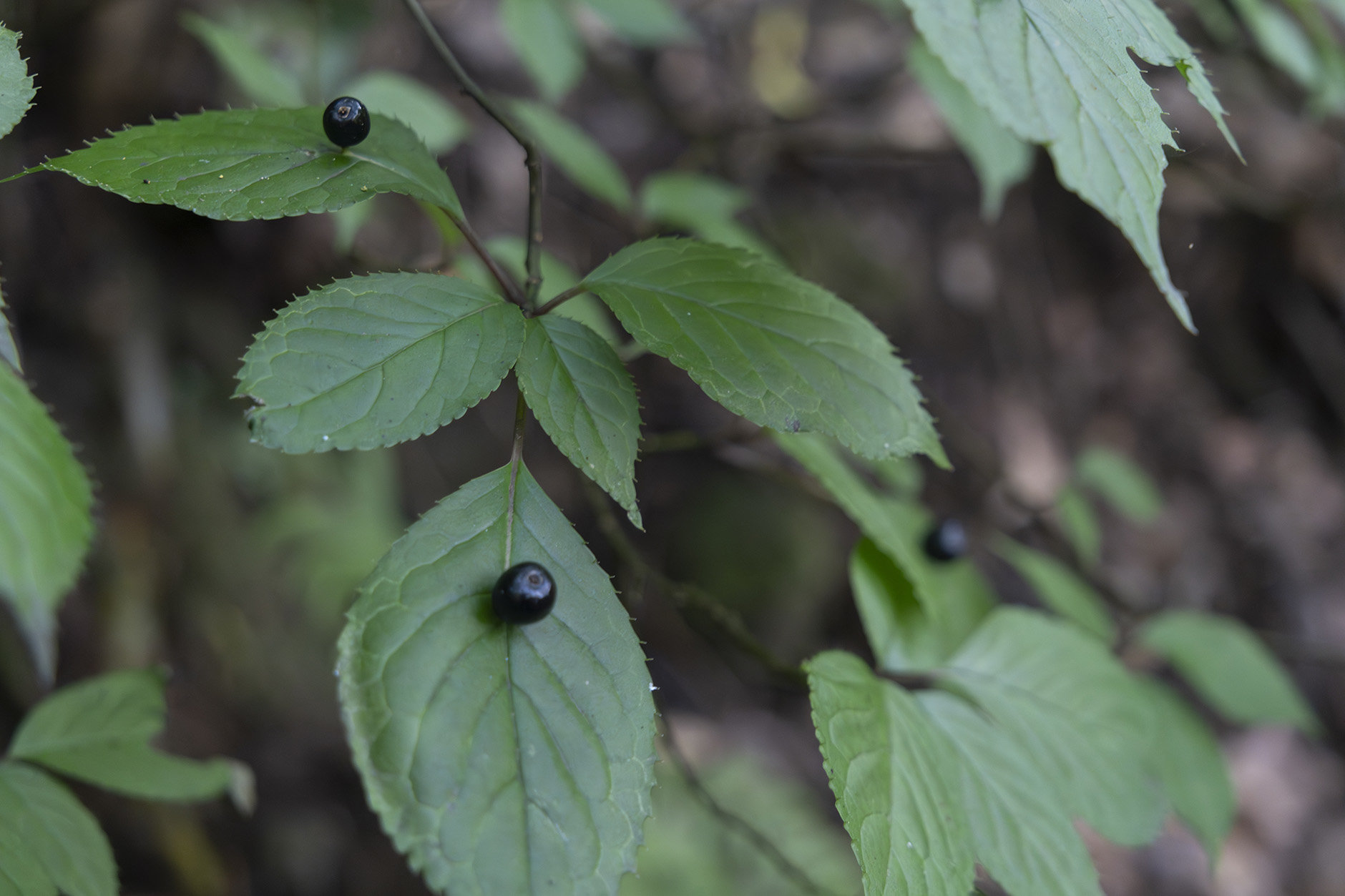
The Japanese helwingia’s flowers bloom and fruit grow on top of its leaves
You can observe the ruins of the old Hitome Castle quarry up close. The quarry was used from the Edo period until the early Showa period.
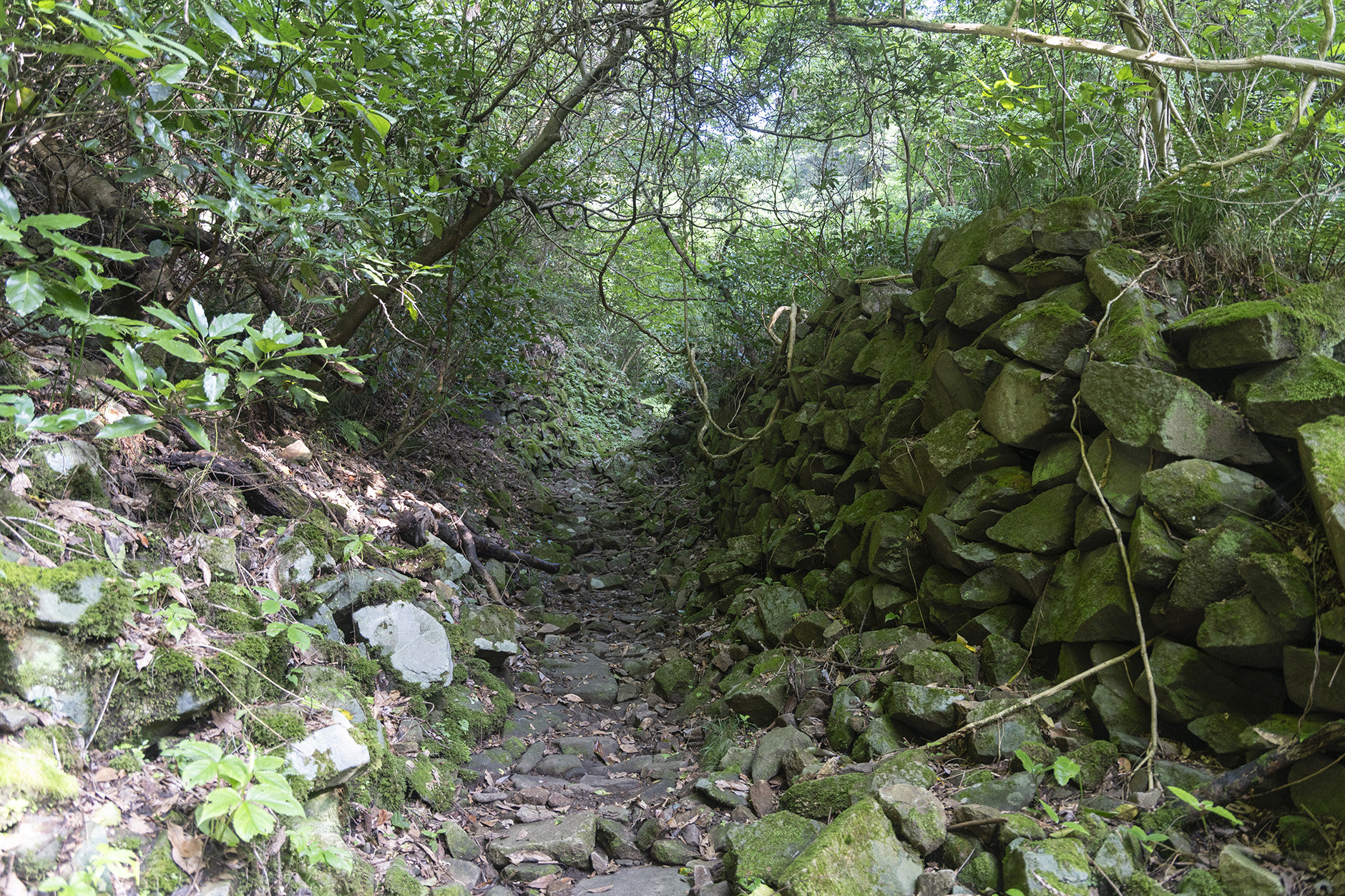
Piles of stones line the trail
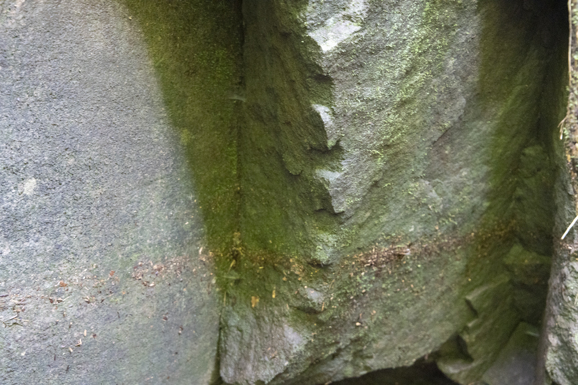
The bumps in the middle of the picture are chisel marks
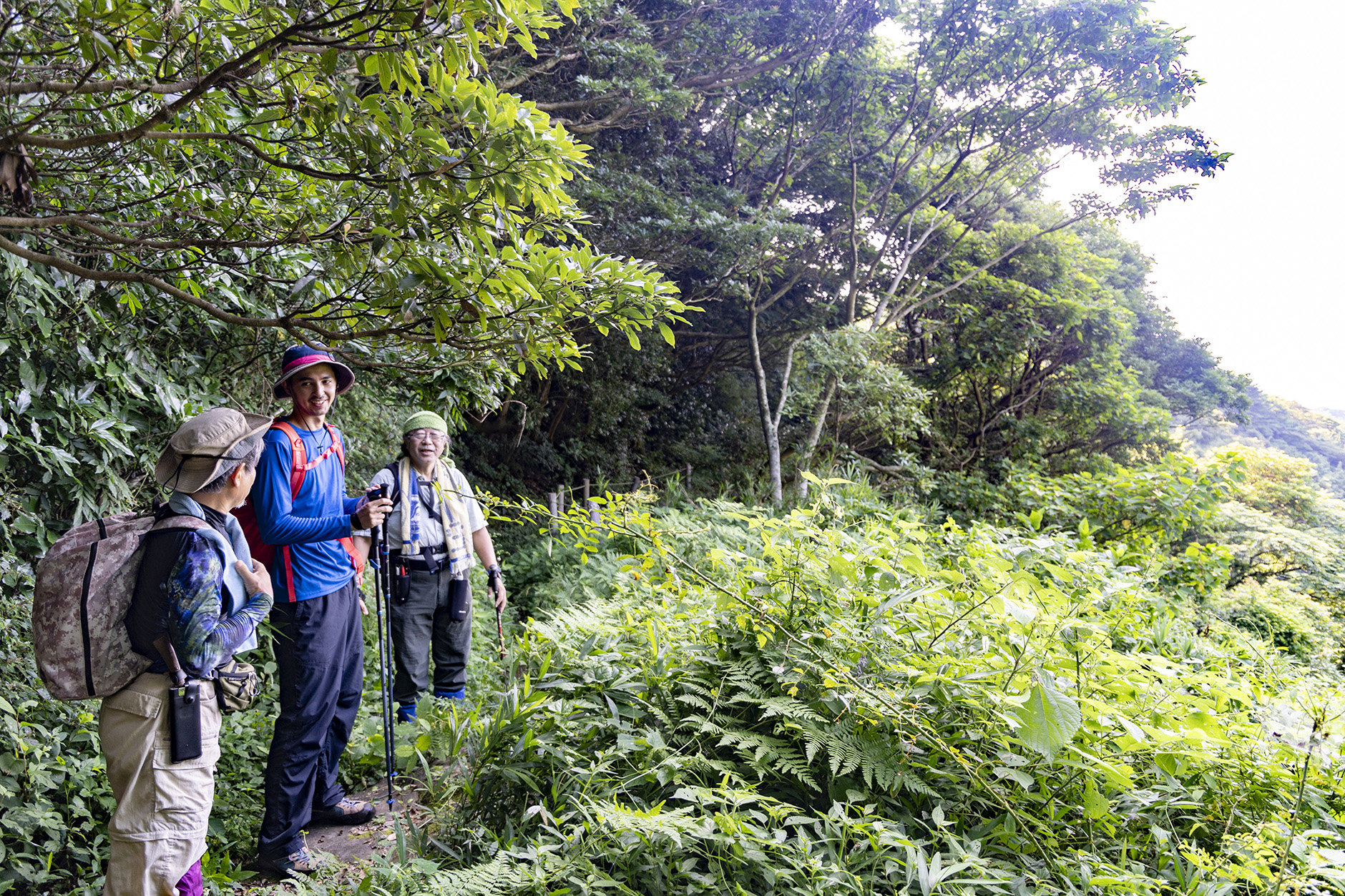
Taking a break at scenic opening
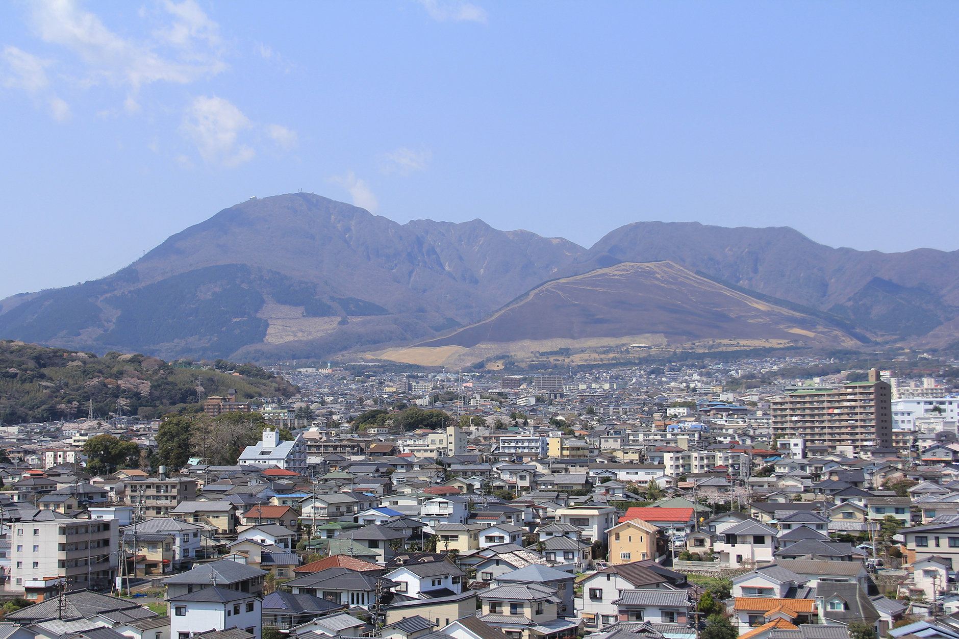
About an hour of climbing, we reached Mt. Nanatsuishi. From there, you can see the center of Hiji Town and Beppu Bay. To the right, you can see the steam rising from Beppu, as well as Mt. Tsurumi and Mt. Yufu. To the north, the mountains of the Kunisaki Peninsula can be seen.
Because of its location overlooking a spectacular view, it is said that the Otomo Clan built a beacon tower here during the Warring States period. The smoke signals from Mt. Nanatsuishi were apparently directed at Mt. Takasaki, which can be seen across Beppu Bay.
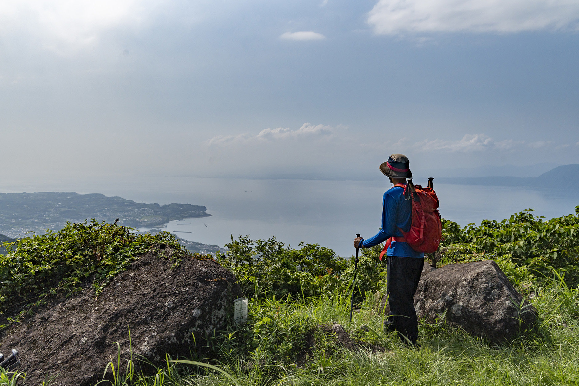
View of Beppu Bay from Mt. Nanatsuishi
"This area used to be covered in bushes until three years ago," says Echi-san, one of our guides. He tells us the bushes were cleared around Mt. Nanatsuishi and along the ridge trail ahead as part of an effort to maintain the trails. Despite the historical signifiance of the Kanagoe mountain range, people stopped coming to parts of the range once the quarries closed in the first half of the 20th century and automobiles became commonplace. The trails in the area only started being maintained again about 30 years ago. The Kanagoe mountain range was certified as a Japan Mountains Heritage in 2022 in recognition of these trail maintenance efforts and the range’s historical signifiance.
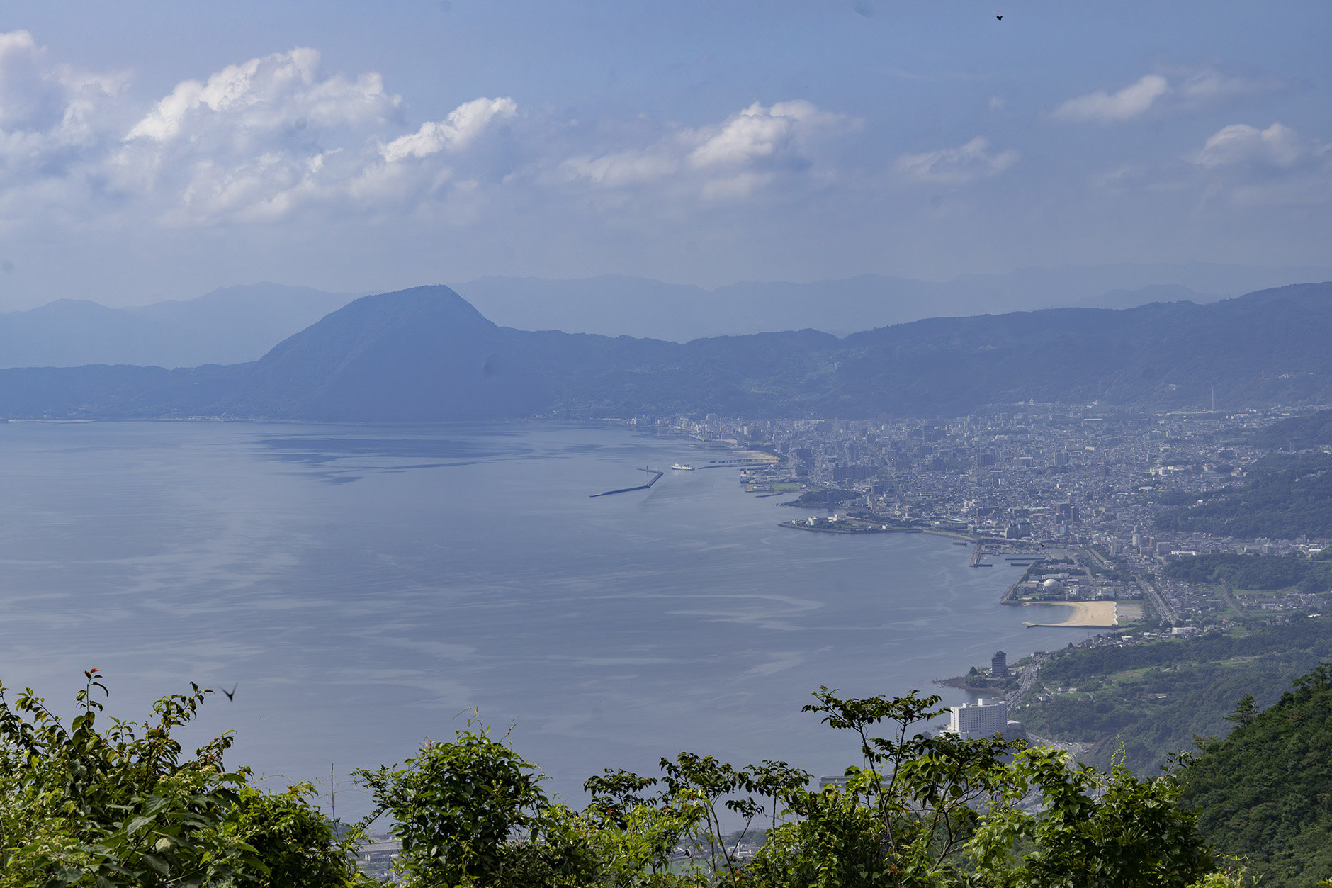
Beppu Bay from Mt. Itago – The city of Beppu can be seen to the right. The triangular Mt. Takasaki can be seen in the center
Leaving Mt. Nanatsuishi, we pass Mt. Itago and a colony of Japanese andromeda on the way to Mt. Kojo. Its name means “Old Castle Mountain,” and as this might suggest, it was once the location of Kanagoe Castle. You can see the remains of the mountain castles, including its moat. The area just below the summit was the steepest ascent of the course.
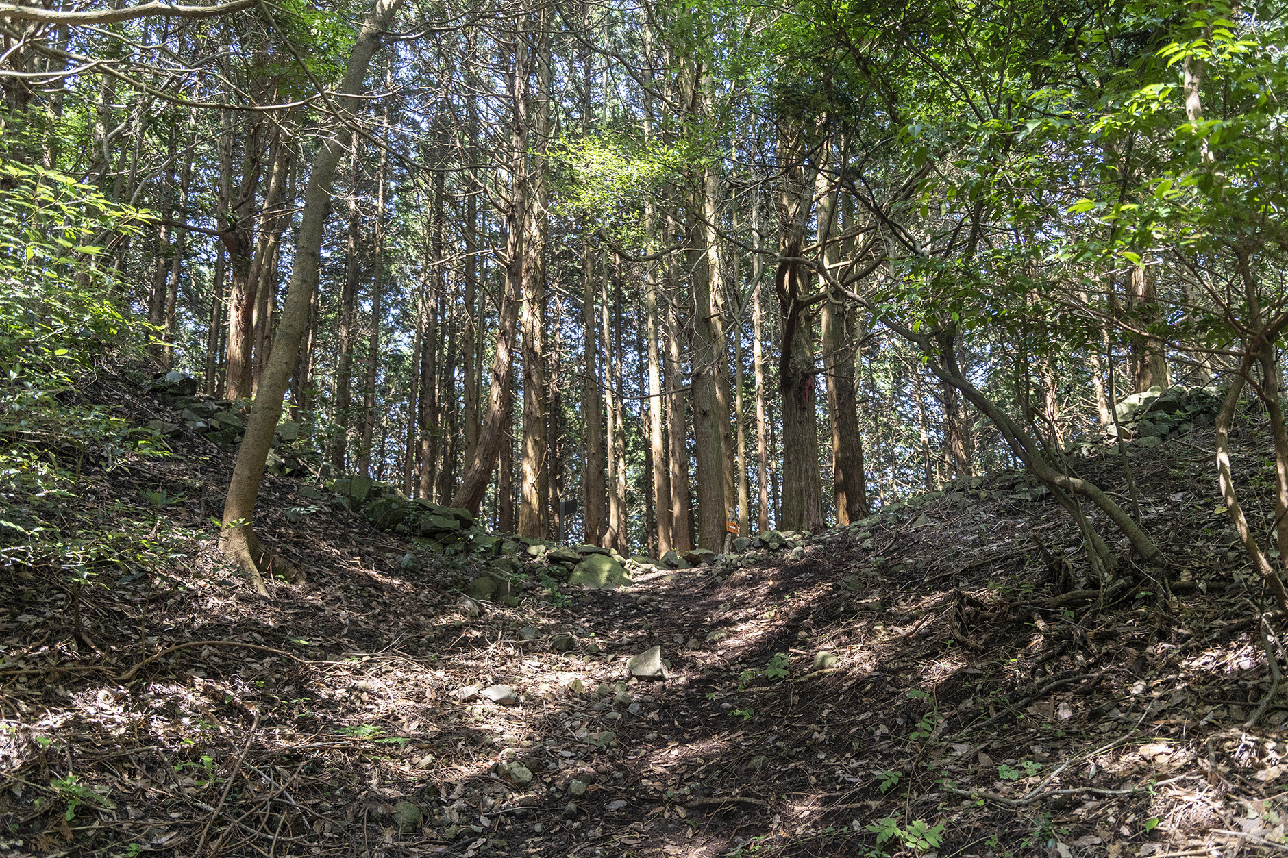
This hollow was the castle’s moat
We take East Kanagoe Trail down the mountain. It was built wide enough that the palanquin carrying the feudal lord could pass, hence its nickname “the Lord’s Road.” Part of the way is built over stone walls. It is said that rickshaws passed through here in the Meiji period.
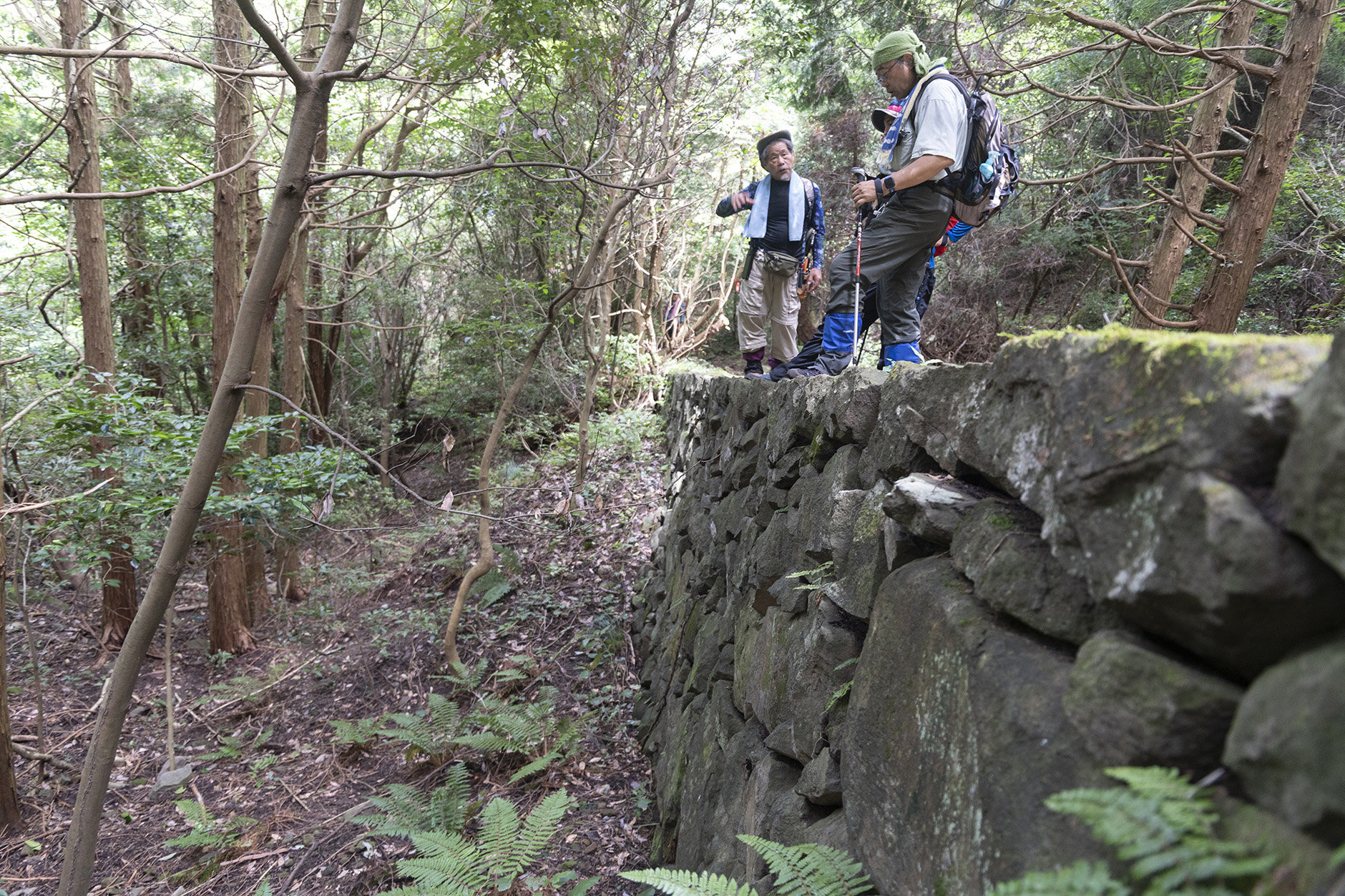
Stone walls still remain on this “Lord’s Road”
After descending the trail, we took a car to just below the summit of Mt. Kyozuka. There is also a well-maintained trail from the pass to the west to Mt. Kyozuka and back, which we recommend if you have the time. Mt. Kyozuka is said to be named after the sutra scrolls that were once buried here. It, too, offers great views. We recommend visting during flower season. The Kyushu azaleas bloom in spring and fall.
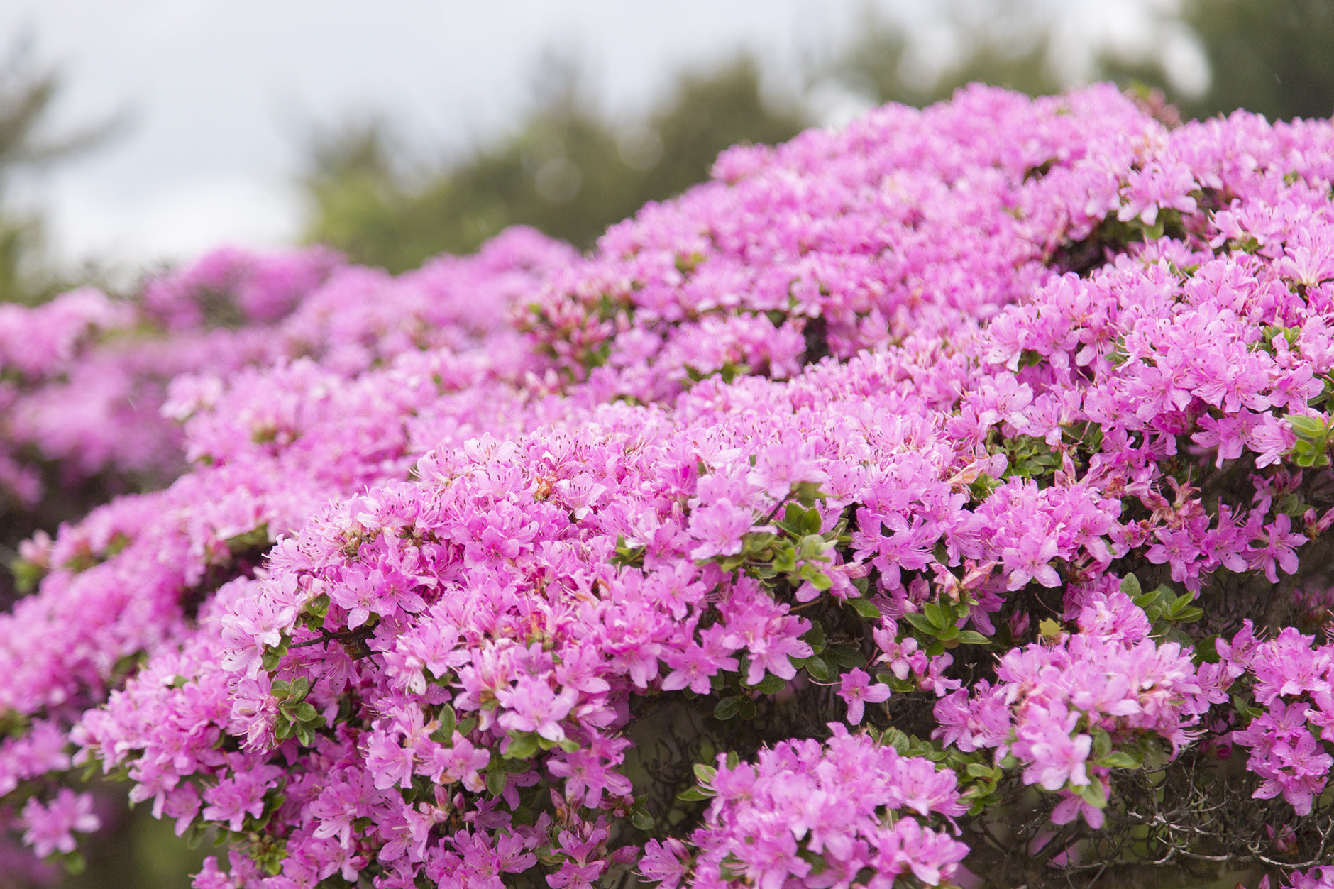
Kyushu azalea blooming in mid-May
The wide-open view from the trail to Mt. Kyozuka
The course we took through the Kanagoe mountain range was both walkable in a day and had much historical appeal. You can feel the activity of people long ago in the Warring States and Edo periods, as well as the passion of the people today who love these mountains and continue to maintain the trails so that they can be enjoyed by all. Just like our guide Mori-san describes the mountains as “a great place to have fun,” the people involved in maintaining the trails love these mountains, and really seem to enjoy the work.
The three guides happily told us that the number of hikers has increased in recent years, thanks in part to the maintenance efforts. We hope to visit again during the autumn foliage season.
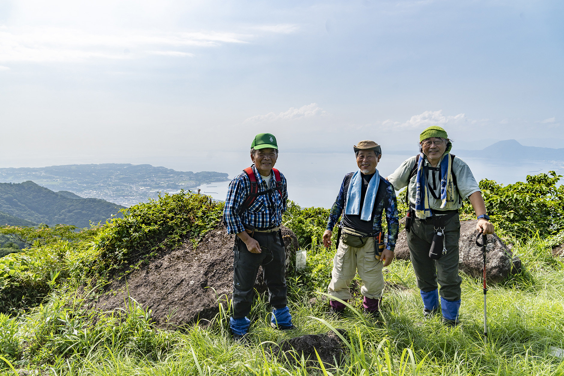
Our guides Echi-san, Mori-san, and Tani-san (from left)
MAP & DATA
Course Time:
(Yamada Spring Trailhead > West Pass > Mt. Kyozuka > Mt. Nanatsuishi > Tonosama-do Trailhead > Yamada Spring Trailhead) Approx. 3 hours and 55 minutes
Advice
It is also possible to traverse up to Mt. Shiroyama. A round trip from Yokozu Shrine to Mt. Shiroyama makes a good short course. The mountain is not very high, but it has a good view of the town.
Also, it is possible to request a guide (for a fee) by making a reservation with the Hiji Town Tourism Association.
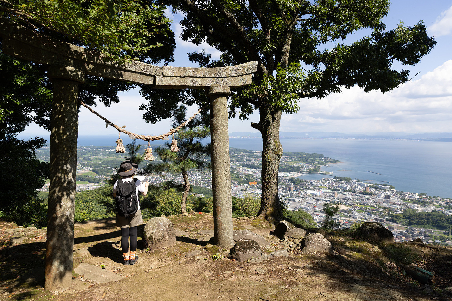
Mt. Shiroyama offers a close-up view of the town that gives it a different impression
Access
We recommend taking your own car or a taxi. There’s a parking lot at the Yamada Spring Trailhead. It is about a 40-minute walk from Bungo-Toyooka Station (JR Nippo Main Line).
Stopovers
[Tourist Information] Ninomaru Yakata
This is Hiji Town’s tourist information center. In addition to rental bicycles and souvenirs, there is also a cafe that changes every day. Next door to Ninomaru Yakata is yagura, a workation space built inside the renovated rear gate guardtower of Hiji Castle.
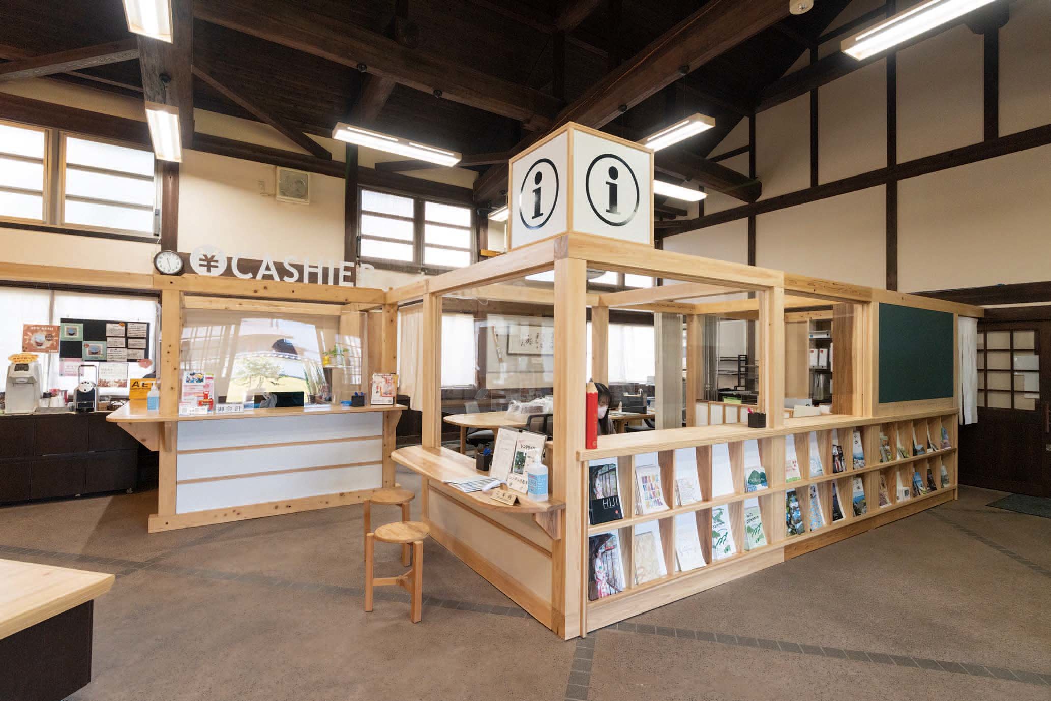
2612-1 Hiji-machi, Hayami-gun, Oita
[Food] Mashimizu Cafe
This cafe near the Ninomaru Yakata and Yokoku Station opened in 2018. It has a relaxed atmosphere where you can enjoy food along with views of the guarden from the wide windows.

2566-1 Hiji-machi, Hayami-gun, Oita
[Accommodations] Sakura Beach Garden
This rental villa features a stunningly scenic beachfront location. One lucky group per day can enjoy staying with their friends and family.
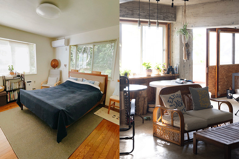
4737 Kawasaki, Hiji-machi, Hayami-gun, Oita
Hiji Souvenirs
Here are some of the souvenirs available at the Ninomaru Yakata.
Bamboo Diffusers and Accessories
Oita Prefecture is one of Japan's leading producers of bamboo. In recent years, there has been a growing trend of crafting items such as fragrances, diffusers, and accessories from bamboo. Bamboo diffuser sets are 5,500 yen. Earrings start at 2,200 yen.

Trappist Cookies
Hiji Town has ties to Francis Xavier, and is an important historical place in Japanese Christianity. The Oita Trappist Monastery in Hiji Town produces these cookies. Prices start at 150 yen for a mini pack.

Take a Short Trip to Hot Springs and a Highland Resort
Why not extend your trip a bit and enjoy hot springs and more mountain climbing?
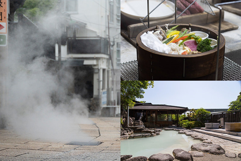
Beppu
We head from Hiji to neighoboring Beppu, one of the best places to enjoy hot springs. It has more sources and produces more hot spring water than anywhere else in Japan, making it one of the country’s best hot springs resorts. It also has many hot springs inns and day spas. The ride from Yokoku Station to Beppu Station takes about 15 minutes.
[Hiking Information] Mt. Tsurumi
Mt. Tsurumi is probably the best-known mountain in Beppu. You can climb it in about three and a half hours. If you take the ropeway, it’s a 10-minute trip each way. There is a park at the peak that offers amazing views. You can see the Kyushu azaleas bloom in late May, as well as frozen rime in the winter.
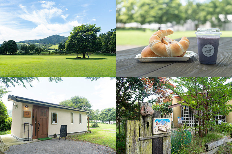
Tsukahara Highlands
The Tsukahara Highlands are a tranquil hilly area located north of Mt. Yufu. It has a number of bed and breakfasts and private villas, as well as cafes, gallaries, and other businesses. We recommend seeing the area by car. Yufuin, a hot spring resort, is located nearby.
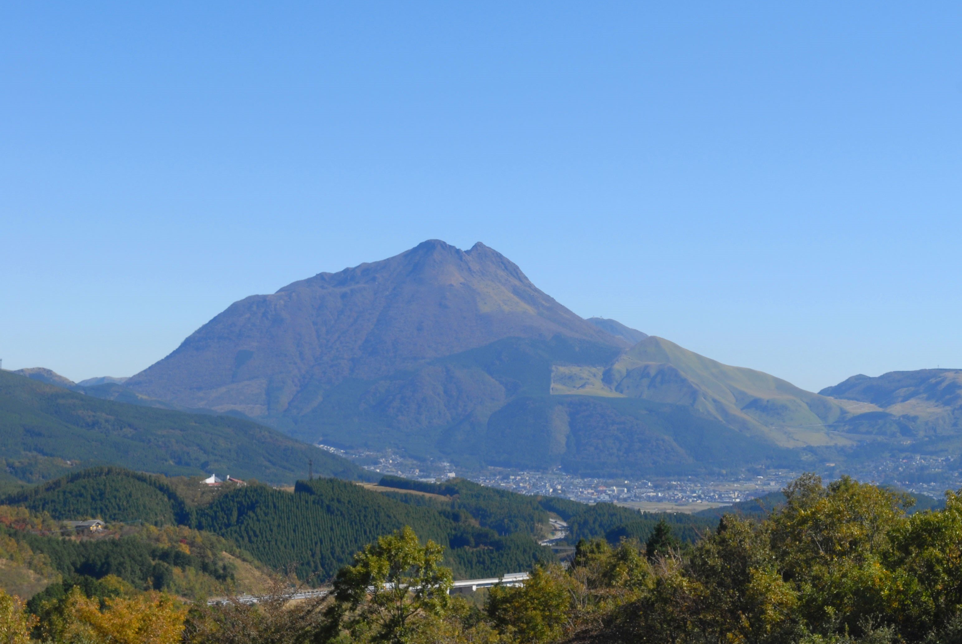
[Hiking Information] Mt. Yufu
The beautiful Mt. Yufu, also known as Bungo Fuji, has twin eastern and western peaks. The area near the peak has a difficult rocky section with chains, so caution is required. The Kyushu azaeals bloom in late May. The frontal route takes about four and a half hours.
Access
Car
It takes about 90 minutes from Kokura to Hiji Interchange on the Higashikyushu Expressway.
It takes about 80 minutes from Tosu Junction to Hiji Interchange on the Oita Expressway.
Train
[From Fukuoka]
It takes about 2 hours and 15 minutes from Kokura Station to Yokoku Station via the JR Nippo Main Line.
[From Oita]
It takes about 30 minutes from Oita Station to Yokoku Station via the JR Nippo Main Line.
Air
You can get from Oita Airport to the center of Hiji Town in about 27 minutes via the Airliner airport express bus.
Inquiries
Hiji Town Tourism Association
https://hijinavi.com/ (Hiji-machi Tourist Information Official Site – Hiji Navi)
